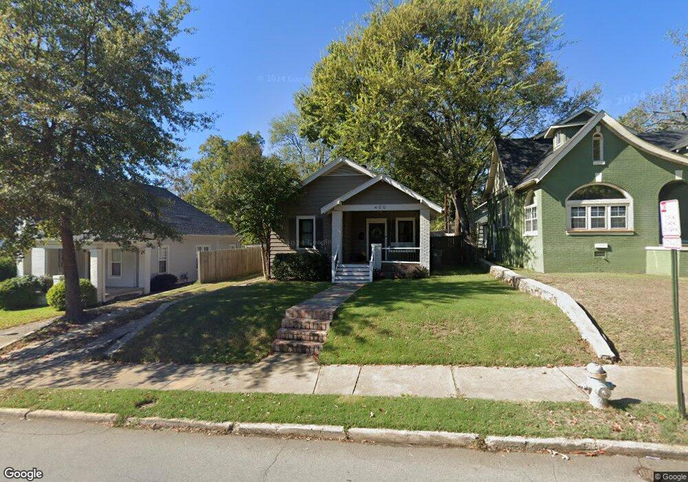
400 N Pine St Little Rock, AR 72205
Hillcrest NeighborhoodEstimated Value: $221,000 - $366,000
Studio
1
Bath
1,191
Sq Ft
$250/Sq Ft
Est. Value
About This Home
This home is located at 400 N Pine St, Little Rock, AR 72205 and is currently estimated at $297,257, approximately $249 per square foot. 400 N Pine St is a home located in Pulaski County with nearby schools including Pulaski Heights Elementary School, Pulaski Heights Middle School, and Central High School.
Ownership History
Date
Name
Owned For
Owner Type
Purchase Details
Closed on
May 3, 2017
Sold by
Tim Fisk
Bought by
Blankenship Elizabeth
Current Estimated Value
Home Financials for this Owner
Home Financials are based on the most recent Mortgage that was taken out on this home.
Original Mortgage
$277,000
Outstanding Balance
$229,361
Interest Rate
4.03%
Estimated Equity
$67,896
Purchase Details
Closed on
Aug 31, 2016
Sold by
Martin Alice M
Bought by
Fisk Tim and Fisk Jennifer
Home Financials for this Owner
Home Financials are based on the most recent Mortgage that was taken out on this home.
Original Mortgage
$188,000
Interest Rate
3.48%
Mortgage Type
Commercial
Create a Home Valuation Report for This Property
The Home Valuation Report is an in-depth analysis detailing your home's value as well as a comparison with similar homes in the area
Home Values in the Area
Average Home Value in this Area
Purchase History
| Date | Buyer | Sale Price | Title Company |
|---|---|---|---|
| Blankenship Elizabeth | -- | -- | |
| Fisk Tim | $112,500 | First National Title Company |
Source: Public Records
Mortgage History
| Date | Status | Borrower | Loan Amount |
|---|---|---|---|
| Open | Blankenship Elizabeth | $277,000 | |
| Closed | Blankenship Elizabeth | -- | |
| Previous Owner | Fisk Tim | $188,000 |
Source: Public Records
Tax History
| Year | Tax Paid | Tax Assessment Tax Assessment Total Assessment is a certain percentage of the fair market value that is determined by local assessors to be the total taxable value of land and additions on the property. | Land | Improvement |
|---|---|---|---|---|
| 2025 | $2,722 | $43,886 | $10,400 | $33,486 |
| 2024 | $2,496 | $43,886 | $10,400 | $33,486 |
| 2023 | $2,496 | $43,886 | $10,400 | $33,486 |
| 2022 | $2,382 | $43,886 | $10,400 | $33,486 |
| 2021 | $2,285 | $32,410 | $10,500 | $21,910 |
| 2020 | $1,894 | $32,410 | $10,500 | $21,910 |
| 2019 | $1,894 | $32,410 | $10,500 | $21,910 |
| 2018 | $1,919 | $32,410 | $10,500 | $21,910 |
| 2017 | $2,269 | $32,410 | $10,500 | $21,910 |
| 2016 | $1,493 | $30,760 | $7,200 | $23,560 |
| 2015 | $1,625 | $25,280 | $7,200 | $18,080 |
| 2014 | $1,625 | $23,180 | $7,200 | $15,980 |
Source: Public Records
Map
Nearby Homes
- 118 N Pine St
- 313 Colonial Ct
- 508 N Oak St
- 100 Colonial Ct
- 4213 A St
- 206 Linwood Ct
- 220 Rose St
- 4001 Cedar Hill Rd
- 621 N Pine St
- 304 Walnut St
- 205 Crystal Ct
- 222 Valmar St
- 201 Beechwood St
- 3901 Cedar Hill #23 Rd
- 3901 Cedar Hill Rd
- 3710 W Capitol Ave
- 400 Fairfax Dr
- 323 Valmar St
- 501 N Palm St
- 507 Uams Blvd