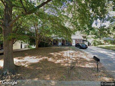
400 Queen Aliese Ln Unit I Jonesboro, GA 30236
Estimated Value: $173,000 - $205,538
3
Beds
2
Baths
1,240
Sq Ft
$151/Sq Ft
Est. Value
About This Home
This home is located at 400 Queen Aliese Ln Unit I, Jonesboro, GA 30236 and is currently estimated at $187,635, approximately $151 per square foot. 400 Queen Aliese Ln Unit I is a home located in Clayton County with nearby schools including Kilpatrick Elementary School, Sequoyah Middle School, and Charles R. Drew High School.
Ownership History
Date
Name
Owned For
Owner Type
Purchase Details
Closed on
Jul 1, 1999
Sold by
Ernst Mark and Ernst Joy
Bought by
Irving Kathy A and Irving Willie J
Current Estimated Value
Home Financials for this Owner
Home Financials are based on the most recent Mortgage that was taken out on this home.
Original Mortgage
$92,735
Interest Rate
7.58%
Mortgage Type
FHA
Create a Home Valuation Report for This Property
The Home Valuation Report is an in-depth analysis detailing your home's value as well as a comparison with similar homes in the area
Home Values in the Area
Average Home Value in this Area
Purchase History
| Date | Buyer | Sale Price | Title Company |
|---|---|---|---|
| Irving Kathy A | $93,500 | -- |
Source: Public Records
Mortgage History
| Date | Status | Borrower | Loan Amount |
|---|---|---|---|
| Previous Owner | Irving Kathy A | $92,735 |
Source: Public Records
Tax History Compared to Growth
Tax History
| Year | Tax Paid | Tax Assessment Tax Assessment Total Assessment is a certain percentage of the fair market value that is determined by local assessors to be the total taxable value of land and additions on the property. | Land | Improvement |
|---|---|---|---|---|
| 2024 | $2,716 | $78,720 | $6,400 | $72,320 |
| 2023 | $2,842 | $78,720 | $6,400 | $72,320 |
| 2022 | $2,234 | $66,040 | $6,400 | $59,640 |
| 2021 | $1,670 | $51,400 | $6,400 | $45,000 |
| 2020 | $1,110 | $36,878 | $6,400 | $30,478 |
| 2019 | $888 | $31,019 | $3,200 | $27,819 |
| 2018 | $751 | $27,635 | $3,200 | $24,435 |
| 2017 | $257 | $15,445 | $3,200 | $12,245 |
| 2016 | $273 | $15,858 | $3,200 | $12,658 |
| 2015 | $277 | $0 | $0 | $0 |
| 2014 | $168 | $13,315 | $3,200 | $10,115 |
Source: Public Records
Map
Nearby Homes
- 410 Queen Aliese Ln Unit 1
- 474 Autumn Dr
- 340 Sir Richard Ct
- 336 Sir Richard Ct
- 7114 Lady Heidi Ct
- 7118 Lady Heidi Ct
- 7428 Mockingbird Trail
- 285 Queen Helen Ln
- 213 Whipporwill Way
- 7371 Ovis Ct
- 758 King Rd
- 680 Sherwood Dr
- 4014 Alderwoods Dr
- 7336 Howard Cir
- 7535 Asbury Dr
- 7323 Howard Place
- 747 Sherwood Dr
- 7279 Mayfair Cir
- 531 Fielding Cir
- 840 Jett Rd
- 400 Queen Aliese Ln Unit I
- 394 Queen Aliese Ln
- 0 Queen Aliese Ln Unit 7279530
- 0 Queen Aliese Ln Unit 7019887
- 0 Queen Aliese Ln Unit 7200579
- 0 Queen Aliese Ln Unit 7022450
- 0 Queen Aliese Ln Unit 7004200
- 0 Queen Aliese Ln Unit 8822025
- 0 Queen Aliese Ln Unit 8209945
- 0 Queen Aliese Ln Unit 8094230
- 0 Queen Aliese Ln Unit 7115516
- 0 Queen Aliese Ln Unit 7131475
- 0 Queen Aliese Ln Unit 3285396
- 0 Queen Aliese Ln Unit 3267755
- 0 Queen Aliese Ln Unit 7596718
- 0 Queen Aliese Ln Unit 7159341
- 0 Queen Aliese Ln Unit 3157830
- 0 Queen Aliese Ln
- 483 King Arthur Ct
- 479 King Arthur Ct