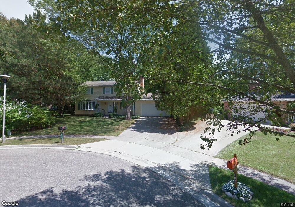
400 Rollcrest Ct Midland, MI 48640
Estimated Value: $306,000 - $372,000
5
Beds
3
Baths
2,240
Sq Ft
$147/Sq Ft
Est. Value
About This Home
This home is located at 400 Rollcrest Ct, Midland, MI 48640 and is currently estimated at $328,405, approximately $146 per square foot. 400 Rollcrest Ct is a home located in Midland County with nearby schools including Siebert School, Jefferson Middle School, and H.H. Dow High School.
Ownership History
Date
Name
Owned For
Owner Type
Purchase Details
Closed on
Sep 28, 2022
Sold by
Garrett Dolores A
Bought by
Morris Tyler and Morris Claire
Current Estimated Value
Home Financials for this Owner
Home Financials are based on the most recent Mortgage that was taken out on this home.
Original Mortgage
$227,050
Outstanding Balance
$215,774
Interest Rate
5.13%
Mortgage Type
New Conventional
Estimated Equity
$112,631
Purchase Details
Closed on
Mar 29, 2012
Sold by
Rentsch Stefan F and Rentsch Janet
Bought by
Garrett Dolores A
Create a Home Valuation Report for This Property
The Home Valuation Report is an in-depth analysis detailing your home's value as well as a comparison with similar homes in the area
Home Values in the Area
Average Home Value in this Area
Purchase History
| Date | Buyer | Sale Price | Title Company |
|---|---|---|---|
| Morris Tyler | $239,000 | None Listed On Document | |
| Garrett Dolores A | $150,000 | -- |
Source: Public Records
Mortgage History
| Date | Status | Borrower | Loan Amount |
|---|---|---|---|
| Open | Morris Tyler | $227,050 |
Source: Public Records
Tax History
| Year | Tax Paid | Tax Assessment Tax Assessment Total Assessment is a certain percentage of the fair market value that is determined by local assessors to be the total taxable value of land and additions on the property. | Land | Improvement |
|---|---|---|---|---|
| 2025 | $5,037 | $140,500 | $0 | $0 |
| 2024 | $3,916 | $130,600 | $0 | $0 |
| 2023 | $3,733 | $117,900 | $0 | $0 |
| 2022 | $4,499 | $112,400 | $0 | $0 |
| 2021 | $3,564 | $90,000 | $0 | $0 |
| 2020 | $3,601 | $86,500 | $0 | $0 |
| 2019 | $3,535 | $85,300 | $22,500 | $62,800 |
| 2018 | $3,546 | $103,600 | $22,500 | $81,100 |
| 2017 | $0 | $84,500 | $22,500 | $62,000 |
| 2016 | $3,461 | $85,100 | $22,500 | $62,600 |
| 2012 | -- | $86,900 | $22,500 | $64,400 |
Source: Public Records
Map
Nearby Homes
- 5711 Summerset Dr
- 108 W Chapel Ln
- 5407 Wanetah Dr
- 5312 Russell St
- 5714 Stillwater Ln
- 405 Hollybrook Dr
- 001 E Monroe Rd
- 428 Morningside Dr
- 1308 Brentwood Dr
- 621 E Wackerly St
- 717 Crescent Dr
- 4903 Grandview Cir
- 210 E Meadowbrook Dr
- 5011 Hidden Pines Ct
- 6103 Eastman Ave
- 1015 Whispering Oak Dr
- 1809 W Wackerly St
- 407 Broadhead Dr
- 1100 E Wheeler St
- 701 Broadhead Dr
- 404 Rollcrest Ct
- 403 Rollcrest Ct
- 408 Rollcrest Ct
- 412 Rollcrest Ct
- 313 Mayfield Ln
- 401 Mayfield Ln
- 309 Mayfield Ln
- 404 Hunters Ridge
- 400 Hunters Ridge
- 405 Mayfield Ln
- 314 Hunters Ridge
- 5706 Summerset Dr
- 5800 Summerset Dr
- 408 Hunters Ridge
- 305 Mayfield Ln
- 310 Hunters Ridge
- VL 409 Mayfield Ln
- 301 Mayfield Ln
- 306 Hunters Ridge
- 5804 Summerset Dr
Your Personal Tour Guide
Ask me questions while you tour the home.