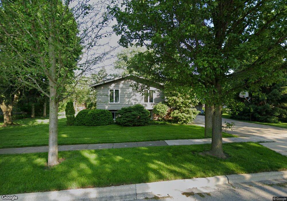
400 S Hubbard St Algonquin, IL 60102
Estimated Value: $325,352 - $373,000
3
Beds
3
Baths
1,372
Sq Ft
$260/Sq Ft
Est. Value
About This Home
This home is located at 400 S Hubbard St, Algonquin, IL 60102 and is currently estimated at $356,088, approximately $259 per square foot. 400 S Hubbard St is a home located in McHenry County with nearby schools including Eastview Elementary School, Algonquin Middle School, and Dundee-Crown High School.
Ownership History
Date
Name
Owned For
Owner Type
Purchase Details
Closed on
Jun 3, 2002
Sold by
Chesek Stephen A and Chesek Mary P
Bought by
Mary & Stephen Chesek Trust and Chesek
Current Estimated Value
Create a Home Valuation Report for This Property
The Home Valuation Report is an in-depth analysis detailing your home's value as well as a comparison with similar homes in the area
Home Values in the Area
Average Home Value in this Area
Purchase History
| Date | Buyer | Sale Price | Title Company |
|---|---|---|---|
| Mary & Stephen Chesek Trust | -- | None Listed On Document | |
| Mary & Stephen Chesek Trust | -- | None Listed On Document |
Source: Public Records
Tax History Compared to Growth
Tax History
| Year | Tax Paid | Tax Assessment Tax Assessment Total Assessment is a certain percentage of the fair market value that is determined by local assessors to be the total taxable value of land and additions on the property. | Land | Improvement |
|---|---|---|---|---|
| 2024 | $6,547 | $99,690 | $15,165 | $84,525 |
| 2023 | $6,124 | $89,160 | $13,563 | $75,597 |
| 2022 | $7,083 | $93,591 | $23,620 | $69,971 |
| 2021 | $6,761 | $87,191 | $22,005 | $65,186 |
| 2020 | $6,564 | $84,104 | $21,226 | $62,878 |
| 2019 | $6,382 | $80,498 | $20,316 | $60,182 |
| 2018 | $6,040 | $74,363 | $18,768 | $55,595 |
| 2017 | $5,881 | $70,055 | $17,681 | $52,374 |
| 2016 | $5,753 | $65,705 | $16,583 | $49,122 |
| 2013 | -- | $56,286 | $15,470 | $40,816 |
Source: Public Records
Map
Nearby Homes
- 102 Center St
- 0 River Dr N Unit MRD12473279
- 314 Washington St
- 600 E Algonquin Rd
- 2 Sunset Ln
- 420 N Harrison St
- 1188 E Algonquin Rd
- 69 Alice St
- 911 Old Oak Cir Unit 1
- 903 Old Oak Cir
- 920 Plymouth Ct
- 0 Natoma Trail
- 925 N River Rd
- 1245 Winaki Trail
- 620 Old Oak Cir
- 721 Brentwood Ct
- lot 25 Wabican Trail
- 1114 Riverwood Dr Unit 1114
- 1659 E Algonquin Rd
- 9999 Sandbloom Rd