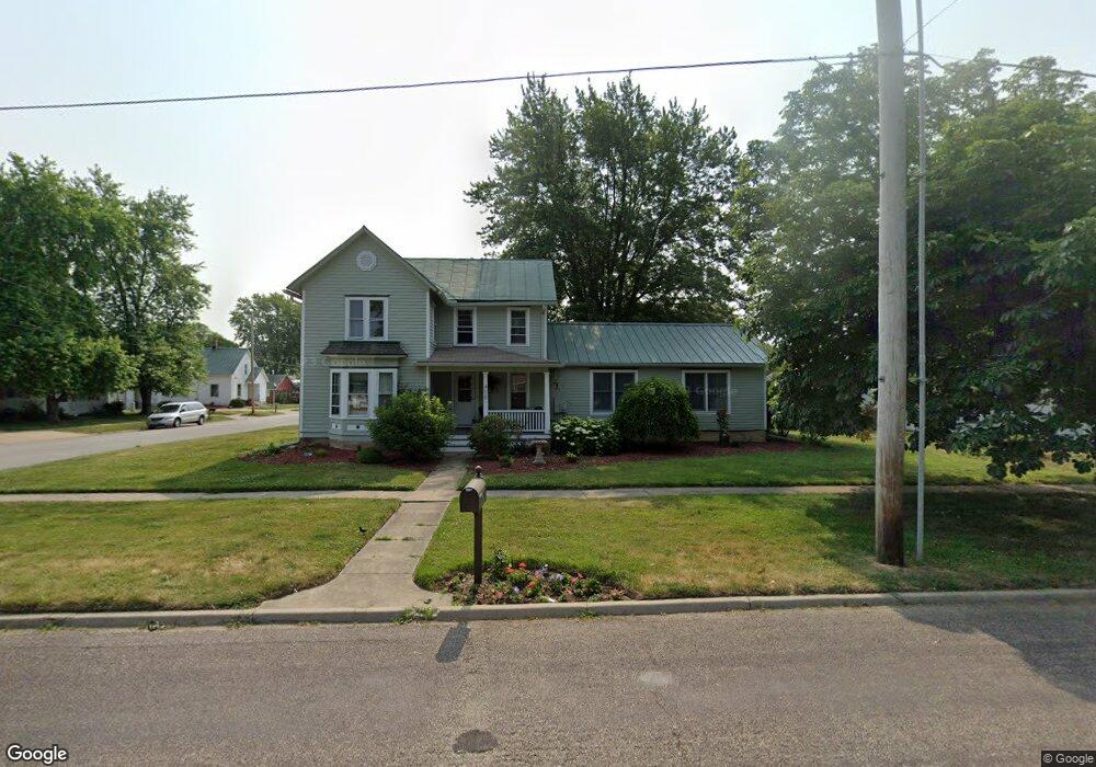
400 S Sampson St Tremont, IL 61568
Estimated Value: $214,000 - $263,000
4
Beds
1
Bath
2,142
Sq Ft
$110/Sq Ft
Est. Value
About This Home
This home is located at 400 S Sampson St, Tremont, IL 61568 and is currently estimated at $236,564, approximately $110 per square foot. 400 S Sampson St is a home located in Tazewell County with nearby schools including Tremont Elementary School, Tremont Middle School, and Tremont High School.
Ownership History
Date
Name
Owned For
Owner Type
Purchase Details
Closed on
Jun 1, 2007
Sold by
Saal Laura J and Saal Troy J
Bought by
Mason Kirk M and Mason Holly R
Current Estimated Value
Home Financials for this Owner
Home Financials are based on the most recent Mortgage that was taken out on this home.
Original Mortgage
$175,200
Outstanding Balance
$107,378
Interest Rate
6.22%
Mortgage Type
Purchase Money Mortgage
Estimated Equity
$129,186
Create a Home Valuation Report for This Property
The Home Valuation Report is an in-depth analysis detailing your home's value as well as a comparison with similar homes in the area
Home Values in the Area
Average Home Value in this Area
Purchase History
| Date | Buyer | Sale Price | Title Company |
|---|---|---|---|
| Mason Kirk M | $176,000 | None Available |
Source: Public Records
Mortgage History
| Date | Status | Borrower | Loan Amount |
|---|---|---|---|
| Open | Mason Kirk M | $175,200 |
Source: Public Records
Tax History Compared to Growth
Tax History
| Year | Tax Paid | Tax Assessment Tax Assessment Total Assessment is a certain percentage of the fair market value that is determined by local assessors to be the total taxable value of land and additions on the property. | Land | Improvement |
|---|---|---|---|---|
| 2024 | $3,691 | $58,530 | $15,080 | $43,450 |
| 2023 | $3,691 | $53,180 | $13,700 | $39,480 |
| 2022 | $3,459 | $48,330 | $12,450 | $35,880 |
| 2021 | $3,337 | $46,470 | $11,970 | $34,500 |
| 2020 | $3,223 | $44,680 | $11,510 | $33,170 |
| 2019 | $3,258 | $44,680 | $11,510 | $33,170 |
| 2018 | $3,213 | $44,680 | $11,510 | $33,170 |
| 2017 | $3,155 | $43,800 | $11,290 | $32,510 |
| 2016 | $3,116 | $43,800 | $11,290 | $32,510 |
| 2015 | $2,412 | $0 | $0 | $0 |
| 2013 | $2,391 | $35,810 | $10,980 | $24,830 |
Source: Public Records
Map
Nearby Homes
- 313 W South St
- 307 N Toepfer St
- 701 E Pearl St
- 417 N Toepfer St
- 0 Locust St Unit RMAPA1257774
- 5859 Broadway Rd
- 16810 Springfield Rd
- 116 Lost Creek Ct
- 1960-1962 Mayflower Dr
- 1920-1922 Mayflower Dr
- 105 Royal Point Ct
- 107 Lost Creek Ct
- 5559 Broadway Rd
- 10237 Arrow Rd
- 10109 Arrow Rd
- 11283 Illinois 9
- 2116 S 2nd Ave
- 3858 Sunset Dr
- 17902 Red Shale Hill Rd
- 154 E Idlewood St
- 101 E Madison St
- 408 S Sampson St
- 100 W Madison St
- 332 S Sampson St
- 401 S James St
- 416 S Sampson St
- 328 S Sampson St
- 325 S Sampson St
- 325 S Sampson St
- 113 E Madison St
- 409 S James St
- 108 W Madison St
- 407 S Sampson St
- 417 S Sampson St
- 324 S Sampson St
- 411 S James St
- 333 S James St
- 323 S Sampson St
- 320 S Sampson St
- 112 W Madison St