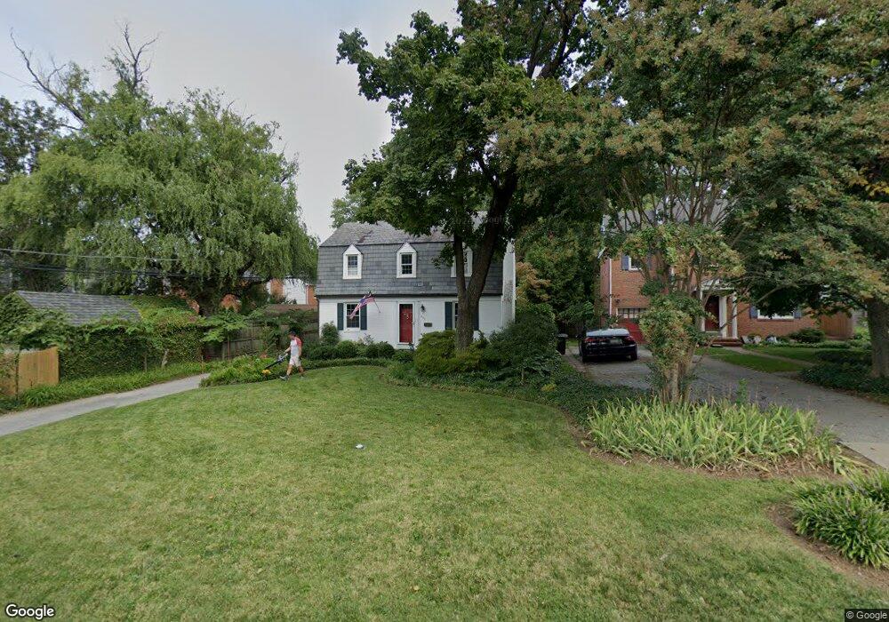
400 Stevenson Ln Towson, MD 21204
Estimated Value: $450,000 - $631,000
Studio
2
Baths
1,560
Sq Ft
$351/Sq Ft
Est. Value
About This Home
This home is located at 400 Stevenson Ln, Towson, MD 21204 and is currently estimated at $546,974, approximately $350 per square foot. 400 Stevenson Ln is a home located in Baltimore County with nearby schools including Rodgers Forge Elementary School, Dumbarton Middle School, and Towson High Law & Public Policy.
Ownership History
Date
Name
Owned For
Owner Type
Purchase Details
Closed on
Aug 12, 2013
Sold by
Marino Robert P and Silcott Timothy H
Bought by
Marino Robert P
Current Estimated Value
Home Financials for this Owner
Home Financials are based on the most recent Mortgage that was taken out on this home.
Original Mortgage
$145,000
Outstanding Balance
$108,346
Interest Rate
4.51%
Mortgage Type
New Conventional
Estimated Equity
$438,628
Purchase Details
Closed on
Jan 27, 1994
Sold by
Mccaughey Kevin H
Bought by
Marino Robert P
Home Financials for this Owner
Home Financials are based on the most recent Mortgage that was taken out on this home.
Original Mortgage
$126,000
Interest Rate
7.11%
Purchase Details
Closed on
May 2, 1984
Sold by
King Robert Price
Bought by
Mccaughey Kevin H
Create a Home Valuation Report for This Property
The Home Valuation Report is an in-depth analysis detailing your home's value as well as a comparison with similar homes in the area
Home Values in the Area
Average Home Value in this Area
Purchase History
| Date | Buyer | Sale Price | Title Company |
|---|---|---|---|
| Marino Robert P | $76,989 | None Available | |
| Marino Robert P | $166,000 | -- | |
| Mccaughey Kevin H | $95,000 | -- |
Source: Public Records
Mortgage History
| Date | Status | Borrower | Loan Amount |
|---|---|---|---|
| Open | Marino Robert P | $145,000 | |
| Previous Owner | Marino Robert P | $126,000 |
Source: Public Records
Tax History
| Year | Tax Paid | Tax Assessment Tax Assessment Total Assessment is a certain percentage of the fair market value that is determined by local assessors to be the total taxable value of land and additions on the property. | Land | Improvement |
|---|---|---|---|---|
| 2025 | $5,829 | $424,600 | $147,000 | $277,600 |
| 2024 | $5,829 | $403,067 | $0 | $0 |
| 2023 | $2,915 | $381,533 | $0 | $0 |
| 2022 | $5,626 | $360,000 | $131,800 | $228,200 |
| 2021 | $5,164 | $353,167 | $0 | $0 |
| 2020 | $5,164 | $346,333 | $0 | $0 |
| 2019 | $5,028 | $339,500 | $131,800 | $207,700 |
| 2018 | $5,049 | $330,867 | $0 | $0 |
| 2017 | $4,624 | $322,233 | $0 | $0 |
| 2016 | $3,509 | $313,600 | $0 | $0 |
| 2015 | $3,509 | $313,600 | $0 | $0 |
| 2014 | $3,509 | $313,600 | $0 | $0 |
Source: Public Records
Map
Nearby Homes
- 517 Worcester Rd
- 609 Stevenson Ln
- 229 Murdock Rd
- 625 Yarmouth Rd
- 318 Hopkins Rd
- 664 Regester Ave
- 310 Worthington Rd
- 613 Anneslie Rd
- 6509 Abbey View Way
- 625 Dunkirk Rd
- 12 Stone Ridge Ct
- 615 Overbrook Rd
- 633 Anneslie Rd
- 706 Anneslie Rd
- 7404 Knollwood Rd
- 722 Anneslie Rd
- 806 Forest Rd
- 415 Schwartz Ave
- 146 Villabrook Way
- 100 Villabrook Way
- 402 Stevenson Ln
- 7303 Yorktowne Dr
- 7305 Yorktowne Dr
- 404 Stevenson Ln
- 7301 Yorktowne Dr
- 7307 Yorktowne Dr
- 7309 Yorktowne Dr
- 406 Stevenson Ln
- 7311 Yorktowne Dr
- 413 Stevenson Ln
- 415 Stevenson Ln
- 408 Stevenson Ln
- 411 Stevenson Ln
- 417 Stevenson Ln
- 7306 Yorktowne Dr
- 409 Stevenson Ln
- 7308 Yorktowne Dr
- 7313 Yorktowne Dr
- 7300 Yorktowne Dr
- 419 Stevenson Ln
Your Personal Tour Guide
Ask me questions while you tour the home.