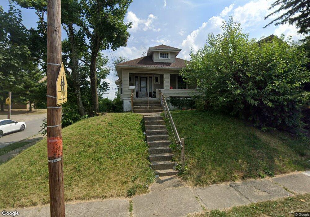
4001 Heyward St Cincinnati, OH 45205
West Price Hill NeighborhoodEstimated Value: $100,036 - $145,000
2
Beds
1
Bath
772
Sq Ft
$152/Sq Ft
Est. Value
About This Home
This home is located at 4001 Heyward St, Cincinnati, OH 45205 and is currently estimated at $117,259, approximately $151 per square foot. 4001 Heyward St is a home located in Hamilton County with nearby schools including Carson School, Gilbert A. Dater High School, and Western Hills High School.
Ownership History
Date
Name
Owned For
Owner Type
Purchase Details
Closed on
Dec 9, 2003
Sold by
Perry John and Perry Patricia L
Bought by
P L P Properties Llc
Current Estimated Value
Purchase Details
Closed on
Sep 2, 2003
Sold by
Luhn Robert J and Luhn Darlene M
Bought by
Perry John
Create a Home Valuation Report for This Property
The Home Valuation Report is an in-depth analysis detailing your home's value as well as a comparison with similar homes in the area
Home Values in the Area
Average Home Value in this Area
Purchase History
| Date | Buyer | Sale Price | Title Company |
|---|---|---|---|
| P L P Properties Llc | -- | -- | |
| Perry John | $38,500 | -- |
Source: Public Records
Tax History
| Year | Tax Paid | Tax Assessment Tax Assessment Total Assessment is a certain percentage of the fair market value that is determined by local assessors to be the total taxable value of land and additions on the property. | Land | Improvement |
|---|---|---|---|---|
| 2025 | $1,602 | $24,497 | $4,253 | $20,244 |
| 2024 | $1,600 | $24,497 | $4,253 | $20,244 |
| 2023 | $1,603 | $24,497 | $4,253 | $20,244 |
| 2022 | $952 | $12,789 | $4,228 | $8,561 |
| 2021 | $921 | $12,789 | $4,228 | $8,561 |
| 2020 | $923 | $12,789 | $4,228 | $8,561 |
| 2019 | $921 | $11,627 | $3,843 | $7,784 |
| 2018 | $922 | $11,627 | $3,843 | $7,784 |
| 2017 | $886 | $11,627 | $3,843 | $7,784 |
| 2016 | $834 | $10,634 | $4,106 | $6,528 |
| 2015 | $749 | $10,634 | $4,106 | $6,528 |
| 2014 | $752 | $10,634 | $4,106 | $6,528 |
| 2013 | $863 | $12,083 | $4,666 | $7,417 |
Source: Public Records
Map
Nearby Homes
- 4000 Akochia Ave
- 1440 Manss Ave
- 2024 Sunset Ave
- 1647 Dewey Ave
- 1705 Wyoming Ave
- 1634 Dewey Ave
- 1710 Wyoming Ave
- 1318 Beech Ave
- 4033 W Liberty St
- 1613 Wyoming Ave
- 1812 Quebec Rd
- 3744 Mayfield Ave
- 3742 Mayfield Ave
- 1222 Dewey Ave
- 2403 Glenway Ave
- 1113 Gilsey Ave
- 2084 Queen City Ave
- 1110 Winfield Ave
- 1226 Rutledge Ave
- 2504 Forthmann Place
- 4005 Heyward St
- 4007 Heyward St
- 1748 Iliff Ave
- 1754 Iliff Ave
- 1756 Iliff Ave
- 1752 Iliff Ave
- 4000 Heyward St
- 1750 Iliff Ave
- 4006 Heyward St
- 3990 Heyward St
- 4008 Heyward St
- 3986 Heyward St
- 3982 Heyward St
- 1811 1st Ave
- 4012 Heyward St
- 1535 Manss Ave
- 1533 Manss Ave
- 1539 Manss Ave
- 1529 Manss Ave
- 1525 Manss Ave
Your Personal Tour Guide
Ask me questions while you tour the home.