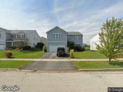
4003 Bluestem Cir Zion, IL 60099
West Zion NeighborhoodEstimated Value: $348,765 - $405,000
3
Beds
3
Baths
2,860
Sq Ft
$131/Sq Ft
Est. Value
About This Home
This home is located at 4003 Bluestem Cir, Zion, IL 60099 and is currently estimated at $374,941, approximately $131 per square foot. 4003 Bluestem Cir is a home located in Lake County with nearby schools including Newport Elementary School, Beach Park Middle School, and Zion-Benton Township High School.
Ownership History
Date
Name
Owned For
Owner Type
Purchase Details
Closed on
Apr 3, 2007
Sold by
Kennedy Homes Lp
Bought by
Prelich Michael Robert and Prelich Victoria
Current Estimated Value
Home Financials for this Owner
Home Financials are based on the most recent Mortgage that was taken out on this home.
Original Mortgage
$270,339
Outstanding Balance
$165,778
Interest Rate
6.19%
Mortgage Type
VA
Create a Home Valuation Report for This Property
The Home Valuation Report is an in-depth analysis detailing your home's value as well as a comparison with similar homes in the area
Home Values in the Area
Average Home Value in this Area
Purchase History
| Date | Buyer | Sale Price | Title Company |
|---|---|---|---|
| Prelich Michael Robert | $265,000 | First American Title Ins |
Source: Public Records
Mortgage History
| Date | Status | Borrower | Loan Amount |
|---|---|---|---|
| Open | Prelich Michael Robert | $270,339 |
Source: Public Records
Tax History Compared to Growth
Tax History
| Year | Tax Paid | Tax Assessment Tax Assessment Total Assessment is a certain percentage of the fair market value that is determined by local assessors to be the total taxable value of land and additions on the property. | Land | Improvement |
|---|---|---|---|---|
| 2023 | -- | $90,259 | $15,623 | $74,636 |
| 2022 | $0 | $86,348 | $12,847 | $73,501 |
| 2021 | $9,980 | $81,002 | $12,052 | $68,950 |
| 2020 | $9,980 | $76,187 | $11,336 | $64,851 |
| 2019 | $9,713 | $70,971 | $10,560 | $60,411 |
| 2018 | $8,946 | $64,613 | $9,558 | $55,055 |
| 2017 | $8,777 | $59,937 | $8,866 | $51,071 |
| 2016 | $8,147 | $54,409 | $8,048 | $46,361 |
| 2015 | $7,828 | $49,368 | $7,302 | $42,066 |
| 2014 | $7,347 | $47,836 | $6,882 | $40,954 |
| 2012 | $7,939 | $50,943 | $7,329 | $43,614 |
Source: Public Records
Map
Nearby Homes
- 0 Stonebridge Dr
- 1402 Reed Rd
- 4049 Ridge Rd
- 1522 Anderson Trail
- 4539 Illinois 173
- 4533 Illinois 173
- 1537 Anderson Trail
- 4006 Hill Dr
- 4211 Gregory Dr
- 1720 Midday Dr
- 13360 W High Ridge Trail
- 1811 Sunshine Ln
- 1940 N Green Bay Rd
- 1903 Kenosha Rd
- 13464 W Hidden Springs Trail
- 3514 Portsmouth Dr
- 3504 Wembley Dr
- 42334 N Heritage Lot 7 Trail
- 43275 N Fago Ave
- 2407 Phillip Dr
- 4003 Bluestem Cir
- 4001 Bluestem Cir
- 4005 Bluestem Cir
- 4100 Stonebridge Dr
- 4000 Bluestem Cir
- 4002 Bluestem Cir
- 4004 Bluestem Cir
- 4102 Stonebridge Dr
- 3923 Stonebridge Dr
- 4104 Stonebridge Dr
- 3927 Stonebridge Dr
- 3921 Stonebridge Dr
- 3918 Stonebridge Dr
- 3919 Stonebridge Dr
- 4106 Stonebridge Dr
- 3916 Stonebridge Dr
- 4019 Bluestem Cir
- 3917 Stonebridge Dr
- 3922 Sedge St
- 3924 Sedge St