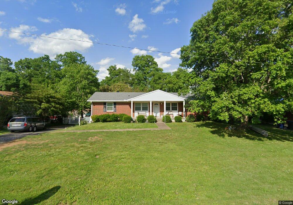
4004 Brookside Dr Columbia, TN 38401
3
Beds
2
Baths
1,714
Sq Ft
16,117
Sq Ft Lot
About This Home
This home is located at 4004 Brookside Dr, Columbia, TN 38401. 4004 Brookside Dr is a home located in Maury County with nearby schools including J.E. Woodard Elementary School, Whitthorne Middle School, and Columbia Central High School.
Create a Home Valuation Report for This Property
The Home Valuation Report is an in-depth analysis detailing your home's value as well as a comparison with similar homes in the area
Home Values in the Area
Average Home Value in this Area
Tax History
| Year | Tax Paid | Tax Assessment Tax Assessment Total Assessment is a certain percentage of the fair market value that is determined by local assessors to be the total taxable value of land and additions on the property. | Land | Improvement |
|---|---|---|---|---|
| 2022 | $1,730 | $63,250 | $12,500 | $50,750 |
Source: Public Records
Map
Nearby Homes
- 3002 Knud Dr
- 2910 Brookside Dr
- 104 Darden Place
- 255 Valley Dr
- 6016 Clifton Dr
- 6006 Clifton Dr
- 4002 Trotwood Ave
- 305 Evergreen Dr
- 5013 Hays Dr
- 2719 Gray Cir
- 120 Pleasant Dr
- 1612 Baucom Dr
- 131 Overlook Place
- 526 Woods Dr
- 1620 Baucom Dr
- 6152 Worthington Rd Unit Lot 23
- 6157 Worthington Rd
- 0 N Stone Dr
- 6161 Worthington Rd Unit Lot 47
- 6161 Worthington Rd
- 4006 Brookside Dr
- 4002 Brookside Dr
- 4000 Brookside Dr
- 4008 Brookside Dr
- 4009 Brookside Dr
- 4013 Brookside Dr
- 4007 Brookside Dr
- 3003 Mcintire Dr
- 2015 Westwood Dr
- 2013 Westwood Dr
- 3010 Brookside Dr
- 2011 Westwood Dr
- 2017 Westwood Dr
- 3000 Park Dr
- 3002 Mcintire Dr
- 4017 Brookside Dr
- 3009 Brookside Dr
- 2019 Westwood Dr
- 2009 Westwood Dr
- 3005 Mcintire Dr
Your Personal Tour Guide
Ask me questions while you tour the home.