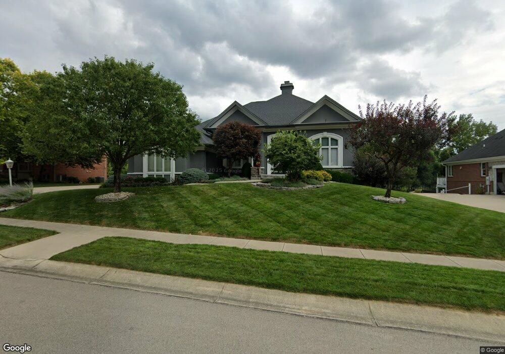
4004 Sable Ridge Dr Bellbrook, OH 45305
Estimated Value: $659,000 - $843,000
4
Beds
4
Baths
4,247
Sq Ft
$177/Sq Ft
Est. Value
About This Home
This home is located at 4004 Sable Ridge Dr, Bellbrook, OH 45305 and is currently estimated at $750,537, approximately $176 per square foot. 4004 Sable Ridge Dr is a home located in Greene County with nearby schools including Stephen Bell Elementary School, Bell Creek Intermediate School, and Bellbrook Middle School.
Ownership History
Date
Name
Owned For
Owner Type
Purchase Details
Closed on
Apr 23, 2012
Sold by
Foster Michael A and Foster Marcia R
Bought by
Schroder Jeffrey and Schroder Sharon
Current Estimated Value
Home Financials for this Owner
Home Financials are based on the most recent Mortgage that was taken out on this home.
Original Mortgage
$105,500
Outstanding Balance
$72,624
Interest Rate
3.99%
Mortgage Type
Future Advance Clause Open End Mortgage
Estimated Equity
$677,913
Purchase Details
Closed on
Mar 29, 2006
Sold by
Foster Michael A and Foster Marcia R
Bought by
Foster Michael A and Foster Marcia R
Purchase Details
Closed on
Feb 23, 2005
Sold by
Bellbrook Land Co
Bought by
Foster Michael A and Foster Marcia R
Create a Home Valuation Report for This Property
The Home Valuation Report is an in-depth analysis detailing your home's value as well as a comparison with similar homes in the area
Home Values in the Area
Average Home Value in this Area
Purchase History
| Date | Buyer | Sale Price | Title Company |
|---|---|---|---|
| Schroder Jeffrey | $550,000 | None Available | |
| Foster Michael A | -- | None Available | |
| Foster Michael A | $71,900 | Midwest Abstract Company |
Source: Public Records
Mortgage History
| Date | Status | Borrower | Loan Amount |
|---|---|---|---|
| Open | Schroder Jeffrey | $105,500 |
Source: Public Records
Tax History
| Year | Tax Paid | Tax Assessment Tax Assessment Total Assessment is a certain percentage of the fair market value that is determined by local assessors to be the total taxable value of land and additions on the property. | Land | Improvement |
|---|---|---|---|---|
| 2024 | $13,692 | $234,510 | $27,050 | $207,460 |
| 2023 | $13,175 | $234,510 | $27,050 | $207,460 |
| 2022 | $12,556 | $182,330 | $27,050 | $155,280 |
| 2021 | $12,684 | $182,330 | $27,050 | $155,280 |
| 2020 | $11,854 | $182,330 | $27,050 | $155,280 |
| 2019 | $13,762 | $191,900 | $28,630 | $163,270 |
| 2018 | $13,777 | $191,900 | $28,630 | $163,270 |
| 2017 | $13,891 | $191,900 | $28,630 | $163,270 |
| 2016 | $13,892 | $192,280 | $28,630 | $163,650 |
| 2015 | $13,933 | $192,280 | $28,630 | $163,650 |
| 2014 | $12,906 | $192,280 | $28,630 | $163,650 |
Source: Public Records
Map
Nearby Homes
- 2250 Jacob Hills Ct
- 3849 Sable Ridge Dr
- 1939 Sugar Run Trail
- 1900 N Belleview Dr
- 2016 Wentworth Village Dr Unit 2016
- 2085 Regent Park Dr
- 1860 Bledsoe Dr
- 3625 Marwood Dr
- 3930 Beechwood Dr
- 4206 N Golden Clove Bend Unit 56-303
- 3611 Ridgeway Rd
- 4208 N Golden Clove Bend Unit 56-103
- 4216 N Golden Clove Bend Unit 56-302
- 4214 N Golden Clove Bend Unit 56-102
- 4222 N Golden Clove Bend Unit 56-201
- 4218 N Golden Clove Bend Unit 56-300
- 1478 Country Wood Dr
- 4228 Apple Branch Dr Unit 55-204
- 4232 Apple Branch Dr Unit 55-305
- 4236 Apple Branch Dr Unit 55-103
- 3996 Sable Ridge Dr
- 4012 Sable Ridge Dr
- 3951 Northfield Dr
- 4020 Sable Ridge Dr
- 4001 Sable Ridge Dr
- 3986 Sable Ridge Dr
- 4009 Sable Ridge Dr
- 3993 Sable Ridge Dr
- 3951 N Field Dr
- 4017 Sable Ridge Dr
- 3945 N Field Dr
- 3974 Sable Ridge Dr
- 4025 Sable Ridge Dr
- 1819 Kensington Dr
- 1818 Kensington Dr
- 3985 Sable Ridge Dr
- 4028 Sable Ridge Dr
- 3935 N Field Dr
- 3964 Sable Ridge Dr
- 3952 N Field Dr
Your Personal Tour Guide
Ask me questions while you tour the home.