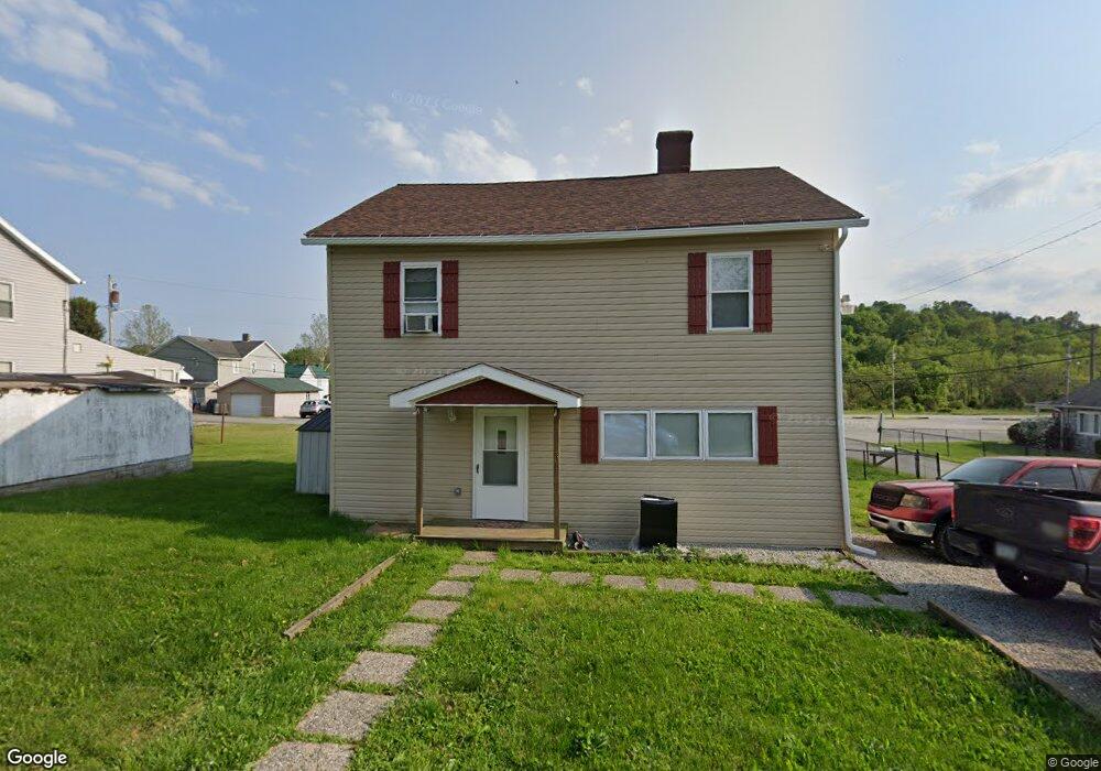
401 1st St Uniontown, PA 15401
Estimated Value: $119,000 - $169,000
4
Beds
1
Bath
1,798
Sq Ft
$75/Sq Ft
Est. Value
About This Home
This home is located at 401 1st St, Uniontown, PA 15401 and is currently estimated at $134,763, approximately $74 per square foot. 401 1st St is a home located in Fayette County with nearby schools including Laurel Highlands Senior High School, St. John the Evangelist School, and Chestnut Ridge Christian Academy.
Ownership History
Date
Name
Owned For
Owner Type
Purchase Details
Closed on
Sep 23, 2022
Sold by
Campbell Daniel and Campbell Danna
Bought by
Campbell Nicholas P
Current Estimated Value
Home Financials for this Owner
Home Financials are based on the most recent Mortgage that was taken out on this home.
Original Mortgage
$93,500
Outstanding Balance
$89,307
Interest Rate
5.22%
Mortgage Type
New Conventional
Estimated Equity
$45,456
Purchase Details
Closed on
Apr 16, 2016
Sold by
Edenfield Diana
Bought by
Campbell Daniel and Hartley Danna
Create a Home Valuation Report for This Property
The Home Valuation Report is an in-depth analysis detailing your home's value as well as a comparison with similar homes in the area
Home Values in the Area
Average Home Value in this Area
Purchase History
| Date | Buyer | Sale Price | Title Company |
|---|---|---|---|
| Campbell Nicholas P | $110,000 | -- | |
| Campbell Daniel | $10,000 | None Available |
Source: Public Records
Mortgage History
| Date | Status | Borrower | Loan Amount |
|---|---|---|---|
| Open | Campbell Nicholas P | $93,500 |
Source: Public Records
Tax History Compared to Growth
Tax History
| Year | Tax Paid | Tax Assessment Tax Assessment Total Assessment is a certain percentage of the fair market value that is determined by local assessors to be the total taxable value of land and additions on the property. | Land | Improvement |
|---|---|---|---|---|
| 2025 | $144 | $5,050 | $4,015 | $1,035 |
| 2024 | $140 | $5,050 | $4,015 | $1,035 |
| 2023 | $269 | $5,050 | $4,015 | $1,035 |
| 2022 | $267 | $5,050 | $4,015 | $1,035 |
| 2021 | $259 | $5,050 | $4,015 | $1,035 |
| 2020 | $259 | $5,050 | $4,015 | $1,035 |
| 2019 | $238 | $5,050 | $4,015 | $1,035 |
| 2018 | $231 | $5,050 | $4,015 | $1,035 |
| 2017 | $231 | $5,050 | $4,015 | $1,035 |
| 2016 | -- | $5,050 | $4,015 | $1,035 |
| 2015 | -- | $5,050 | $4,015 | $1,035 |
| 2014 | -- | $10,100 | $8,030 | $2,070 |
Source: Public Records
Map
Nearby Homes
- 405 1st St
- 9 Cycle Ave
- 479 Walnut Hill Rd
- 477 Walnut Hill Rd
- 400 1st St
- 402 1st St
- 483 Walnut Hill Rd
- 473 Walnut Hill Rd
- 406 1st St
- 413 1st St
- 485 Walnut Hill Rd
- 469 Walnut Hill Rd
- 481 Walnut Hill Rd
- 410 1st St
- 411 1st St
- 415 1st St
- 467 Walnut Hill Rd
- 0 Community Ave
- 15 Community Ave
- 487 Walnut Hill Rd