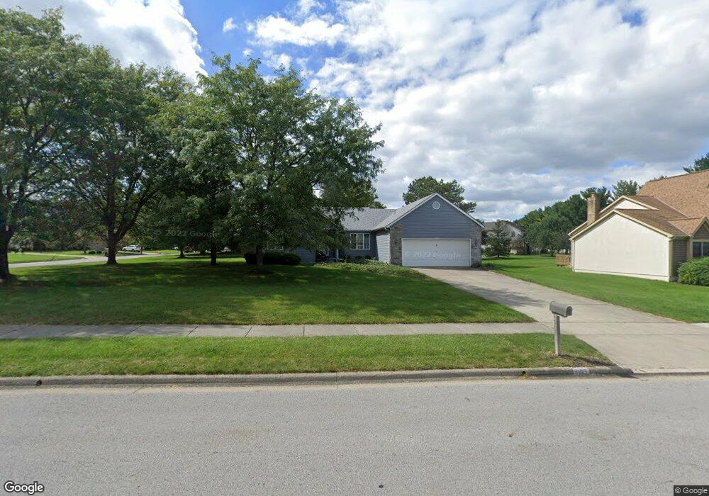
401 Briarbend Blvd Powell, OH 43065
Estimated Value: $478,605 - $592,000
3
Beds
2
Baths
2,000
Sq Ft
$261/Sq Ft
Est. Value
About This Home
This home is located at 401 Briarbend Blvd, Powell, OH 43065 and is currently estimated at $521,651, approximately $260 per square foot. 401 Briarbend Blvd is a home located in Delaware County with nearby schools including Tyler Run Elementary School, Olentangy Liberty Middle School, and Olentangy Liberty High School.
Ownership History
Date
Name
Owned For
Owner Type
Purchase Details
Closed on
Feb 17, 2017
Bought by
Norman E Reed
Current Estimated Value
Home Financials for this Owner
Home Financials are based on the most recent Mortgage that was taken out on this home.
Interest Rate
4.15%
Purchase Details
Closed on
Mar 28, 2005
Sold by
Carnes Gary L
Bought by
Reed Norman E and Reed Donna
Home Financials for this Owner
Home Financials are based on the most recent Mortgage that was taken out on this home.
Original Mortgage
$289,136
Interest Rate
6.05%
Mortgage Type
VA
Create a Home Valuation Report for This Property
The Home Valuation Report is an in-depth analysis detailing your home's value as well as a comparison with similar homes in the area
Home Values in the Area
Average Home Value in this Area
Purchase History
| Date | Buyer | Sale Price | Title Company |
|---|---|---|---|
| Norman E Reed | $260,900 | -- | |
| Reed Norman E | $279,900 | Chicago Title |
Source: Public Records
Mortgage History
| Date | Status | Borrower | Loan Amount |
|---|---|---|---|
| Closed | Norman E Reed | -- | |
| Previous Owner | Reed Norman E | $289,136 |
Source: Public Records
Tax History
| Year | Tax Paid | Tax Assessment Tax Assessment Total Assessment is a certain percentage of the fair market value that is determined by local assessors to be the total taxable value of land and additions on the property. | Land | Improvement |
|---|---|---|---|---|
| 2024 | $6,978 | $133,180 | $36,580 | $96,600 |
| 2023 | $7,005 | $133,180 | $36,580 | $96,600 |
| 2022 | $6,673 | $100,590 | $24,500 | $76,090 |
| 2021 | $6,788 | $100,590 | $24,500 | $76,090 |
| 2020 | $6,813 | $100,590 | $24,500 | $76,090 |
| 2019 | $5,919 | $90,650 | $24,500 | $66,150 |
| 2018 | $5,988 | $90,650 | $24,500 | $66,150 |
| 2017 | $5,960 | $91,320 | $20,370 | $70,950 |
| 2016 | $6,472 | $91,320 | $20,370 | $70,950 |
| 2015 | $5,890 | $91,320 | $20,370 | $70,950 |
| 2014 | $5,972 | $91,320 | $20,370 | $70,950 |
| 2013 | $6,199 | $92,680 | $20,370 | $72,310 |
Source: Public Records
Map
Nearby Homes
- 1937 Liberty St
- 120 S Liberty St
- 92 Barrington Place
- 130 Barrington Place
- 156 Meadow Ridge Ct
- 170 Barrington Place
- 18 Murphys View Place Unit I18
- 104 Encore Park Bend
- 86 Cressingham Ln
- Irving Plan at Encore Park of Powell - Uptown Collection
- Oakley Plan at Encore Park of Powell - Uptown Collection
- 471 Commons Dr Unit 471
- 255 Winter Hill Place
- 149 Trail Edge Cir
- 2288 Benning Dr
- 22 Brookehill Dr
- 144 Valley Run Place
- 8292 Breckenridge Way
- 22 Liberty Ridge Ave
- 9427 Clermont Cir Unit 9427
- 381 Briarbend Blvd
- 170 Whitegate Ct
- 160 Whitegate Ct
- 421 Briarbend Blvd
- 175 Whitegate Ct
- 402 Briarbend Blvd
- 384 Briarbend Blvd
- 150 Whitegate Ct
- 424 Briarbend Blvd
- 171 Whitegate Ct
- 441 Briarbend Blvd
- 355 Briarbend Blvd
- 446 Briarbend Blvd
- 165 Whitegate Ct
- 161 Whitegate Ct
- 180 Briarbend Ct
- 238 Woodsfield Ct
- 140 Whitegate Ct
- 360 Briarbend Blvd
- 153 Whitegate Ct
Your Personal Tour Guide
Ask me questions while you tour the home.