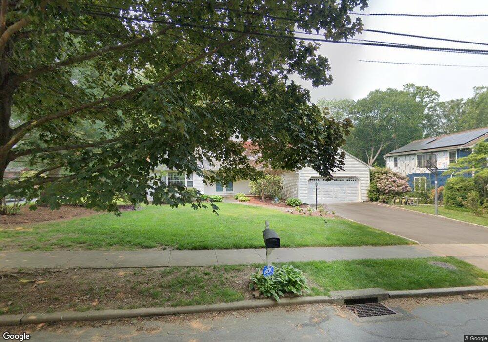
401 Carroll Rd Fairfield, CT 06824
University NeighborhoodEstimated Value: $1,224,000 - $1,537,000
4
Beds
3
Baths
2,291
Sq Ft
$582/Sq Ft
Est. Value
About This Home
This home is located at 401 Carroll Rd, Fairfield, CT 06824 and is currently estimated at $1,333,029, approximately $581 per square foot. 401 Carroll Rd is a home located in Fairfield County with nearby schools including Riverfield Elementary School, Roger Ludlowe Middle School, and Fairfield Ludlowe High School.
Ownership History
Date
Name
Owned For
Owner Type
Purchase Details
Closed on
May 4, 1987
Sold by
Eckert Robert E
Bought by
Gilroy John A
Current Estimated Value
Home Financials for this Owner
Home Financials are based on the most recent Mortgage that was taken out on this home.
Original Mortgage
$175,000
Interest Rate
8.99%
Mortgage Type
Purchase Money Mortgage
Create a Home Valuation Report for This Property
The Home Valuation Report is an in-depth analysis detailing your home's value as well as a comparison with similar homes in the area
Home Values in the Area
Average Home Value in this Area
Purchase History
| Date | Buyer | Sale Price | Title Company |
|---|---|---|---|
| Gilroy John A | $428,000 | -- |
Source: Public Records
Mortgage History
| Date | Status | Borrower | Loan Amount |
|---|---|---|---|
| Closed | Gilroy John A | $160,000 | |
| Closed | Gilroy John A | $175,000 |
Source: Public Records
Tax History Compared to Growth
Tax History
| Year | Tax Paid | Tax Assessment Tax Assessment Total Assessment is a certain percentage of the fair market value that is determined by local assessors to be the total taxable value of land and additions on the property. | Land | Improvement |
|---|---|---|---|---|
| 2025 | $15,127 | $532,840 | $307,860 | $224,980 |
| 2024 | $14,866 | $532,840 | $307,860 | $224,980 |
| 2023 | $14,658 | $532,840 | $307,860 | $224,980 |
| 2022 | $14,515 | $532,840 | $307,860 | $224,980 |
| 2021 | $14,376 | $532,840 | $307,860 | $224,980 |
| 2020 | $14,903 | $556,290 | $304,640 | $251,650 |
| 2019 | $14,903 | $556,290 | $304,640 | $251,650 |
| 2018 | $14,664 | $556,290 | $304,640 | $251,650 |
| 2017 | $14,363 | $556,290 | $304,640 | $251,650 |
| 2016 | $14,158 | $556,290 | $304,640 | $251,650 |
| 2015 | $13,964 | $563,290 | $320,670 | $242,620 |
| 2014 | $13,744 | $563,290 | $320,670 | $242,620 |
Source: Public Records
Map
Nearby Homes
- 44 Deer Run Rd
- 105 Charter Oak Rd
- 66 Adams Rd
- 338 Orchard Hill Ln
- 33 Middlebrook Place
- 45 Robin Cir
- 1207 Stillson Rd
- 83 Pell Meadow Dr
- 42 Robin Cir
- 25 Millspaugh Dr
- 1165 Stillson Rd
- 232 Pell Meadow Dr
- 1137 Stillson Rd
- 68 Figlar Ave
- 2107 N Benson Rd
- 359 Reid St
- 56 Drake Ln
- 478 Crestwood Rd
- 133 Green Acre Ln
- 15 Barton Rd
- 391 Carroll Rd
- 419 Carroll Rd
- 369 Carroll Rd
- 345 Carroll Rd
- 201 College Park Dr
- 179 College Park Dr
- 159 College Park Dr
- 139 College Park Dr
- 139 College Park Dr Unit 139
- 184 College Park Dr
- 200 College Park Dr
- 315 Carroll Rd
- 162 College Park Dr
- 40 Thor Place
- 140 College Park Dr
- 287 Carroll Rd
- 120 College Park Dr
- 43 Thor Place
- 78 Deer Run Rd
- 64 Deer Run Rd