Estimated Value: $157,000 - $212,000
3
Beds
1
Bath
1,131
Sq Ft
$163/Sq Ft
Est. Value
About This Home
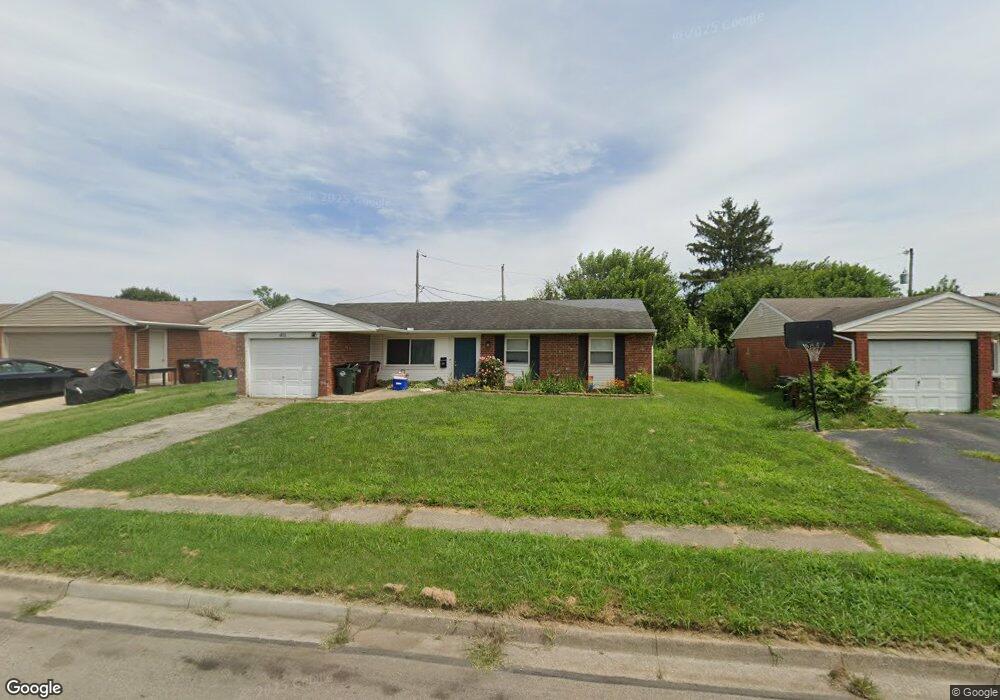
This home is located at 401 Colorado Dr, Xenia, OH 45385 and is currently estimated at $184,357, approximately $163 per square foot. 401 Colorado Dr is a home located in Greene County with nearby schools including Xenia High School and Summit Academy Community School for Alternative Learners - Xenia.
Ownership History
Date
Name
Owned For
Owner Type
Purchase Details
Closed on
Sep 25, 2024
Sold by
Ferguson Andrew D and Ferguson Amy L
Bought by
Ferguson Andrew D and Ferguson Amy L
Current Estimated Value
Purchase Details
Closed on
Jun 7, 2012
Sold by
P K Family Lp
Bought by
Ferguson Andrew D
Home Financials for this Owner
Home Financials are based on the most recent Mortgage that was taken out on this home.
Original Mortgage
$66,768
Interest Rate
3.9%
Mortgage Type
FHA
Create a Home Valuation Report for This Property
The Home Valuation Report is an in-depth analysis detailing your home's value as well as a comparison with similar homes in the area
Home Values in the Area
Average Home Value in this Area
Purchase History
| Date | Buyer | Sale Price | Title Company |
|---|---|---|---|
| Ferguson Andrew D | -- | None Listed On Document | |
| Ferguson Andrew D | $68,000 | None Available |
Source: Public Records
Mortgage History
| Date | Status | Borrower | Loan Amount |
|---|---|---|---|
| Previous Owner | Ferguson Andrew D | $66,768 |
Source: Public Records
Tax History Compared to Growth
Tax History
| Year | Tax Paid | Tax Assessment Tax Assessment Total Assessment is a certain percentage of the fair market value that is determined by local assessors to be the total taxable value of land and additions on the property. | Land | Improvement |
|---|---|---|---|---|
| 2024 | $2,065 | $45,960 | $10,680 | $35,280 |
| 2023 | $1,967 | $45,960 | $10,680 | $35,280 |
| 2022 | $1,633 | $32,550 | $6,280 | $26,270 |
| 2021 | $1,655 | $32,550 | $6,280 | $26,270 |
| 2020 | $1,586 | $32,550 | $6,280 | $26,270 |
| 2019 | $1,206 | $23,310 | $6,240 | $17,070 |
| 2018 | $1,211 | $23,310 | $6,240 | $17,070 |
| 2017 | $1,176 | $23,310 | $6,240 | $17,070 |
| 2016 | $1,095 | $20,680 | $6,240 | $14,440 |
| 2015 | $1,098 | $20,680 | $6,240 | $14,440 |
| 2014 | $1,051 | $20,680 | $6,240 | $14,440 |
Source: Public Records
Map
Nearby Homes
- 414 Whisper Ln
- 219 Kansas Dr
- 2758 Wyoming Dr
- 2142 Michigan Dr
- 161 Montana Dr
- 2545 Harmony Dr
- 1653 Seneca Dr
- 2257 Maryland Dr
- 1769 Gayhart Dr
- 1829 Gayhart Dr
- 1618 Navajo Dr
- 1568 Cheyenne Dr
- 1908 Whitt St
- 1778 Arapaho Dr
- 1107 Arkansas Dr
- 1255 Colorado Dr
- 2345 Tennessee Dr
- 1866 Roxbury Dr
- 121 S Progress Dr
- 1144 Rockwell Dr
- 415 Colorado Dr
- 385 Colorado Dr
- 1985 Oklahoma Dr
- 1986 Iowa Dr
- 429 Colorado Dr
- 414 Colorado Dr
- 1971 Oklahoma Dr
- 1972 Iowa Dr
- 400 Colorado Dr
- 428 Colorado Dr
- 386 Colorado Dr
- 367 Colorado Dr
- 442 Colorado Dr
- 1958 Iowa Dr
- 1957 Oklahoma Dr
- 370 Kansas Dr
- 372 Colorado Dr
- 391 Whisper Ln
- 399 Whisper Ln
- 413 Whisper Ln