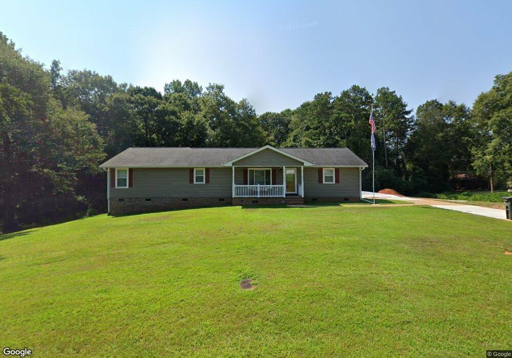
401 Fernwood Cir Anderson, SC 29626
Estimated Value: $227,000 - $247,000
--
Bed
--
Bath
1,797
Sq Ft
$132/Sq Ft
Est. Value
About This Home
This home is located at 401 Fernwood Cir, Anderson, SC 29626 and is currently estimated at $237,907, approximately $132 per square foot. 401 Fernwood Cir is a home located in Anderson County with nearby schools including McLees Elementary School, Robert Anderson Middle School, and Westside High School.
Ownership History
Date
Name
Owned For
Owner Type
Purchase Details
Closed on
Oct 29, 2019
Sold by
Crooks Stacy B
Bought by
Crooks Stacy B and Crooks Linda N
Current Estimated Value
Home Financials for this Owner
Home Financials are based on the most recent Mortgage that was taken out on this home.
Original Mortgage
$120,000
Interest Rate
3.7%
Mortgage Type
New Conventional
Purchase Details
Closed on
Jan 23, 2014
Sold by
Crooks Franklin D and Crooks Dino
Bought by
Crooks Stacy B
Home Financials for this Owner
Home Financials are based on the most recent Mortgage that was taken out on this home.
Original Mortgage
$110,500
Interest Rate
4.44%
Mortgage Type
New Conventional
Purchase Details
Closed on
Nov 5, 2012
Sold by
Crooks Franklin D and Crooks Dino
Bought by
Crooks Stacy B
Create a Home Valuation Report for This Property
The Home Valuation Report is an in-depth analysis detailing your home's value as well as a comparison with similar homes in the area
Home Values in the Area
Average Home Value in this Area
Purchase History
| Date | Buyer | Sale Price | Title Company |
|---|---|---|---|
| Crooks Stacy B | -- | None Available | |
| Crooks Stacy B | -- | -- | |
| Crooks Stacy B | -- | -- |
Source: Public Records
Mortgage History
| Date | Status | Borrower | Loan Amount |
|---|---|---|---|
| Closed | Crooks Stacy B | $120,000 | |
| Closed | Crooks Stacy B | $110,500 |
Source: Public Records
Tax History Compared to Growth
Tax History
| Year | Tax Paid | Tax Assessment Tax Assessment Total Assessment is a certain percentage of the fair market value that is determined by local assessors to be the total taxable value of land and additions on the property. | Land | Improvement |
|---|---|---|---|---|
| 2024 | $779 | $6,170 | $690 | $5,480 |
| 2023 | $779 | $6,170 | $690 | $5,480 |
| 2022 | $748 | $6,170 | $690 | $5,480 |
| 2021 | $670 | $5,490 | $810 | $4,680 |
| 2020 | $2,591 | $8,240 | $1,220 | $7,020 |
| 2019 | $663 | $5,490 | $810 | $4,680 |
| 2018 | $674 | $5,490 | $810 | $4,680 |
| 2017 | -- | $5,490 | $810 | $4,680 |
| 2016 | $621 | $4,980 | $490 | $4,490 |
| 2015 | $633 | $4,970 | $480 | $4,490 |
| 2014 | $627 | $3,930 | $480 | $3,450 |
Source: Public Records
Map
Nearby Homes
- 2403 Dobbins Bridge Rd
- 203 Fernwood Cir
- 202 Hazelwood Ave
- 2501 Dobbins Bridge Rd
- 205 Hazelwood Ave Unit Lot 10 Block A
- 209 and 205 Hazelwood Ave Unit Lots 12 (209) & 10 (
- 209 Hazelwood Ave Unit Lot 12 Block A
- 318 Fretwell Dr
- 636 Jasmin Dr
- 417 Westwood Dr
- 2521 W Whitner St
- 109 Sunrise Ct
- 111 Sunrise Ct Unit SUN0006
- 111 Sunrise Ct
- 113 Sunrise Ct
- 307 Beaty Square
- 00 Highway 24
- 1520 Pearman Dairy Rd
- 0000 Pearman Dairy Rd
- 104 Marsh Creek Dr
- 2303 Dobbins Bridge Rd
- 101 Hazelwood Ave
- 103 Hazelwood Ave
- 2215 Dobbins Bridge Rd
- 105 Hazelwood Ave
- 107 Hazelwood Ave
- TRACT A Dobbins Bridge Rd
- 102 Hazelwood Ave
- 2401 Dobbins Bridge Rd
- 104 Hazelwood Ave
- 109 Hazelwood Ave
- 00 Jasmin Dr
- 205 Fernwood Cir
- 106 Hazelwood Ave
- L35 Kingsboro Rd
- 300 Jasmin Dr
- 203 Jasmin Dr
- 2214 Dobbins Bridge Rd
- 2212 Dobbins Bridge Rd
- 401 Chauga Dr