Estimated Value: $209,000 - $302,000
3
Beds
1
Bath
1,356
Sq Ft
$192/Sq Ft
Est. Value
About This Home
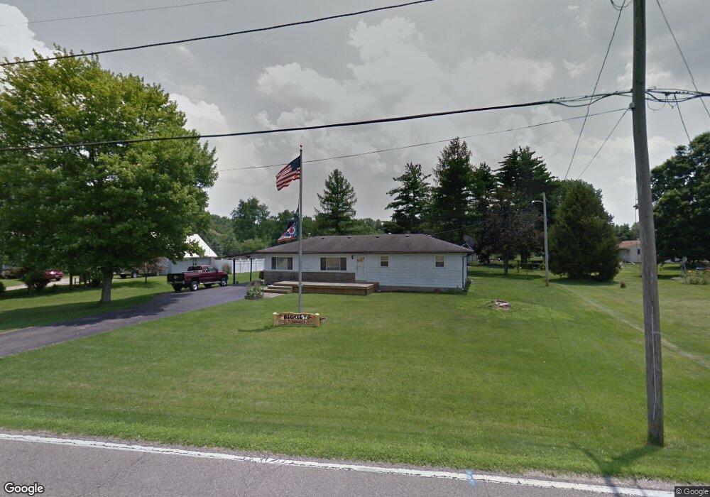
This home is located at 401 Heath Rd, Heath, OH 43056 and is currently estimated at $260,800, approximately $192 per square foot. 401 Heath Rd is a home located in Licking County with nearby schools including Garfield Elementary School, Stevenson Elementary School, and Heath Middle School.
Ownership History
Date
Name
Owned For
Owner Type
Purchase Details
Closed on
Dec 8, 2022
Sold by
Bickley Darla
Bought by
Cook Donald A and Cook Terri L
Current Estimated Value
Purchase Details
Closed on
Jun 30, 2006
Sold by
Hill Jeffrey A and Hill Clarissa M
Bought by
Bickley James J
Home Financials for this Owner
Home Financials are based on the most recent Mortgage that was taken out on this home.
Original Mortgage
$127,000
Interest Rate
6.73%
Mortgage Type
Unknown
Purchase Details
Closed on
Mar 17, 2005
Sold by
Meyer Betty L
Bought by
Hill Jeffrey A and Hill Clarissa M
Home Financials for this Owner
Home Financials are based on the most recent Mortgage that was taken out on this home.
Original Mortgage
$114,950
Interest Rate
5.67%
Mortgage Type
Unknown
Create a Home Valuation Report for This Property
The Home Valuation Report is an in-depth analysis detailing your home's value as well as a comparison with similar homes in the area
Home Values in the Area
Average Home Value in this Area
Purchase History
| Date | Buyer | Sale Price | Title Company |
|---|---|---|---|
| Cook Donald A | -- | None Listed On Document | |
| Bickley James J | $127,000 | Stewart | |
| Hill Jeffrey A | $121,000 | -- |
Source: Public Records
Mortgage History
| Date | Status | Borrower | Loan Amount |
|---|---|---|---|
| Previous Owner | Bickley James J | $127,000 | |
| Previous Owner | Hill Jeffrey A | $114,950 |
Source: Public Records
Tax History
| Year | Tax Paid | Tax Assessment Tax Assessment Total Assessment is a certain percentage of the fair market value that is determined by local assessors to be the total taxable value of land and additions on the property. | Land | Improvement |
|---|---|---|---|---|
| 2024 | $2,653 | $60,450 | $18,870 | $41,580 |
| 2023 | $3,085 | $60,450 | $18,870 | $41,580 |
| 2022 | $2,684 | $49,490 | $13,230 | $36,260 |
| 2021 | $2,739 | $49,490 | $13,230 | $36,260 |
| 2020 | $2,660 | $47,780 | $13,230 | $34,550 |
| 2019 | $2,142 | $39,170 | $12,600 | $26,570 |
| 2018 | $2,166 | $0 | $0 | $0 |
| 2017 | $3,230 | $0 | $0 | $0 |
| 2016 | $2,349 | $0 | $0 | $0 |
| 2015 | $1,194 | $0 | $0 | $0 |
| 2014 | $3,359 | $0 | $0 | $0 |
| 2013 | $2,373 | $0 | $0 | $0 |
Source: Public Records
Map
Nearby Homes
- 1094 Aldine Dr
- 105 Clark Ave
- 1100 Thornwood Dr Unit Lot 1005
- 1100 Thornwood Dr SW Unit 1018
- 1100 Thornwood Dr SW Unit Lot 58
- 1100 Thornwood Dr SW Unit Lot 1008
- 1100 Thornwood Dr SW Unit Lot 1011
- 164 Licking View Dr
- 944 Fieldson Dr
- 18 Swainford Dr
- 101 Fieldpoint Rd
- 92 Jonathan Dr
- 514 S 30th St
- 1285 Bluejack Ln
- 1700 W Main St
- 231 Fieldpoint Rd
- 175 Oak Valley Ct
- 172 Badger Pass
- 2290 Overlook Way
- 69 N Terrace Ave
Your Personal Tour Guide
Ask me questions while you tour the home.