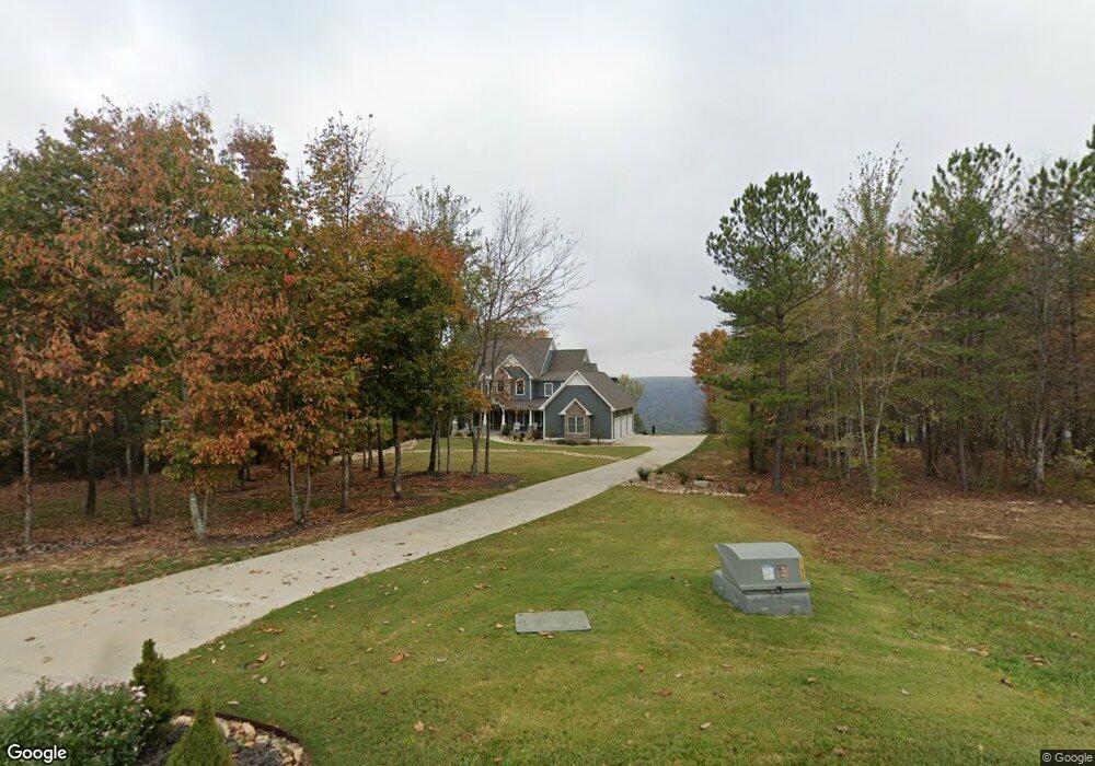
401 High Point Ln Jasper, TN 37347
Estimated Value: $1,220,000 - $1,816,000
--
Bed
1
Bath
3,405
Sq Ft
$406/Sq Ft
Est. Value
About This Home
This home is located at 401 High Point Ln, Jasper, TN 37347 and is currently estimated at $1,382,573, approximately $406 per square foot. 401 High Point Ln is a home with nearby schools including South Pittsburg Elementary School, Jasper Elementary School, and Monteagle Elementary School.
Ownership History
Date
Name
Owned For
Owner Type
Purchase Details
Closed on
Oct 14, 2019
Sold by
Brewer Keith Delaney and Brewer Anita Kay
Bought by
Brewer Keith Delaney and Brewer Anita Kay
Current Estimated Value
Purchase Details
Closed on
Jan 23, 2019
Sold by
Brewer Keith Delaney and Brewer Anita Kay
Bought by
Brewer Keith Delaney and Brewer Anita Kay
Purchase Details
Closed on
Jul 7, 2016
Sold by
Jasper Highlands Development Inc
Bought by
Bre Brewer Keith Delaney and Keith Delaney And Anita Kay Brewer Rev L
Purchase Details
Closed on
Oct 29, 2015
Bought by
Jasper Highlands Development Inc
Create a Home Valuation Report for This Property
The Home Valuation Report is an in-depth analysis detailing your home's value as well as a comparison with similar homes in the area
Home Values in the Area
Average Home Value in this Area
Purchase History
| Date | Buyer | Sale Price | Title Company |
|---|---|---|---|
| Brewer Keith Delaney | -- | None Available | |
| Brewer Keith Delaney | -- | None Available | |
| Bre Brewer Keith Delaney | $131,500 | -- | |
| Jasper Highlands Development Inc | -- | -- |
Source: Public Records
Tax History Compared to Growth
Tax History
| Year | Tax Paid | Tax Assessment Tax Assessment Total Assessment is a certain percentage of the fair market value that is determined by local assessors to be the total taxable value of land and additions on the property. | Land | Improvement |
|---|---|---|---|---|
| 2024 | $4,439 | $252,175 | $61,975 | $190,200 |
| 2023 | $4,439 | $252,175 | $0 | $0 |
| 2022 | $4,439 | $252,175 | $61,975 | $190,200 |
| 2021 | $4,439 | $252,175 | $61,975 | $190,200 |
| 2020 | $4,230 | $252,175 | $61,975 | $190,200 |
| 2019 | $4,289 | $197,775 | $43,750 | $154,025 |
| 2018 | $732 | $197,775 | $43,750 | $154,025 |
| 2017 | $732 | $33,750 | $33,750 | $0 |
| 2016 | $949 | $43,750 | $0 | $0 |
| 2015 | -- | $43,750 | $0 | $0 |
Source: Public Records
Map
Nearby Homes
- 0 High Point Ln Unit 1520255
- 0 High Point Ln Unit RTC2992262
- 0 High Point Ln Unit 1518565
- 220 High Point Ln
- 0 Wilderness Dr Unit 1511552
- 260 Compass Dr
- 595 Compass Dr
- 179 High Point Ln
- 465 Compass Dr
- 316 Compass Dr
- 201/225 Compass Dr
- Rb 61 River Bluffs Dr
- - River Bluffs Dr
- Rb73 River Bluffs Dr
- 1899 River Bluffs Dr
- 440 Lookout View Dr
- 275 Lookout View Dr
- 245 Lookout View Dr
- 234 Lookout View Dr
- 285 Pioneer Rd
- 345 High Point Ln
- 0 High Point Ln Unit RTC2822882
- 0 High Point Ln Unit 1507164
- 0 High Point Ln Unit RTC2773059
- 0 High Point Ln Unit 1326155
- 0 High Point Ln Unit 1325928
- 0 High Point Ln Unit 1308638
- 0 High Point Ln Unit 1294386
- 0 High Point Ln Unit 1285356
- 0 High Point Ln Unit 1269029
- 0 High Point Ln Unit RTC2768965
- 0 High Point Ln Unit 1369434
- 0 High Point Ln Unit 1349110
- 0 High Point Ln Unit 1353149
- 0 High Point Ln Unit 1338072
- 0 High Point Ln Unit 1291222
- 0 High Point Ln Unit 1279833
- 0 High Point Ln Unit 1275061
- 0 High Point Ln Unit RTC2727032
- 0 High Point Ln Unit RTC2725042