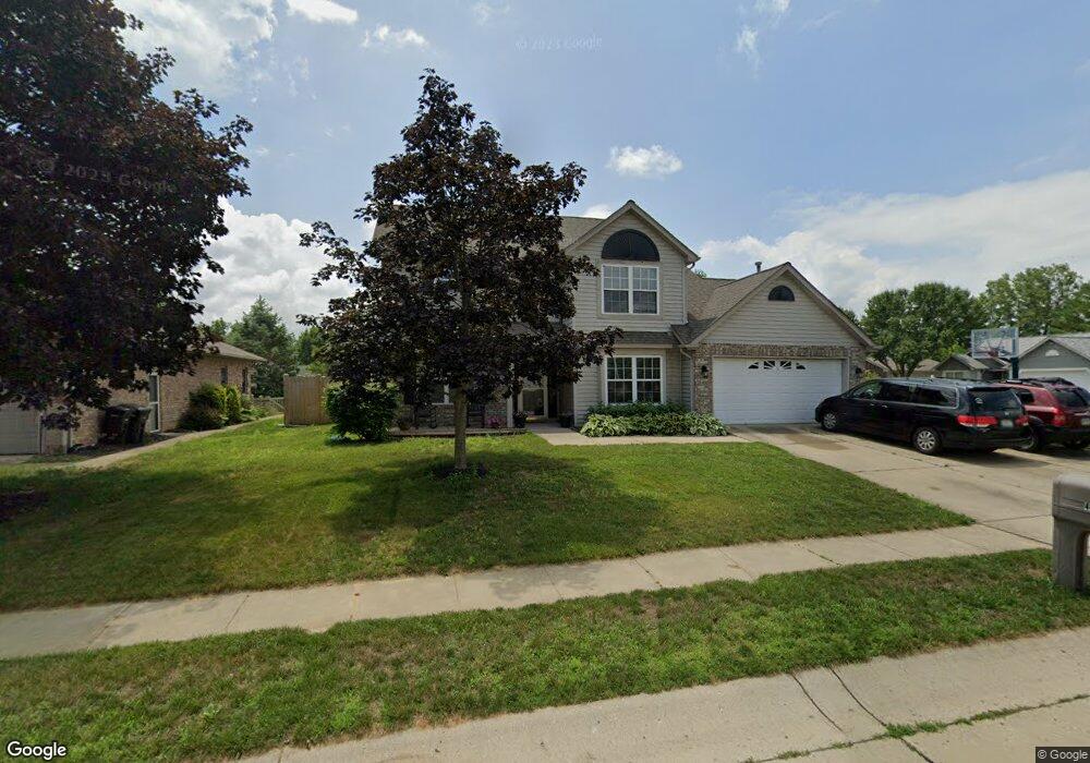
401 Little Rock Rd Lafayette, IN 47909
Estimated Value: $341,000 - $379,000
--
Bed
1
Bath
2,325
Sq Ft
$154/Sq Ft
Est. Value
About This Home
This home is located at 401 Little Rock Rd, Lafayette, IN 47909 and is currently estimated at $357,873, approximately $153 per square foot. 401 Little Rock Rd is a home located in Tippecanoe County with nearby schools including Wea Ridge Elementary School, Wea Ridge Middle School, and McCutcheon High School.
Ownership History
Date
Name
Owned For
Owner Type
Purchase Details
Closed on
Apr 13, 2006
Sold by
Hilbun J Kenneth and Hilbun Valeska L
Bought by
Lacey Timothy P and Lacey Jodie L
Current Estimated Value
Home Financials for this Owner
Home Financials are based on the most recent Mortgage that was taken out on this home.
Original Mortgage
$148,400
Outstanding Balance
$85,182
Interest Rate
6.34%
Mortgage Type
Fannie Mae Freddie Mac
Estimated Equity
$272,691
Create a Home Valuation Report for This Property
The Home Valuation Report is an in-depth analysis detailing your home's value as well as a comparison with similar homes in the area
Home Values in the Area
Average Home Value in this Area
Purchase History
| Date | Buyer | Sale Price | Title Company |
|---|---|---|---|
| Lacey Timothy P | -- | None Available |
Source: Public Records
Mortgage History
| Date | Status | Borrower | Loan Amount |
|---|---|---|---|
| Open | Lacey Timothy P | $148,400 |
Source: Public Records
Tax History Compared to Growth
Tax History
| Year | Tax Paid | Tax Assessment Tax Assessment Total Assessment is a certain percentage of the fair market value that is determined by local assessors to be the total taxable value of land and additions on the property. | Land | Improvement |
|---|---|---|---|---|
| 2024 | $3,169 | $316,900 | $52,000 | $264,900 |
| 2023 | $2,897 | $289,700 | $35,000 | $254,700 |
| 2022 | $2,130 | $213,700 | $35,000 | $178,700 |
| 2021 | $2,016 | $202,300 | $35,000 | $167,300 |
| 2020 | $1,851 | $185,800 | $35,000 | $150,800 |
| 2019 | $1,746 | $175,300 | $35,000 | $140,300 |
| 2018 | $1,718 | $170,700 | $35,000 | $135,700 |
| 2017 | $1,688 | $167,700 | $35,000 | $132,700 |
| 2016 | $1,657 | $166,600 | $35,000 | $131,600 |
| 2014 | $1,618 | $167,600 | $35,000 | $132,600 |
| 2013 | $1,652 | $167,700 | $35,000 | $132,700 |
Source: Public Records
Map
Nearby Homes
- 3638 Round Rock Ct
- 3416 Coventry Ln
- 318 Thames Ave
- 12 Brookhill Ct
- 304 Jersey Ln
- 51 Brookberry Dr
- 126 Kensal Ct
- 116 Wise Dr
- 312 Hibiscus Dr
- 936 Brookridge Ct
- 904 N Southland Dr
- 1007 Waterstone Dr
- 1018 Southport Dr
- 1301 Norma Jean Dr
- 324 Persimmon Trail
- 1120 Stoneripple Cir
- 2820 Limestone Ln
- 3428 Ingram Ct
- 1401 Normandy Dr
- 2830 Duroc Dr Unit A
- 405 Little Rock Rd
- 3635 Round Rock Ct
- 3645 Round Rock Ct
- 3622 Round Rock Ct
- 3626 Round Rock Ct
- 3635 Round Rock Ct
- 3613 Round Rock Cir
- 409 Little Rock Rd
- 404 Little Rock Rd
- 3618 Round Rock Cir
- 3630 Round Rock Ct
- 3649 Round Rock Ct
- 408 Little Rock Rd
- 413 Little Rock Rd
- 3614 Round Rock Cir
- 3609 Round Rock Cir
- 3634 Round Rock Ct
- 3603 Thornhill Cir E
- 3607 Thornhill Cir E
- 3525 Thornhill Cir E