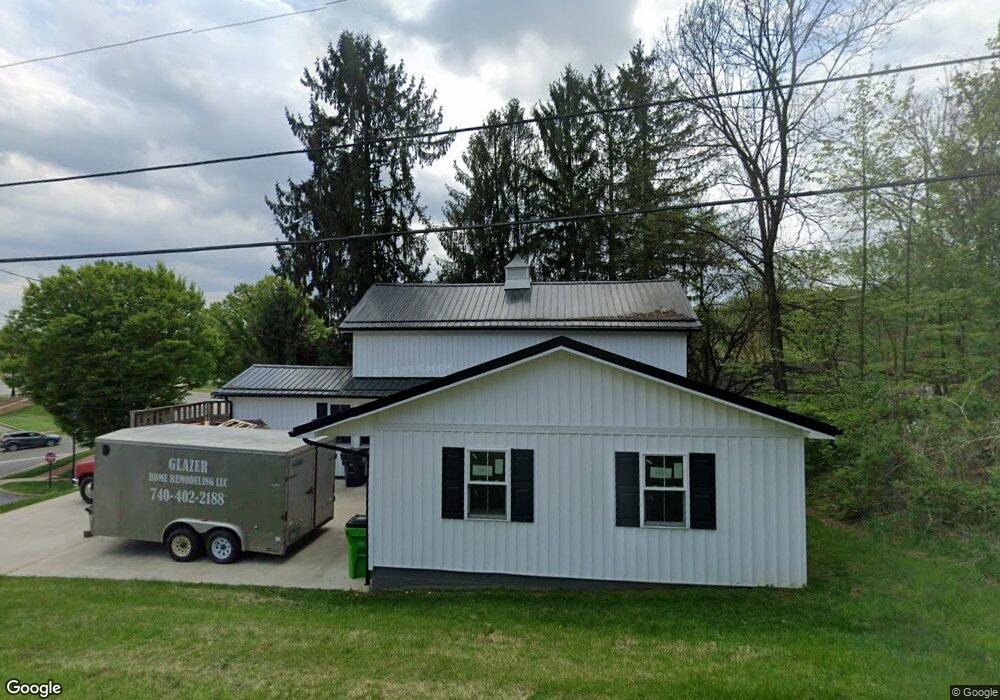
401 Maple St Coshocton, OH 43812
Estimated Value: $171,000 - $306,000
4
Beds
2
Baths
2,000
Sq Ft
$107/Sq Ft
Est. Value
About This Home
This home is located at 401 Maple St, Coshocton, OH 43812 and is currently estimated at $214,891, approximately $107 per square foot. 401 Maple St is a home located in Coshocton County with nearby schools including River View High School, Coshocton Opportunity School, and Sacred Heart School.
Ownership History
Date
Name
Owned For
Owner Type
Purchase Details
Closed on
Apr 26, 2021
Sold by
Rb Hall Properties
Bought by
Lowe Rob and Lowe Natalie
Current Estimated Value
Home Financials for this Owner
Home Financials are based on the most recent Mortgage that was taken out on this home.
Original Mortgage
$168,000
Outstanding Balance
$152,012
Interest Rate
3%
Mortgage Type
New Conventional
Estimated Equity
$62,879
Purchase Details
Closed on
Mar 5, 2020
Sold by
Ged Investments Ltd
Bought by
R B Hall Properties
Purchase Details
Closed on
Jul 10, 2003
Sold by
Strickler Marcia Louise Le
Bought by
Strickler Marcia Louise
Purchase Details
Closed on
Sep 29, 1992
Sold by
Patterson Harry H
Bought by
Strickler Marcia Louise Le
Create a Home Valuation Report for This Property
The Home Valuation Report is an in-depth analysis detailing your home's value as well as a comparison with similar homes in the area
Home Values in the Area
Average Home Value in this Area
Purchase History
| Date | Buyer | Sale Price | Title Company |
|---|---|---|---|
| Lowe Rob | $210,000 | None Available | |
| Lowe Rob | $210,000 | None Listed On Document | |
| R B Hall Properties | $50,100 | None Available | |
| Strickler Marcia Louise | -- | -- | |
| G E D Investments Ltd | $79,900 | -- | |
| Strickler Marcia Louise Le | -- | -- |
Source: Public Records
Mortgage History
| Date | Status | Borrower | Loan Amount |
|---|---|---|---|
| Open | Lowe Rob | $168,000 | |
| Closed | Lowe Rob | $168,000 |
Source: Public Records
Tax History Compared to Growth
Tax History
| Year | Tax Paid | Tax Assessment Tax Assessment Total Assessment is a certain percentage of the fair market value that is determined by local assessors to be the total taxable value of land and additions on the property. | Land | Improvement |
|---|---|---|---|---|
| 2024 | $1,098 | $30,880 | $4,410 | $26,470 |
| 2023 | $1,098 | $24,259 | $3,084 | $21,175 |
| 2022 | $930 | $24,259 | $3,084 | $21,175 |
| 2021 | $930 | $24,259 | $3,084 | $21,175 |
| 2020 | $988 | $25,701 | $2,363 | $23,338 |
| 2019 | $1,010 | $25,701 | $2,363 | $23,338 |
| 2018 | $908 | $25,701 | $2,363 | $23,338 |
| 2017 | $836 | $21,494 | $2,205 | $19,289 |
| 2016 | $793 | $21,494 | $2,205 | $19,289 |
| 2015 | $833 | $21,494 | $2,205 | $19,289 |
| 2014 | $1,101 | $21,508 | $2,205 | $19,303 |
Source: Public Records
Map
Nearby Homes
- 0 Ohio 83
- 481 Hill St
- 518 Hill St
- 771 State Route 541
- 300 Hillsdale Dr
- 595 Hydraulic Ave
- 14405 Ohio 83
- 73 Retilly Dr
- 21569 State Route 16
- 0 Retilly Dr Unit Lot 4790 225015414
- 0 Retilly Dr Unit Lot 4791 225015416
- 0 Retilly Dr Unit 20250289
- 0 Retilly Dr Unit Lot 4786 225015407
- 0 Retilly Dr Unit Lot4783 225015396
- 0 Retilly Dr Unit 5161720
- 0 Retilly Dr Unit 20250287
- 0 Retilly Dr Unit Lot 4793 225015422
- 0 Retilly Dr Unit 20250290
- 0 Retilly Dr Unit Lot 4789 225015411
- 0 Retilly Dr