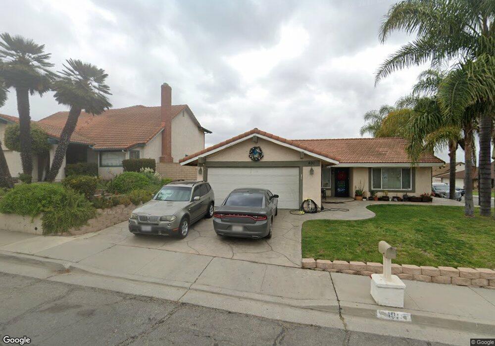
401 Morrison Ln Santa Paula, CA 93060
Estimated Value: $699,020 - $840,000
3
Beds
2
Baths
1,305
Sq Ft
$579/Sq Ft
Est. Value
About This Home
This home is located at 401 Morrison Ln, Santa Paula, CA 93060 and is currently estimated at $756,005, approximately $579 per square foot. 401 Morrison Ln is a home located in Ventura County with nearby schools including Blanchard Elementary School, Isbell Middle, and Santa Paula High.
Ownership History
Date
Name
Owned For
Owner Type
Purchase Details
Closed on
Mar 28, 2011
Sold by
Riverhawk Property Management Llc
Bought by
Oseguera Esmeralda
Current Estimated Value
Purchase Details
Closed on
Nov 24, 2010
Sold by
Alvarez Agustin
Bought by
Riverhawk Property Management Llc
Purchase Details
Closed on
Jan 25, 2005
Sold by
Jones William S and Jones Anita M
Bought by
Alvarez Agustin
Home Financials for this Owner
Home Financials are based on the most recent Mortgage that was taken out on this home.
Original Mortgage
$344,000
Interest Rate
5.73%
Mortgage Type
Purchase Money Mortgage
Create a Home Valuation Report for This Property
The Home Valuation Report is an in-depth analysis detailing your home's value as well as a comparison with similar homes in the area
Home Values in the Area
Average Home Value in this Area
Purchase History
| Date | Buyer | Sale Price | Title Company |
|---|---|---|---|
| Oseguera Esmeralda | $306,000 | Fidelity Natl Title Co La | |
| Riverhawk Property Management Llc | $236,300 | Fidelity Natl Title Co La | |
| Alvarez Agustin | $469,000 | Old Republic Title Company |
Source: Public Records
Mortgage History
| Date | Status | Borrower | Loan Amount |
|---|---|---|---|
| Previous Owner | Alvarez Agustin | $344,000 |
Source: Public Records
Tax History
| Year | Tax Paid | Tax Assessment Tax Assessment Total Assessment is a certain percentage of the fair market value that is determined by local assessors to be the total taxable value of land and additions on the property. | Land | Improvement |
|---|---|---|---|---|
| 2025 | $4,423 | $392,025 | $196,013 | $196,012 |
| 2024 | $4,423 | $384,339 | $192,170 | $192,169 |
| 2023 | $4,330 | $376,803 | $188,402 | $188,401 |
| 2022 | $4,203 | $369,415 | $184,708 | $184,707 |
| 2021 | $4,189 | $362,172 | $181,086 | $181,086 |
| 2020 | $4,169 | $358,460 | $179,230 | $179,230 |
| 2019 | $3,940 | $351,432 | $175,716 | $175,716 |
| 2018 | $3,889 | $344,542 | $172,271 | $172,271 |
| 2017 | $3,933 | $337,788 | $168,894 | $168,894 |
| 2016 | $3,695 | $331,166 | $165,583 | $165,583 |
| 2015 | $3,531 | $326,194 | $163,097 | $163,097 |
| 2014 | $3,586 | $319,806 | $159,903 | $159,903 |
Source: Public Records
Map
Nearby Homes
- 535 Ridgecrest Dr
- 0 Foothill Rd
- 747 Southwick St
- 736 Center Ln
- 423 Atmore Dr
- 83 Cabrillo Ct
- 362 W Santa Barbara St
- 312 W Santa Barbara St
- 324 W Santa Barbara St
- 975 W Telegraph Rd Unit 71
- 975 W Telegraph Rd Unit 10
- 304 Moultrie Place
- 340 Campbell Ct
- 420 Snowdrop Ln
- 351 Princeton St
- 265 S Beckwith Rd Unit 57
- 180 E Pleasant St
- 129 E Ventura St Unit A
- 102 E Ventura St Unit A
- 114 E Ventura St Unit H
- 407 Morrison Ln
- 400 King Ct
- 406 King Ct
- 413 Morrison Ln
- 682 Richard Rd
- 676 Richard Rd
- 400 Morrison Ln
- 412 King Ct
- 702 Richard Rd
- 406 Morrison Ln
- 670 Richard Rd
- 419 Morrison Ln
- 412 Morrison Ln
- 706 Richard Rd
- 418 King Ct
- 664 Richard Rd
- 679 Southwick St
- 683 Southwick St
- 418 Morrison Ln
- 675 Southwick St
Your Personal Tour Guide
Ask me questions while you tour the home.