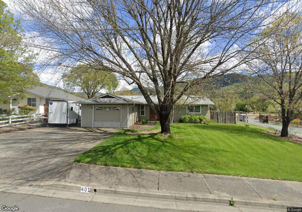
401 Nugget Dr Rogue River, OR 97537
Estimated Value: $308,078 - $336,000
3
Beds
2
Baths
1,140
Sq Ft
$282/Sq Ft
Est. Value
About This Home
This home is located at 401 Nugget Dr, Rogue River, OR 97537 and is currently estimated at $321,020, approximately $281 per square foot. 401 Nugget Dr is a home located in Jackson County with nearby schools including Rogue River Elementary School, South Valley Academy, and Rogue River Junior/Senior High School.
Ownership History
Date
Name
Owned For
Owner Type
Purchase Details
Closed on
Oct 15, 2020
Sold by
Hall Wayne
Bought by
Hall Wayne and Hall Michele
Current Estimated Value
Home Financials for this Owner
Home Financials are based on the most recent Mortgage that was taken out on this home.
Original Mortgage
$209,250
Outstanding Balance
$184,496
Interest Rate
2.8%
Mortgage Type
New Conventional
Estimated Equity
$136,524
Purchase Details
Closed on
Nov 5, 2003
Sold by
Mein Brian J and Mein Pamela L
Bought by
Hall Wayne
Home Financials for this Owner
Home Financials are based on the most recent Mortgage that was taken out on this home.
Original Mortgage
$112,000
Interest Rate
5.94%
Mortgage Type
Seller Take Back
Create a Home Valuation Report for This Property
The Home Valuation Report is an in-depth analysis detailing your home's value as well as a comparison with similar homes in the area
Home Values in the Area
Average Home Value in this Area
Purchase History
| Date | Buyer | Sale Price | Title Company |
|---|---|---|---|
| Hall Wayne | -- | Servicelink | |
| Hall Wayne | $149,000 | First American |
Source: Public Records
Mortgage History
| Date | Status | Borrower | Loan Amount |
|---|---|---|---|
| Open | Hall Wayne | $209,250 | |
| Closed | Hall Wayne | $112,000 |
Source: Public Records
Tax History
| Year | Tax Paid | Tax Assessment Tax Assessment Total Assessment is a certain percentage of the fair market value that is determined by local assessors to be the total taxable value of land and additions on the property. | Land | Improvement |
|---|---|---|---|---|
| 2026 | $2,215 | $154,680 | -- | -- |
| 2025 | $2,144 | $150,180 | $58,110 | $92,070 |
| 2024 | $2,144 | $145,810 | $56,420 | $89,390 |
| 2023 | $2,075 | $141,570 | $54,770 | $86,800 |
| 2022 | $2,026 | $141,570 | $54,770 | $86,800 |
| 2021 | $1,969 | $137,450 | $53,170 | $84,280 |
| 2020 | $1,919 | $133,450 | $51,620 | $81,830 |
| 2019 | $1,872 | $125,800 | $48,660 | $77,140 |
| 2018 | $1,823 | $122,140 | $47,240 | $74,900 |
| 2017 | $1,782 | $122,140 | $47,240 | $74,900 |
| 2016 | $1,737 | $115,140 | $44,520 | $70,620 |
| 2015 | $1,689 | $115,140 | $47,400 | $67,740 |
| 2014 | $1,634 | $108,540 | $44,680 | $63,860 |
Source: Public Records
Map
Nearby Homes
- 2661 Wards Creek Rd
- 182 Wards Creek Rd
- 105 Brolin Ct
- 707 Wards Creek Rd
- 101 Cedar Ridge Terrace
- 5525 Red Tail Ln
- 5500 Red Tail Ln
- 904 Broadway St Unit 503
- 111 Cedar St
- 949 Wards Creek Rd
- 512 Pine St
- 207 Madrone St
- 970 Wards Creek Rd
- 214 Berglund St
- 815 Pine St
- 815 Pine St Unit 10
- 442 Tenney Dr
- 208 W Main St
- 4529 E Evans Creek Rd
- 210 W Main St
Your Personal Tour Guide
Ask me questions while you tour the home.