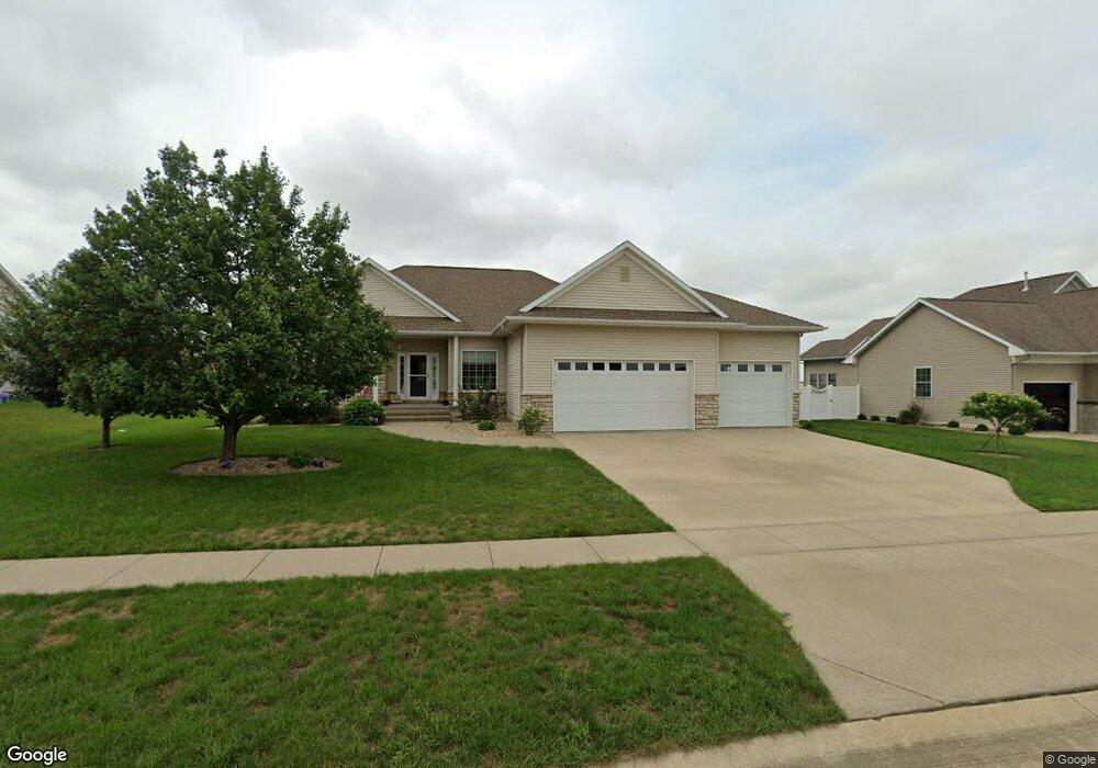
401 White Pine St Robins, IA 52328
Estimated Value: $417,000 - $481,000
4
Beds
4
Baths
1,604
Sq Ft
$272/Sq Ft
Est. Value
About This Home
This home is located at 401 White Pine St, Robins, IA 52328 and is currently estimated at $436,899, approximately $272 per square foot. 401 White Pine St is a home located in Linn County with nearby schools including Hiawatha Elementary School, Harding Middle School, and John F. Kennedy High School.
Ownership History
Date
Name
Owned For
Owner Type
Purchase Details
Closed on
Mar 28, 2019
Sold by
Jamieson Curtis L and Jamieson Karen S
Bought by
Jamieson Curtis L and Jamieson Karen S
Current Estimated Value
Purchase Details
Closed on
Apr 23, 2009
Sold by
Jeffrey N Smith Ltd
Bought by
Jamieson Curtis L and Jamieson Karen S
Home Financials for this Owner
Home Financials are based on the most recent Mortgage that was taken out on this home.
Original Mortgage
$170,000
Outstanding Balance
$108,100
Interest Rate
5.05%
Mortgage Type
Purchase Money Mortgage
Estimated Equity
$328,799
Create a Home Valuation Report for This Property
The Home Valuation Report is an in-depth analysis detailing your home's value as well as a comparison with similar homes in the area
Home Values in the Area
Average Home Value in this Area
Purchase History
| Date | Buyer | Sale Price | Title Company |
|---|---|---|---|
| Jamieson Curtis L | -- | None Available | |
| Jamieson Curtis L | $264,500 | None Available |
Source: Public Records
Mortgage History
| Date | Status | Borrower | Loan Amount |
|---|---|---|---|
| Open | Jamieson Curtis L | $170,000 |
Source: Public Records
Tax History
| Year | Tax Paid | Tax Assessment Tax Assessment Total Assessment is a certain percentage of the fair market value that is determined by local assessors to be the total taxable value of land and additions on the property. | Land | Improvement |
|---|---|---|---|---|
| 2025 | $4,592 | $396,900 | $59,500 | $337,400 |
| 2024 | $4,452 | $366,400 | $59,500 | $306,900 |
| 2023 | $4,452 | $366,400 | $59,500 | $306,900 |
| 2022 | $4,738 | $304,400 | $59,500 | $244,900 |
| 2021 | $5,186 | $304,400 | $59,500 | $244,900 |
| 2020 | $5,186 | $308,300 | $59,500 | $248,800 |
| 2019 | $4,596 | $279,300 | $49,600 | $229,700 |
Source: Public Records
Map
Nearby Homes
- 70.78 Acres M/L Quass Rd
- 26.35 Acres M/L Quass Rd
- 0 70 78 Acres M L Quass Rd
- 130 Woodland Ct
- 0 26 35 Acres M L Quass Rd
- 1915 Kaylin Ct
- 0 Rd
- 1917 Kaylin Ct
- 1920 Kaylin Ct
- 1940 Kaylin Ct
- 0 28 72 Acres N Center Point Rd
- 1970 Kaylin Ct
- 0 8 98 Acres M L N Center Point Rd Unit 2507297
- 1975 Kaylin Ct
- 39.69 Acres M/L N Center Point Rd
- 28.72 Acres M/L N Center Point Rd
- 8.98 Acres M/L N Center Point Rd
- 195 Morgan Ct
- 3221 Village Way
- 3217 Village Way
- 405 White Pine St
- 391 White Pine St
- 410 Kilbirnie Rd
- 400 Kilbirnie Rd
- 870 Leslie Ln
- 375 White Pine St
- 385 White Pine St
- 411 White Pine St
- 390 Kilbirnie Rd
- 875 Hemlock Ct
- 875 Leslie Ln
- 860 Leslie Ln
- 380 Kilbirnie Rd
- 865 Hemlock Ct
- 419 White Pine St
- 865 Leslie Ln
- 405 Kilbirnie Rd
- 415 Kilbirnie Rd
- 890 Tamarac Ln
- 850 Leslie Ln
Your Personal Tour Guide
Ask me questions while you tour the home.