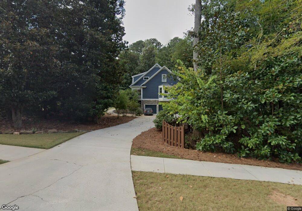
401 Wicklow St Tyrone, GA 30290
Estimated Value: $662,031 - $840,000
6
Beds
5
Baths
3,999
Sq Ft
$190/Sq Ft
Est. Value
About This Home
This home is located at 401 Wicklow St, Tyrone, GA 30290 and is currently estimated at $760,508, approximately $190 per square foot. 401 Wicklow St is a home located in Fayette County with nearby schools including Crabapple Lane Elementary School, Flat Rock Middle School, and Sandy Creek High School.
Ownership History
Date
Name
Owned For
Owner Type
Purchase Details
Closed on
Aug 19, 2009
Sold by
Wade Ingrid V
Bought by
Wade Albert T and Wade Ingrid
Current Estimated Value
Home Financials for this Owner
Home Financials are based on the most recent Mortgage that was taken out on this home.
Original Mortgage
$319,200
Outstanding Balance
$204,479
Interest Rate
5.19%
Estimated Equity
$556,029
Purchase Details
Closed on
May 27, 2004
Sold by
Alpha Vi Inc
Bought by
Layson Robert and Layson Mary
Home Financials for this Owner
Home Financials are based on the most recent Mortgage that was taken out on this home.
Original Mortgage
$46,995
Interest Rate
5.24%
Mortgage Type
New Conventional
Create a Home Valuation Report for This Property
The Home Valuation Report is an in-depth analysis detailing your home's value as well as a comparison with similar homes in the area
Home Values in the Area
Average Home Value in this Area
Purchase History
| Date | Buyer | Sale Price | Title Company |
|---|---|---|---|
| Wade Albert T | -- | -- | |
| Wade Ingrid | $399,000 | -- | |
| Layson Robert | $470,000 | -- |
Source: Public Records
Mortgage History
| Date | Status | Borrower | Loan Amount |
|---|---|---|---|
| Open | Wade Ingrid | $319,200 | |
| Previous Owner | Layson Robert | $46,995 | |
| Previous Owner | Layson Robert | $375,960 |
Source: Public Records
Tax History
| Year | Tax Paid | Tax Assessment Tax Assessment Total Assessment is a certain percentage of the fair market value that is determined by local assessors to be the total taxable value of land and additions on the property. | Land | Improvement |
|---|---|---|---|---|
| 2025 | $6,785 | $290,158 | $44,940 | $245,218 |
| 2024 | $6,607 | $271,176 | $42,000 | $229,176 |
| 2023 | $6,118 | $259,960 | $42,000 | $217,960 |
| 2022 | $6,095 | $226,960 | $42,000 | $184,960 |
| 2021 | $5,694 | $194,840 | $30,000 | $164,840 |
| 2020 | $5,643 | $183,200 | $30,000 | $153,200 |
| 2019 | $5,658 | $181,920 | $30,000 | $151,920 |
| 2018 | $5,358 | $170,640 | $30,000 | $140,640 |
| 2017 | $5,385 | $170,880 | $30,000 | $140,880 |
| 2016 | $4,854 | $151,240 | $22,800 | $128,440 |
| 2015 | $5,733 | $175,240 | $22,800 | $152,440 |
| 2014 | $5,062 | $152,440 | $22,800 | $129,640 |
| 2013 | -- | $148,280 | $0 | $0 |
Source: Public Records
Map
Nearby Homes
- 130 Windchime Way Unit 9
- 150 Kylemore Pass
- 100 Clydesdale Ct
- 135 Arabian
- 121 Northwoods Rd
- 80 Northwoods Rd
- 108 Tullamore Trail
- 200 Chaparral Trace
- 28 Border Point
- 100 Leisure Trail
- 235 Ashmere Ct
- 321 Cottonwood Cir
- 113 Creggan Hill Ct
- 152 Ardenlee Dr
- 1103 Maybeck Way
- 134 Ardenlee Dr
- 135 French Village Blvd
- 208 Silver Maple Ct
- 535 Laurelwood Dr
- 308 Dalston Way
- 594 Mcdade St
- 403 Wicklow St Unit 74
- 403 Wicklow St
- 591 Mcdade St
- 593 Mcdade St
- 589 Mcdade St
- 598 Mcdade St
- 595 Mcdade St
- 302 Roundstone Rock Unit 75
- 402 Wicklow St Unit 64
- 402 Wicklow St
- 587 Mcdade St
- 304 Roundstone Rock
- 304 Roundstone Rock Unit 76
- 592 Mcdade St
- 585 Mcdade St
- 597 Mcdade St
- 404 Wicklow St Unit 65
- 404 Wicklow St
- 404 Wicklow St Unit N/
Your Personal Tour Guide
Ask me questions while you tour the home.