Estimated Value: $425,879 - $467,000
5
Beds
3
Baths
3,207
Sq Ft
$138/Sq Ft
Est. Value
About This Home
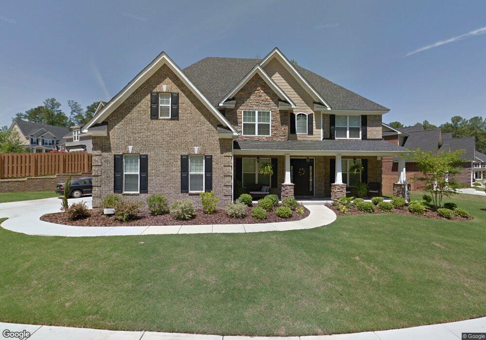
This home is located at 4010 Battery Dr, Evans, GA 30809 and is currently estimated at $442,220, approximately $137 per square foot. 4010 Battery Dr is a home located in Columbia County with nearby schools including Evans Elementary School, Evans Middle School, and Evans High School.
Ownership History
Date
Name
Owned For
Owner Type
Purchase Details
Closed on
Jan 7, 2010
Sold by
Meredith Homes Inc
Bought by
Fielding Melvin J
Current Estimated Value
Home Financials for this Owner
Home Financials are based on the most recent Mortgage that was taken out on this home.
Original Mortgage
$242,100
Outstanding Balance
$155,166
Interest Rate
4.8%
Mortgage Type
New Conventional
Estimated Equity
$287,054
Purchase Details
Closed on
Nov 19, 2009
Sold by
Porterfield Invst Llc
Bought by
Meredith Homes Inc
Home Financials for this Owner
Home Financials are based on the most recent Mortgage that was taken out on this home.
Original Mortgage
$242,100
Outstanding Balance
$155,166
Interest Rate
4.8%
Mortgage Type
New Conventional
Estimated Equity
$287,054
Create a Home Valuation Report for This Property
The Home Valuation Report is an in-depth analysis detailing your home's value as well as a comparison with similar homes in the area
Home Values in the Area
Average Home Value in this Area
Purchase History
| Date | Buyer | Sale Price | Title Company |
|---|---|---|---|
| Fielding Melvin J | $269,000 | -- | |
| Meredith Homes Inc | $47,000 | -- |
Source: Public Records
Mortgage History
| Date | Status | Borrower | Loan Amount |
|---|---|---|---|
| Open | Fielding Melvin J | $242,100 | |
| Previous Owner | Meredith Homes Inc | $47,000 |
Source: Public Records
Tax History
| Year | Tax Paid | Tax Assessment Tax Assessment Total Assessment is a certain percentage of the fair market value that is determined by local assessors to be the total taxable value of land and additions on the property. | Land | Improvement |
|---|---|---|---|---|
| 2025 | $3,972 | $166,097 | $26,104 | $139,993 |
| 2024 | $3,995 | $159,534 | $26,104 | $133,430 |
| 2023 | $3,995 | $148,385 | $23,704 | $124,681 |
| 2022 | $3,569 | $137,062 | $23,104 | $113,958 |
| 2021 | $3,357 | $123,301 | $22,004 | $101,297 |
| 2020 | $3,372 | $121,300 | $21,604 | $99,696 |
| 2019 | $3,344 | $120,287 | $21,404 | $98,883 |
| 2018 | $3,130 | $112,177 | $19,804 | $92,373 |
| 2017 | $3,029 | $108,192 | $14,804 | $93,388 |
| 2016 | $2,973 | $110,141 | $14,780 | $95,361 |
| 2015 | $2,932 | $108,423 | $12,880 | $95,543 |
| 2014 | $3,012 | $110,029 | $12,780 | $97,249 |
Source: Public Records
Map
Nearby Homes
- 4622 Brittany Dr
- 4560 Mulberry Creek Dr
- 4712 Walnut Hill Dr
- 599 Windward Ct
- 604 Kimberley Place
- 5068 Hereford Farm Rd
- 642 Kimberley Place
- 4593 Gray Ln
- 648 River Oaks Ln
- 665 Steeplechase Way
- 726 Whitney Shoals Rd
- 881 Audubon Way
- 814 Audubon Way
- 625 Dunloe Cir
- 4614 Stoneridge Ct
- 385 Canterbury Dr
- 305 Sumac Trail
- 3542 Hilltop Trail
- 3527 Hilltop Trail
- 3538 Hilltop Trail
- 4012 Battery Dr
- 503 Canon Ct
- 4014 Battery Dr
- 4009 Battery Dr
- 4013 Battery Dr
- 4007 Battery Dr
- 4011 Battery Dr
- 4005 Battery Dr
- 4003 Battery Dr
- 505 Canon Ct
- 4016 Battery Dr
- 4015 Battery Dr
- 501 Canon Ct
- 500 Canon Ct
- 4001 Battery Dr
- 502 Canon Ct
- 4017 Battery Dr
- 4600 Mulberry Creek Dr
- 507 Canon Ct
- 504 Canon Ct
Your Personal Tour Guide
Ask me questions while you tour the home.