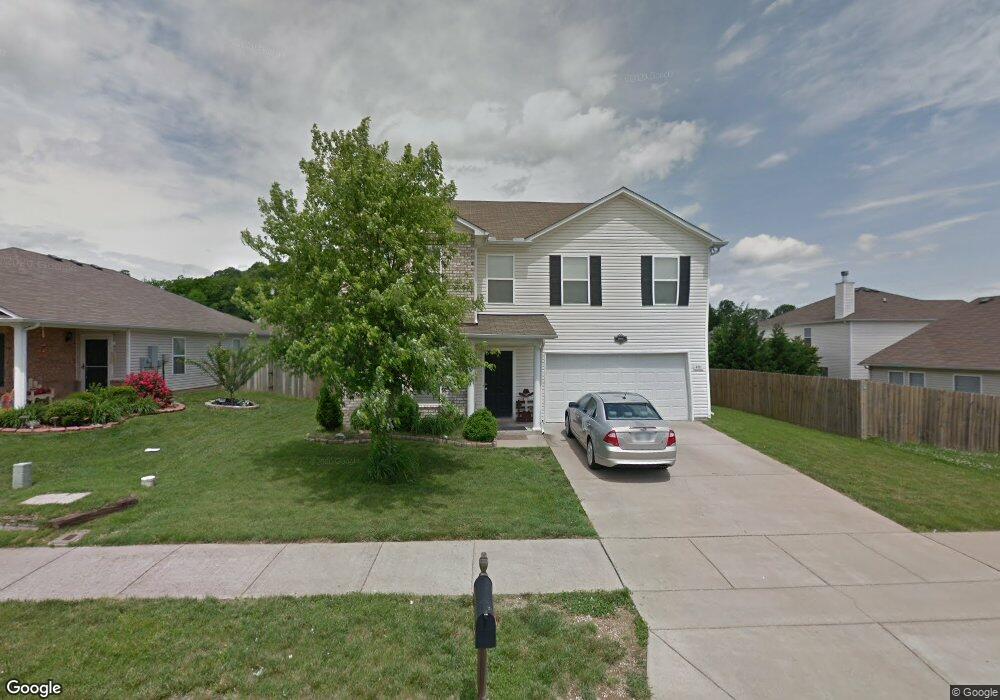
4011 Randall Ln Thompsons Station, TN 37179
Estimated Value: $442,000 - $490,000
--
Bed
4
Baths
2,434
Sq Ft
$195/Sq Ft
Est. Value
About This Home
This home is located at 4011 Randall Ln, Thompsons Station, TN 37179 and is currently estimated at $473,699, approximately $194 per square foot. 4011 Randall Ln is a home located in Williamson County with nearby schools including Primrose School of Spring Hill.
Ownership History
Date
Name
Owned For
Owner Type
Purchase Details
Closed on
Apr 19, 2017
Sold by
Rosta Paul and Rosta Kathryn A
Bought by
Ah4r Tn 3 Llc
Current Estimated Value
Purchase Details
Closed on
Sep 4, 2007
Sold by
Ciaramitaro Mathew M and Ciaramitaro Felicia B
Bought by
Rosta Paul and Rosta Kathryn A
Home Financials for this Owner
Home Financials are based on the most recent Mortgage that was taken out on this home.
Original Mortgage
$113,400
Interest Rate
6.65%
Mortgage Type
New Conventional
Purchase Details
Closed on
Apr 26, 2005
Sold by
Centex Homes
Bought by
Ciaramitaro Mathew M and Ciaramitaro Felicia B
Home Financials for this Owner
Home Financials are based on the most recent Mortgage that was taken out on this home.
Original Mortgage
$159,481
Interest Rate
5.88%
Mortgage Type
FHA
Create a Home Valuation Report for This Property
The Home Valuation Report is an in-depth analysis detailing your home's value as well as a comparison with similar homes in the area
Home Values in the Area
Average Home Value in this Area
Purchase History
| Date | Buyer | Sale Price | Title Company |
|---|---|---|---|
| Ah4r Tn 3 Llc | $186,000 | None Available | |
| Rosta Paul | $189,000 | Homeland Title Llc | |
| Ciaramitaro Mathew M | $162,000 | -- |
Source: Public Records
Mortgage History
| Date | Status | Borrower | Loan Amount |
|---|---|---|---|
| Previous Owner | Rosta Paul | $113,400 | |
| Previous Owner | Ciaramitaro Mathew M | $159,481 |
Source: Public Records
Tax History Compared to Growth
Tax History
| Year | Tax Paid | Tax Assessment Tax Assessment Total Assessment is a certain percentage of the fair market value that is determined by local assessors to be the total taxable value of land and additions on the property. | Land | Improvement |
|---|---|---|---|---|
| 2024 | $578 | $78,175 | $18,750 | $59,425 |
| 2023 | $578 | $78,175 | $18,750 | $59,425 |
| 2022 | $1,431 | $78,175 | $18,750 | $59,425 |
| 2021 | $1,431 | $78,175 | $18,750 | $59,425 |
| 2020 | $1,210 | $56,025 | $11,250 | $44,775 |
| 2019 | $1,210 | $56,025 | $11,250 | $44,775 |
| 2018 | $1,171 | $56,025 | $11,250 | $44,775 |
| 2017 | $1,160 | $56,025 | $11,250 | $44,775 |
| 2016 | $1,143 | $56,025 | $11,250 | $44,775 |
| 2015 | -- | $41,275 | $8,750 | $32,525 |
| 2014 | -- | $41,275 | $8,750 | $32,525 |
Source: Public Records
Map
Nearby Homes
- 462 Buckwood Ave W
- 466 Buckwood Ave W
- 454 Buckwood Ave E
- 467 Buckwood Ave E
- 457 Buckwood Ave E
- 303 Buckwood Ln
- 450 Buckwood Ave W
- 321 Buckwood Ln N
- Charleville Plan at Emberly
- Belmont Plan at Emberly
- Corsair Plan at Emberly
- Magnolia Plan at Emberly
- Harpeth Plan at Emberly
- 440 Buckwood Ave W
- 461 Buckwood Ave E
- 455 Buckwood Ave W
- 463 Buckwood Ave E
- 459 Buckwood Ln E
- 2131 Carlton Ln
- 458 Buckwood Ave W
- 4009 Randall Ln
- 5001 Hancock Cir
- 5003 Hancock Cir
- 6006 Burnett Cir
- 6008 Burnett Cir
- 4007 Randall Ln
- 5005 Hancock Cir
- 6004 Burnett Cir
- 4012 Randall Ln
- 4014 Randall Ln
- 4010 Randall Ln
- 4005 Randall Ln
- 4005 Randall Ln
- 4016 Randall Ln
- 4008 Randall Ln
- 6002 Burnett Cir
- 5007 Hancock Cir
- 4018 Randall Ln
- 4003 Randall Ln
- 4006 Randall Ln