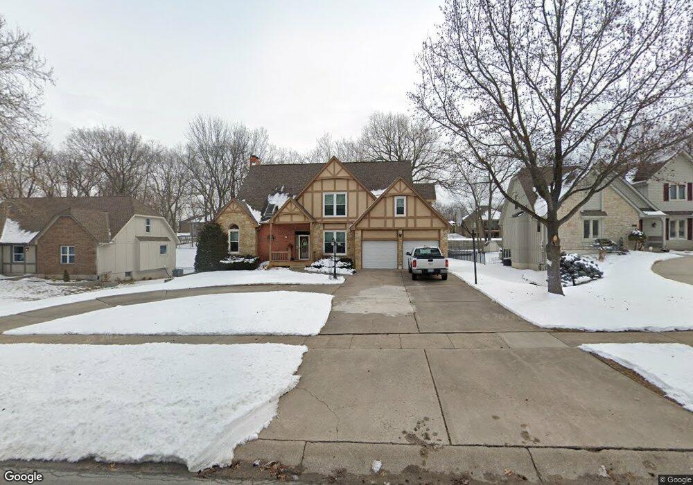
4013 NE Channel Dr Lees Summit, MO 64064
Chapel Ridge NeighborhoodEstimated Value: $467,871 - $569,000
4
Beds
3
Baths
2,732
Sq Ft
$187/Sq Ft
Est. Value
About This Home
This home is located at 4013 NE Channel Dr, Lees Summit, MO 64064 and is currently estimated at $511,968, approximately $187 per square foot. 4013 NE Channel Dr is a home located in Jackson County with nearby schools including Chapel Lakes Elementary School, Delta Woods Middle School, and Blue Springs South High School.
Ownership History
Date
Name
Owned For
Owner Type
Purchase Details
Closed on
Aug 22, 1996
Sold by
Constance Byron and Christenson James A
Bought by
Stewart John K and Stewart Patricia A
Current Estimated Value
Home Financials for this Owner
Home Financials are based on the most recent Mortgage that was taken out on this home.
Original Mortgage
$145,000
Outstanding Balance
$9,396
Interest Rate
6.12%
Mortgage Type
Purchase Money Mortgage
Estimated Equity
$502,572
Create a Home Valuation Report for This Property
The Home Valuation Report is an in-depth analysis detailing your home's value as well as a comparison with similar homes in the area
Home Values in the Area
Average Home Value in this Area
Purchase History
| Date | Buyer | Sale Price | Title Company |
|---|---|---|---|
| Stewart John K | -- | -- |
Source: Public Records
Mortgage History
| Date | Status | Borrower | Loan Amount |
|---|---|---|---|
| Open | Stewart John K | $145,000 |
Source: Public Records
Tax History
| Year | Tax Paid | Tax Assessment Tax Assessment Total Assessment is a certain percentage of the fair market value that is determined by local assessors to be the total taxable value of land and additions on the property. | Land | Improvement |
|---|---|---|---|---|
| 2025 | $5,486 | $73,821 | $10,408 | $63,413 |
| 2024 | $5,387 | $71,630 | $16,431 | $55,199 |
| 2023 | $5,387 | $71,630 | $16,431 | $55,199 |
| 2022 | $5,196 | $61,180 | $16,036 | $45,144 |
| 2021 | $5,191 | $61,180 | $16,036 | $45,144 |
| 2020 | $4,992 | $58,185 | $16,036 | $42,149 |
| 2019 | $4,838 | $58,185 | $16,036 | $42,149 |
| 2018 | $4,158 | $48,507 | $5,905 | $42,602 |
| 2016 | $3,604 | $42,180 | $5,054 | $37,126 |
Source: Public Records
Map
Nearby Homes
- 4014 NE Woodridge Dr
- 4121 NE Edgewater Ct
- 232 NE Bayview Dr
- 46 NE Shoreview Dr
- 3907 NE Clearbrook Dr
- 210 NE Bayview Dr
- 3709 NE Grant St
- 3743 NE Woodland Ct
- 448 NE Point Dr
- 211 NW Juniper St
- 102 NW Hackberry St
- 793 NE Algonquin St Unit A
- 4602 NE Dick Howser Cir
- 720 NE Lone Hill Dr Unit B
- 718 NE Lone Hill Dr Unit A
- 224 NW Locust St
- 405 NE Grant Ct
- 201 NW Hackberry St
- 183 NE Chinquapin Ct
- 3617 NW Blue Jacket Dr
- 4009 NE Channel Dr
- 4021 NE Channel Dr
- 4020 NE Grant St
- 4016 NE Grant St
- 4024 NE Grant St
- 4012 NE Grant St
- 4025 NE Channel Dr
- 4028 NE Grant St
- 4005 NE Woodridge Dr
- 4003 NE Woodridge Dr
- 4001 NE Channel Dr
- 4008 NE Grant St
- 4007 NE Woodridge Dr
- 4001 NE Woodridge Dr
- 4004 NE Grant St
- 4032 NE Grant St
- 4009 NE Woodridge Dr
- 3929 NE Channel Dr
- 4000 NE Grant St
- 4041 NE Grant St
Your Personal Tour Guide
Ask me questions while you tour the home.