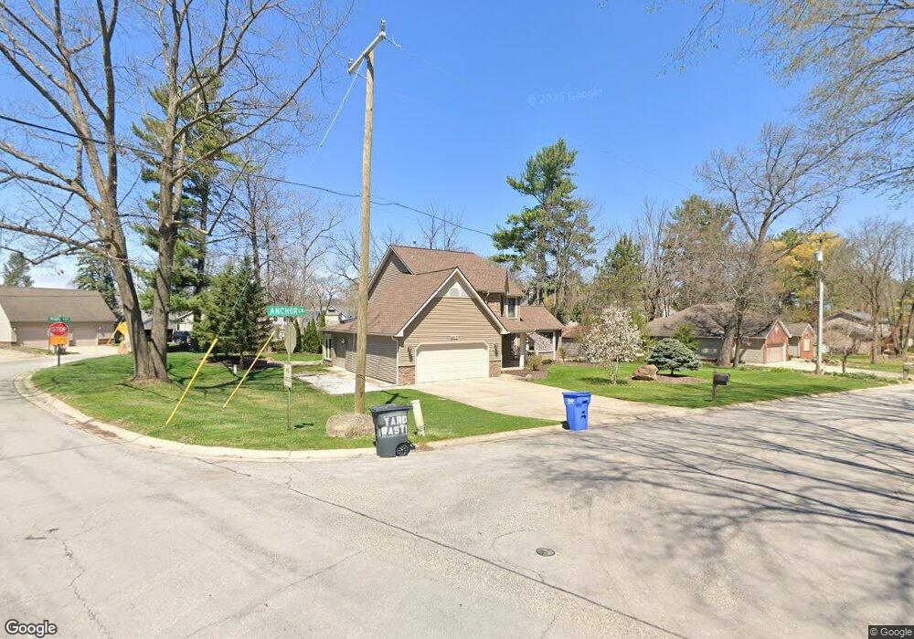
4017 Anchor Ln Brighton, MI 48116
Estimated Value: $538,681 - $856,000
3
Beds
3
Baths
2,292
Sq Ft
$279/Sq Ft
Est. Value
About This Home
This home is located at 4017 Anchor Ln, Brighton, MI 48116 and is currently estimated at $638,670, approximately $278 per square foot. 4017 Anchor Ln is a home located in Livingston County with nearby schools including Hornung Elementary School, Scranton Middle School, and Brighton High School.
Ownership History
Date
Name
Owned For
Owner Type
Purchase Details
Closed on
Mar 23, 2022
Sold by
Ratke Richard and Ratke Martha A
Bought by
Ratke Richard and Ratke Martha A
Current Estimated Value
Purchase Details
Closed on
Oct 11, 2002
Sold by
Neal William A
Bought by
Mullins Robert O F
Home Financials for this Owner
Home Financials are based on the most recent Mortgage that was taken out on this home.
Original Mortgage
$247,500
Interest Rate
5.37%
Mortgage Type
Balloon
Purchase Details
Closed on
Sep 17, 1999
Sold by
Fleming Michael E and Fleming Holly D
Bought by
Neal William A
Create a Home Valuation Report for This Property
The Home Valuation Report is an in-depth analysis detailing your home's value as well as a comparison with similar homes in the area
Home Values in the Area
Average Home Value in this Area
Purchase History
| Date | Buyer | Sale Price | Title Company |
|---|---|---|---|
| Ratke Richard | -- | None Listed On Document | |
| Mullins Robert O F | $275,000 | Title One | |
| Neal William A | $260,000 | Metropolitan Title Company |
Source: Public Records
Mortgage History
| Date | Status | Borrower | Loan Amount |
|---|---|---|---|
| Previous Owner | Mullins Robert O F | $247,500 |
Source: Public Records
Tax History
| Year | Tax Paid | Tax Assessment Tax Assessment Total Assessment is a certain percentage of the fair market value that is determined by local assessors to be the total taxable value of land and additions on the property. | Land | Improvement |
|---|---|---|---|---|
| 2025 | $1,938 | $233,500 | $0 | $0 |
| 2024 | $1,885 | $226,400 | $0 | $0 |
| 2023 | $1,804 | $199,400 | $0 | $0 |
| 2022 | $3,226 | $147,600 | $0 | $0 |
| 2021 | $3,084 | $169,600 | $0 | $0 |
| 2020 | $3,135 | $150,500 | $0 | $0 |
| 2019 | $3,089 | $147,600 | $0 | $0 |
| 2018 | $2,914 | $141,900 | $0 | $0 |
| 2017 | $2,856 | $141,900 | $0 | $0 |
| 2016 | $2,839 | $133,800 | $0 | $0 |
| 2014 | $2,395 | $109,300 | $0 | $0 |
| 2012 | $2,395 | $105,600 | $0 | $0 |
Source: Public Records
Map
Nearby Homes
- 4455 Quebec Ln Unit 74
- 4531 Clifford Rd
- 4358 Skusa Dr
- 5380 Versailles Ave
- 4563 Clifford Rd
- 4592 Leblanc Ct Unit 20
- 4227 Colonial Ct
- 4179 Saint Andrews St
- 4868 Pine Eagles Ct Unit 1
- 3340 Pineridge Ln
- 4525 Mapleton Dr
- 3186 Aspen Ridge Ct
- 5060 Glenway Dr
- 4001 S Latson Rd
- 5080 Chilson Rd
- 5885 Cedar Knoll Dr
- 6511 Forest Beach Dr
- 4422 Argenta Dr
- 1047 Weatherstone Ln
- 5728 Eggert Place
- 4010 Clifford Rd
- UNIT40 Clifford Rd -Lots Ct
- 4041 Anchor Ln
- 4030 Anchor Ln
- 4004 Clifford Rd
- 4026 Clifford Rd
- 4211 Highcrest Dr
- 0 Highcrest Dr
- 3986 Highcrest Dr
- 3994 Highcrest Dr
- 3980 Highcrest Dr
- 4030 Clifford Rd
- 4011 Highcrest Dr
- 3974 Highcrest Dr
- 4055 Anchor Ln
- 4036 Clifford Rd Unit Bldg-Unit
- 4036 Clifford Rd
- 4010 Highcrest Dr
- 5082 Willow Grove Ln
Your Personal Tour Guide
Ask me questions while you tour the home.