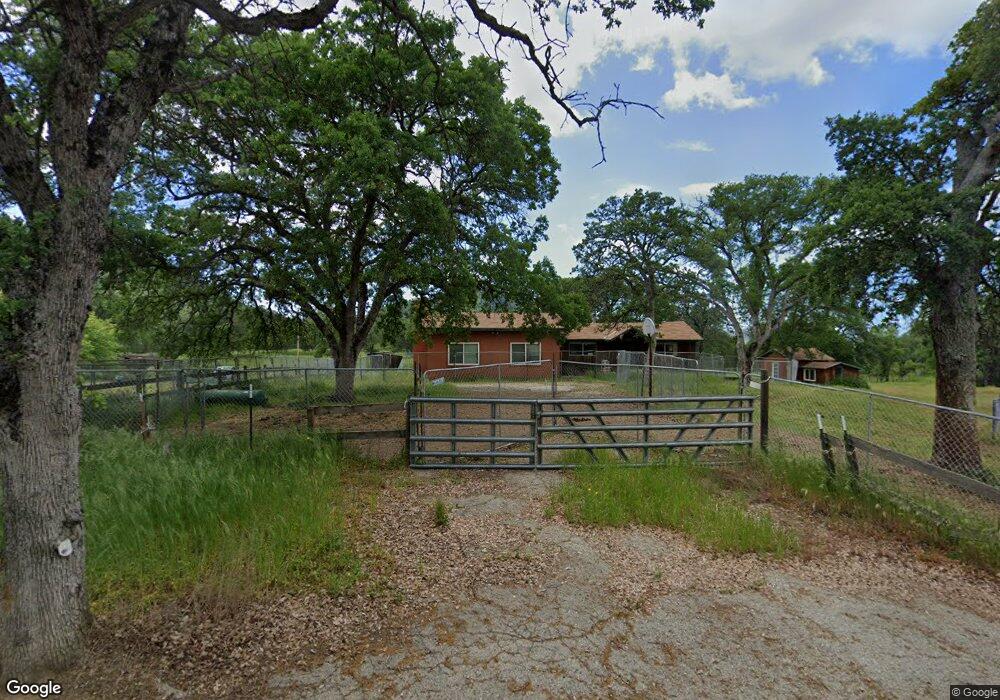
40195 Dunlap Rd Dunlap, CA 93621
Estimated Value: $184,000 - $302,000
3
Beds
2
Baths
1,510
Sq Ft
$160/Sq Ft
Est. Value
About This Home
This home is located at 40195 Dunlap Rd, Dunlap, CA 93621 and is currently estimated at $241,600, approximately $160 per square foot. 40195 Dunlap Rd is a home located in Fresno County with nearby schools including Dunlap Elementary School, Reedley High School, and Dunlap Leadership Academy.
Ownership History
Date
Name
Owned For
Owner Type
Purchase Details
Closed on
Feb 8, 2011
Sold by
Fannie Mae
Bought by
Bower Maret and Bower Alexandra
Current Estimated Value
Purchase Details
Closed on
Oct 15, 2010
Sold by
Rochin Candy M
Bought by
Federal National Mortgage Association
Purchase Details
Closed on
Jul 5, 2004
Sold by
Rochin Michael
Bought by
Rochin Candy M
Home Financials for this Owner
Home Financials are based on the most recent Mortgage that was taken out on this home.
Original Mortgage
$120,000
Interest Rate
6.27%
Mortgage Type
New Conventional
Create a Home Valuation Report for This Property
The Home Valuation Report is an in-depth analysis detailing your home's value as well as a comparison with similar homes in the area
Purchase History
| Date | Buyer | Sale Price | Title Company |
|---|---|---|---|
| Bower Maret | $73,500 | First American Title Company | |
| Federal National Mortgage Association | $185,550 | None Available | |
| Rochin Candy M | -- | Stewart Title Of Fresno |
Source: Public Records
Mortgage History
| Date | Status | Borrower | Loan Amount |
|---|---|---|---|
| Previous Owner | Rochin Candy M | $120,000 |
Source: Public Records
Tax History
| Year | Tax Paid | Tax Assessment Tax Assessment Total Assessment is a certain percentage of the fair market value that is determined by local assessors to be the total taxable value of land and additions on the property. | Land | Improvement |
|---|---|---|---|---|
| 2025 | $1,047 | $92,871 | $44,833 | $48,038 |
| 2023 | $1,018 | $89,267 | $43,093 | $46,174 |
| 2022 | $1,011 | $87,518 | $42,249 | $45,269 |
| 2021 | $991 | $85,803 | $41,421 | $44,382 |
| 2020 | $992 | $84,924 | $40,997 | $43,927 |
| 2019 | $970 | $83,260 | $40,194 | $43,066 |
| 2018 | $952 | $81,628 | $39,406 | $42,222 |
| 2017 | $930 | $80,029 | $38,634 | $41,395 |
| 2016 | $908 | $78,461 | $37,877 | $40,584 |
| 2015 | $898 | $77,284 | $37,309 | $39,975 |
| 2014 | $888 | $75,771 | $36,579 | $39,192 |
Source: Public Records
Map
Nearby Homes
- 39950 Millwood Rd
- 0 High Oaks Ln Unit FR25247411
- 0 High Oaks Ln Unit 643539
- 0 High Oaks Ln Unit 639063
- 0 High Oaks Ln Unit 238041
- 43520 Brookside Rd
- 743 Rosemary Ln
- 38284 Barberry Ln
- 0 Chuckwagon Rd Unit ND25194313
- 38168 Barberry Ln
- 50890 Rosemary Ln
- 37799 Barberry Ln
- 697 Chuckwagon Rd
- 50740 Bramble Ln
- 713 Bramble Ln
- 15 Acres
- 37041 Dunlap Rd
- 8 Acres
- 47595 Diablo Ln
- 44001 Dunlap Rd
- 40271 Dunlap Rd
- 40083 Millwood Rd
- 40320 Dunlap Rd
- 41480 Dunlap Rd
- 40396 Dunlap Rd
- 39972 Dunlap Rd
- 40326 Dunlap Rd
- 39775 Dunlap Rd
- 40400 Dunlap Rd
- 40264 Millwood Rd
- 40210 Millwood Rd
- 40334 Millwood Rd
- 40274 Millwood Rd
- 39770 Dunlap Rd
- 40164 Millwood Rd
- 0 Dunlap Unit MD13022511
- 0 Dunlap Unit 320458
- 0 Dunlap Unit 404279
- 0 Dunlap Unit FR19217546
- 0 Dunlap Unit FR19147373
Your Personal Tour Guide
Ask me questions while you tour the home.