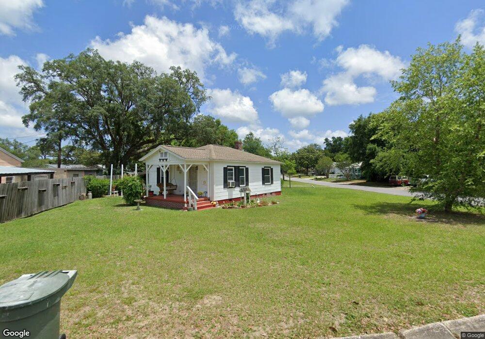
402 Bryant Rd Pensacola, FL 32507
Warrington NeighborhoodEstimated Value: $137,000 - $196,000
--
Bed
1
Bath
800
Sq Ft
$201/Sq Ft
Est. Value
About This Home
This home is located at 402 Bryant Rd, Pensacola, FL 32507 and is currently estimated at $160,851, approximately $201 per square foot. 402 Bryant Rd is a home located in Escambia County with nearby schools including Navy Point Elementary School, Jim C. Bailey Middle School, and Pensacola High School.
Ownership History
Date
Name
Owned For
Owner Type
Purchase Details
Closed on
Feb 25, 2021
Sold by
Morris Darrellyn A
Bought by
Rice Dale Rae
Current Estimated Value
Purchase Details
Closed on
Apr 12, 2006
Sold by
Cook Joiner James W and Cook Joiner Diane
Bought by
Swanger Jeanette
Home Financials for this Owner
Home Financials are based on the most recent Mortgage that was taken out on this home.
Original Mortgage
$36,000
Interest Rate
6.29%
Mortgage Type
Purchase Money Mortgage
Create a Home Valuation Report for This Property
The Home Valuation Report is an in-depth analysis detailing your home's value as well as a comparison with similar homes in the area
Home Values in the Area
Average Home Value in this Area
Purchase History
| Date | Buyer | Sale Price | Title Company |
|---|---|---|---|
| Rice Dale Rae | -- | Accommodation | |
| Swanger Jeanette | $38,000 | Lawyers Title Ins |
Source: Public Records
Mortgage History
| Date | Status | Borrower | Loan Amount |
|---|---|---|---|
| Previous Owner | Swanger Jeanette | $36,000 |
Source: Public Records
Tax History Compared to Growth
Tax History
| Year | Tax Paid | Tax Assessment Tax Assessment Total Assessment is a certain percentage of the fair market value that is determined by local assessors to be the total taxable value of land and additions on the property. | Land | Improvement |
|---|---|---|---|---|
| 2024 | $245 | $49,561 | -- | -- |
| 2023 | $245 | $48,118 | $0 | $0 |
| 2022 | $240 | $46,717 | $0 | $0 |
| 2021 | $241 | $45,357 | $0 | $0 |
| 2020 | $243 | $44,731 | $0 | $0 |
| 2019 | $239 | $43,726 | $0 | $0 |
| 2018 | $376 | $42,911 | $0 | $0 |
| 2017 | $369 | $42,029 | $0 | $0 |
| 2016 | $361 | $41,165 | $0 | $0 |
| 2015 | $335 | $40,879 | $0 | $0 |
| 2014 | $319 | $40,555 | $0 | $0 |
Source: Public Records
Map
Nearby Homes
- 406 NW Syrcle Dr
- 302 W Sunset Ave
- 601 W Sunset Ave
- 700 Mills Ave
- 213 Bryant Rd
- 327 Gibbs Rd
- 411 Greve Rd
- 6 Cousineau Rd
- 105 SE Kalash Rd
- 619 W Sunset Ave
- 1304 Leeway Dr
- 1306 Leeway Dr
- 1308 Leeway Dr
- 1310 Leeway Dr
- 1300 Leeway Dr
- 1302 Leeway Dr
- 1 Ellis Dr
- 211 W Sunset Ave
- 729 Lownde Ave
- Palm B Interior Plan at Ellie's Cove
- 404 Bryant Rd
- 315 Flannan Rd
- 316 Flannan Rd
- 319 NW Syrcle Dr
- 403 Bryant Rd
- 317 NW Syrcle Dr
- 401 Bryant Rd
- 313 Flannan Rd
- 314 Flannan Rd
- 326 Bryant Rd
- 315 NW Syrcle Dr
- 401 NW Syrcle Dr
- 329 Bryant Rd
- 312 Flannan Rd
- 311 Flannan Rd
- 313 NW Syrcle Dr
- 324 Bryant Rd
- 403 NW Syrcle Dr
- 508 W Sunset Ave
- 327 Bryant Rd