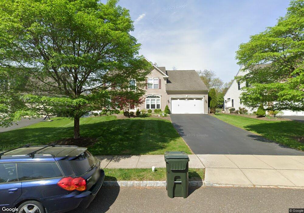
402 Dover Dr Chalfont, PA 18914
Estimated Value: $830,305 - $951,000
4
Beds
3
Baths
3,224
Sq Ft
$272/Sq Ft
Est. Value
About This Home
This home is located at 402 Dover Dr, Chalfont, PA 18914 and is currently estimated at $878,076, approximately $272 per square foot. 402 Dover Dr is a home located in Bucks County with nearby schools including Simon Butler Elementary, Unami Middle School, and Central Bucks High School - South.
Ownership History
Date
Name
Owned For
Owner Type
Purchase Details
Closed on
May 30, 2007
Sold by
Nvr Inc
Bought by
Meehan Lorelei T and Meehan James G
Current Estimated Value
Home Financials for this Owner
Home Financials are based on the most recent Mortgage that was taken out on this home.
Original Mortgage
$78,850
Outstanding Balance
$47,175
Interest Rate
6.14%
Mortgage Type
Stand Alone Second
Estimated Equity
$830,901
Purchase Details
Closed on
Feb 15, 2007
Sold by
New Britain Funding Co Lp
Bought by
Nvr Inc and Ryan Homes
Create a Home Valuation Report for This Property
The Home Valuation Report is an in-depth analysis detailing your home's value as well as a comparison with similar homes in the area
Home Values in the Area
Average Home Value in this Area
Purchase History
| Date | Buyer | Sale Price | Title Company |
|---|---|---|---|
| Meehan Lorelei T | $525,795 | None Available | |
| Nvr Inc | $225,212 | None Available |
Source: Public Records
Mortgage History
| Date | Status | Borrower | Loan Amount |
|---|---|---|---|
| Open | Meehan Lorelei T | $78,850 | |
| Open | Meehan Lorelei T | $420,600 |
Source: Public Records
Tax History
| Year | Tax Paid | Tax Assessment Tax Assessment Total Assessment is a certain percentage of the fair market value that is determined by local assessors to be the total taxable value of land and additions on the property. | Land | Improvement |
|---|---|---|---|---|
| 2025 | $9,057 | $52,260 | $7,830 | $44,430 |
| 2024 | $9,057 | $52,260 | $7,830 | $44,430 |
| 2023 | $8,769 | $52,260 | $7,830 | $44,430 |
| 2022 | $8,595 | $52,260 | $7,830 | $44,430 |
| 2021 | $8,498 | $52,260 | $7,830 | $44,430 |
| 2020 | $8,498 | $52,260 | $7,830 | $44,430 |
| 2019 | $8,394 | $52,260 | $7,830 | $44,430 |
| 2018 | $8,394 | $52,260 | $7,830 | $44,430 |
| 2017 | $8,328 | $52,260 | $7,830 | $44,430 |
| 2016 | $8,328 | $52,260 | $7,830 | $44,430 |
| 2015 | -- | $52,260 | $7,830 | $44,430 |
| 2014 | -- | $52,260 | $7,830 | $44,430 |
Source: Public Records
Map
Nearby Homes
- 331 Village Way
- 4595 County Line Rd
- 165 Township Line Rd
- 173 Township Line Rd
- 292 Walter Rd
- 102 Railroad Ave
- 2732 Valley Woods Rd
- 13 Brook Ln
- 83 Bethlehem Pike Unit 1306- HAMILTON PLAN
- 83 Bethlehem Pike Unit 1405
- 83 Bethlehem Pike Unit 1111
- 83 Bethlehem Pike Unit 1106- MADISON PLAN
- 83 Bethlehem Pike Unit 1102- IVY FLOORPLAN
- 83 Bethlehem Pike Unit 1109 LEWIS FLOORPLAN
- 109 Briarwood Ln
- 2288 Rebecca Dr
- 105 Brentwood Ct
- 31 Farber Dr
- 138 Woodland Dr
- 50 Hickory Ln
Your Personal Tour Guide
Ask me questions while you tour the home.