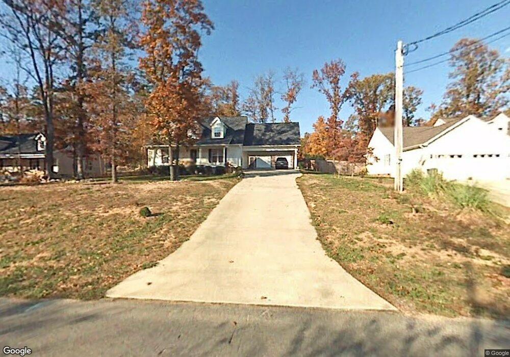
402 Forrest Park Rd Dalton, GA 30721
Estimated Value: $289,070 - $335,000
4
Beds
4
Baths
2,300
Sq Ft
$132/Sq Ft
Est. Value
About This Home
This home is located at 402 Forrest Park Rd, Dalton, GA 30721 and is currently estimated at $304,018, approximately $132 per square foot. 402 Forrest Park Rd is a home located in Whitfield County with nearby schools including Pleasant Grove Elementary School, New Hope Middle School, and Northwest Whitfield County High School.
Ownership History
Date
Name
Owned For
Owner Type
Purchase Details
Closed on
Aug 22, 2014
Sold by
Federal National Mortgage Association
Bought by
Gonzalez Ana
Current Estimated Value
Purchase Details
Closed on
Nov 25, 2013
Sold by
Lopez Jose
Bought by
Federal National Mtg Associati
Purchase Details
Closed on
Jun 1, 2004
Sold by
Armstrong David
Bought by
Lopez Jose R and Lopez Roberta
Purchase Details
Closed on
Feb 29, 2000
Sold by
Stinson Jewell
Bought by
Armstrong David
Create a Home Valuation Report for This Property
The Home Valuation Report is an in-depth analysis detailing your home's value as well as a comparison with similar homes in the area
Purchase History
| Date | Buyer | Sale Price | Title Company |
|---|---|---|---|
| Gonzalez Ana | $159,588 | -- | |
| Federal National Mtg Associati | $184,755 | -- | |
| Lopez Jose R | $197,500 | -- | |
| Armstrong David | $18,100 | -- |
Source: Public Records
Tax History
| Year | Tax Paid | Tax Assessment Tax Assessment Total Assessment is a certain percentage of the fair market value that is determined by local assessors to be the total taxable value of land and additions on the property. | Land | Improvement |
|---|---|---|---|---|
| 2025 | $2,764 | $126,455 | $15,600 | $110,855 |
| 2024 | $2,764 | $126,455 | $15,600 | $110,855 |
| 2023 | $2,484 | $91,322 | $10,600 | $80,722 |
| 2022 | $1,958 | $74,938 | $10,600 | $64,338 |
| 2021 | $1,959 | $74,938 | $10,600 | $64,338 |
| 2020 | $2,014 | $74,938 | $10,600 | $64,338 |
| 2019 | $2,041 | $74,938 | $10,600 | $64,338 |
| 2018 | $1,917 | $70,140 | $10,600 | $59,540 |
| 2017 | $1,918 | $70,140 | $10,600 | $59,540 |
| 2016 | $1,859 | $70,197 | $12,600 | $57,597 |
| 2014 | $1,691 | $70,197 | $12,600 | $57,597 |
| 2013 | -- | $73,043 | $12,600 | $60,443 |
Source: Public Records
Map
Nearby Homes
- 107 Driftwood Ln
- 101 Forrest Park Rd
- 522 Westbrook Rd
- 503 Moore Dr
- 2502 E Hillview Dr
- 629 Mahogany Ln NW
- 1903 Summit View Dr Unit 188
- 1903 Middle Summit Dr
- 1899 N Summit Dr Unit 66
- 1709 Willow Oak Ln Unit 53
- 1706 Chestnut Oak Dr Unit 91
- 112 Albertson Dr
- 1702 Chestnut Oak Dr Unit 81
- 1702 Chestnut Oak Dr Unit 83
- 1702 Chestnut Oak Dr
- 627 Fox Den Cir
- 621 Fox Den Cir
- 615 Fox Den Cir
- 620 Fox Den Cir
- 1702 White Oak Ln
- 402 Forrest Park Rd
- 400 Forrest Park Rd
- 404 Forrest Park Rd
- 107 Green Leaf Cir
- 00 Greenleaf Cir
- 75 Green Leaf Cir
- 406 Forrest Park Rd
- 401 Forrest Park Rd
- 403 Forrest Park Rd
- LOT 53 Forest Park Rd
- 306 Forrest Park Rd
- 109 Green Leaf Cir
- 309 Forrest Park Rd
- 309 Forrest Park Rd
- 407 Forrest Park Rd
- 0 Greenleaf Cir Unit RTC2721569
- 0 Greenleaf Cir Unit 116546
- 0 Greenleaf Cir Unit RTC2335434
- 100 Greenleaf Cir
- 402 Forest Park Rd
Your Personal Tour Guide
Ask me questions while you tour the home.