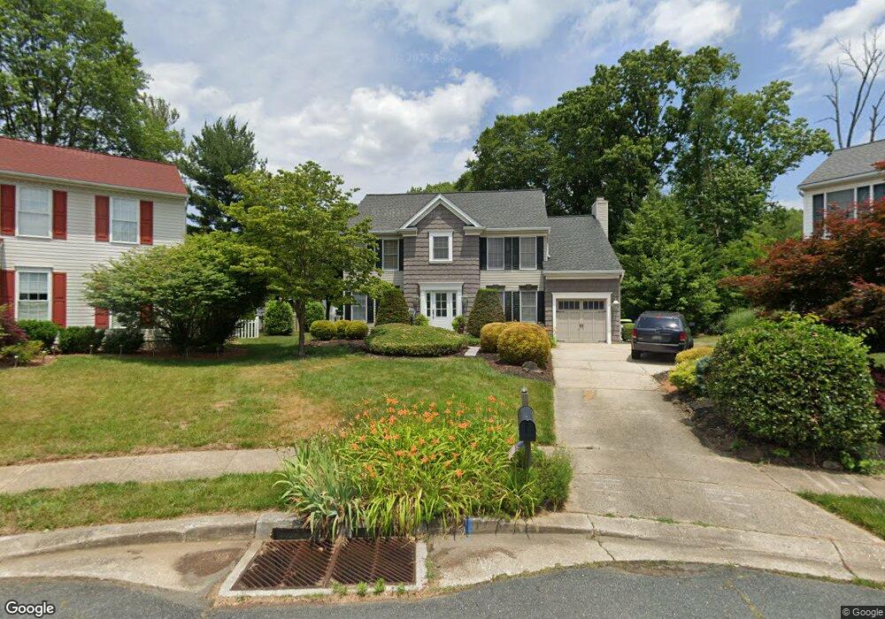
402 Gresham Ct Bel Air, MD 21014
Estimated Value: $455,275 - $532,000
Studio
3
Baths
2,251
Sq Ft
$220/Sq Ft
Est. Value
About This Home
This home is located at 402 Gresham Ct, Bel Air, MD 21014 and is currently estimated at $495,069, approximately $219 per square foot. 402 Gresham Ct is a home located in Harford County with nearby schools including Red Pump Elementary School, Bel Air Middle School, and Bel Air High School.
Ownership History
Date
Name
Owned For
Owner Type
Purchase Details
Closed on
May 29, 1991
Sold by
Logos Construction Company
Bought by
Pasko Stephen M and Pasko Phyllis M
Current Estimated Value
Home Financials for this Owner
Home Financials are based on the most recent Mortgage that was taken out on this home.
Original Mortgage
$100,000
Interest Rate
9.47%
Purchase Details
Closed on
Feb 19, 1991
Sold by
Birchwood Manor Inc
Bought by
Logos Construction Company
Home Financials for this Owner
Home Financials are based on the most recent Mortgage that was taken out on this home.
Original Mortgage
$136,200
Interest Rate
9.25%
Create a Home Valuation Report for This Property
The Home Valuation Report is an in-depth analysis detailing your home's value as well as a comparison with similar homes in the area
Home Values in the Area
Average Home Value in this Area
Purchase History
| Date | Buyer | Sale Price | Title Company |
|---|---|---|---|
| Pasko Stephen M | $170,300 | -- | |
| Logos Construction Company | $34,500 | -- |
Source: Public Records
Mortgage History
| Date | Status | Borrower | Loan Amount |
|---|---|---|---|
| Closed | Pasko Stephen M | $100,000 | |
| Previous Owner | Logos Construction Company | $136,200 |
Source: Public Records
Tax History
| Year | Tax Paid | Tax Assessment Tax Assessment Total Assessment is a certain percentage of the fair market value that is determined by local assessors to be the total taxable value of land and additions on the property. | Land | Improvement |
|---|---|---|---|---|
| 2025 | $4,122 | $394,700 | $103,500 | $291,200 |
| 2024 | $4,122 | $378,233 | $0 | $0 |
| 2023 | $3,943 | $361,767 | $0 | $0 |
| 2022 | $3,763 | $345,300 | $103,500 | $241,800 |
| 2021 | $1,873 | $334,933 | $0 | $0 |
| 2020 | $1,873 | $324,567 | $0 | $0 |
| 2019 | $3,626 | $314,200 | $120,700 | $193,500 |
| 2018 | $3,568 | $311,967 | $0 | $0 |
| 2017 | $3,542 | $314,200 | $0 | $0 |
| 2016 | -- | $307,500 | $0 | $0 |
| 2015 | $3,669 | $307,500 | $0 | $0 |
| 2014 | $3,669 | $307,500 | $0 | $0 |
Source: Public Records
Map
Nearby Homes
- 1322 Locust Ave
- 335 Princeton Ln
- 806 Harness Way
- 922 Rock Spring Rd
- 1372 Scoflo Ct
- 747 Roland Ave
- 423 Red Pump Rd
- 402 Aggies Cir Unit B
- 402 Hall St
- 974 Chesney Ln
- 725 Heston Ln
- 730 Heston Ln
- 918 Chesney Ln
- 911 Chesney Ln
- 1521 Cedarwood Dr
- 109 Marshall Dr
- 1522 Cedarwood Dr
- 1605 Samantha Dr
- 943 Lynham Ct
- 400 Chadford Ct
Your Personal Tour Guide
Ask me questions while you tour the home.