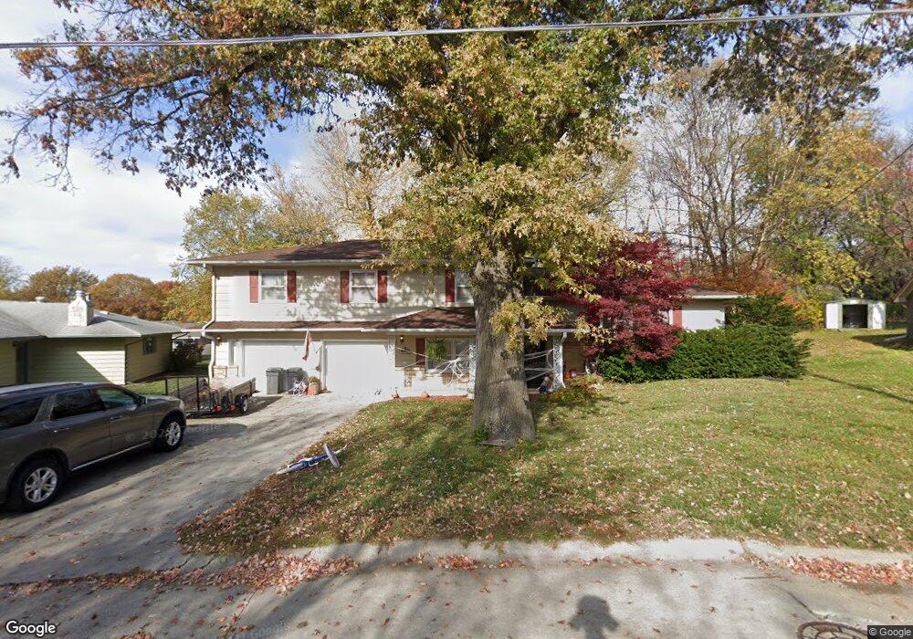
402 Linden Ave Shenandoah, IA 51601
Estimated Value: $228,000 - $259,000
3
Beds
3
Baths
1,664
Sq Ft
$144/Sq Ft
Est. Value
About This Home
This home is located at 402 Linden Ave, Shenandoah, IA 51601 and is currently estimated at $239,555, approximately $143 per square foot. 402 Linden Ave is a home located in Page County with nearby schools including Shenandoah Elementary School, Shenandoah Middle School, and Shenandoah High School.
Ownership History
Date
Name
Owned For
Owner Type
Purchase Details
Closed on
Jan 5, 2024
Sold by
Greene Noah M and Greene Chelsie N
Bought by
Campbell Eric
Current Estimated Value
Home Financials for this Owner
Home Financials are based on the most recent Mortgage that was taken out on this home.
Original Mortgage
$176,000
Outstanding Balance
$172,959
Interest Rate
7.29%
Mortgage Type
New Conventional
Estimated Equity
$66,596
Purchase Details
Closed on
May 13, 2016
Sold by
Porter Candance S
Bought by
Greene Noah M and Greene Chelsie N
Purchase Details
Closed on
May 30, 2014
Sold by
Lovitt Jay R and Lovitt Ingrid
Bought by
Porter Candance S
Home Financials for this Owner
Home Financials are based on the most recent Mortgage that was taken out on this home.
Original Mortgage
$100,000
Interest Rate
4.2%
Mortgage Type
New Conventional
Create a Home Valuation Report for This Property
The Home Valuation Report is an in-depth analysis detailing your home's value as well as a comparison with similar homes in the area
Home Values in the Area
Average Home Value in this Area
Purchase History
| Date | Buyer | Sale Price | Title Company |
|---|---|---|---|
| Campbell Eric | $220,000 | None Listed On Document | |
| Greene Noah M | $135,000 | None Available | |
| Porter Candance S | $135,000 | None Available |
Source: Public Records
Mortgage History
| Date | Status | Borrower | Loan Amount |
|---|---|---|---|
| Open | Campbell Eric | $176,000 | |
| Previous Owner | Porter Candance S | $100,000 |
Source: Public Records
Tax History Compared to Growth
Tax History
| Year | Tax Paid | Tax Assessment Tax Assessment Total Assessment is a certain percentage of the fair market value that is determined by local assessors to be the total taxable value of land and additions on the property. | Land | Improvement |
|---|---|---|---|---|
| 2025 | $3,176 | $211,560 | $17,670 | $193,890 |
| 2024 | $3,176 | $183,180 | $17,670 | $165,510 |
| 2023 | $3,218 | $183,180 | $17,670 | $165,510 |
| 2022 | $3,182 | $161,900 | $17,670 | $144,230 |
| 2021 | $3,182 | $168,230 | $16,960 | $151,270 |
| 2020 | $2,930 | $140,180 | $16,960 | $123,220 |
Source: Public Records
Map
Nearby Homes
- 123 Sleepy Hollow Dr
- 108 W Nishna Rd
- 803 E Nishna Rd
- 201 E Clarinda Ave
- 905 Page St
- 208 W Summit Ave
- 712 West St
- 600 West St
- 12 Mayridge Dr
- 24 Mayridge Dr
- 9 Country Club Ln
- 46 Keith Dr
- 402 W Clarinda Ave
- 104 E Sheridan Ave
- 1400 Maple St
- 505 S Elm St
- 24 Applewood Dr
- 702 7th Ave
- 806 9th Ave
- 213 W Sheridan Ave
- 401 Johnson Dr
- 404 Linden Ave
- 313 Johnson Dr
- 403 Johnson Dr
- 405 Johnson Dr
- 406 Linden Ave
- 311 Johnson Dr
- 400 Johnson Dr
- 404 Johnson Dr
- 405 Linden Ave
- 1200 Longman Dr
- 309 Johnson Dr
- 307 Johnson Dr
- 1203 Longman Dr
- 409 Johnson Dr
- 407 Johnson Dr
- 402 E Nishna Rd
- 404 E Nishna Rd
- 408 E Nishna Rd
- 310 E Nishna Rd