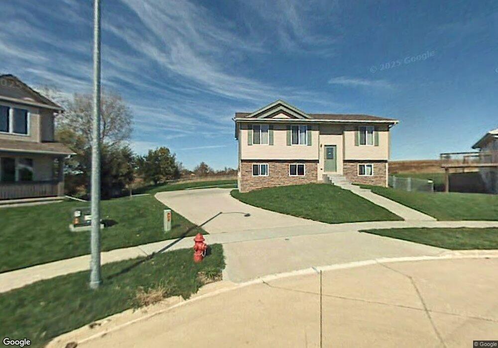
402 Molly Ct Runnells, IA 50237
Estimated Value: $232,888 - $309,000
3
Beds
2
Baths
1,024
Sq Ft
$264/Sq Ft
Est. Value
About This Home
This home is located at 402 Molly Ct, Runnells, IA 50237 and is currently estimated at $270,472, approximately $264 per square foot. 402 Molly Ct is a home located in Polk County with nearby schools including Runnells Elementary School, Southeast Polk Spring Creek- 6th Grade, and Southeast Polk Junior High School.
Ownership History
Date
Name
Owned For
Owner Type
Purchase Details
Closed on
Dec 28, 2012
Sold by
Davis Mindy L and Davis Matthew J
Bought by
Davis Matthew J and Davis Mindy L
Current Estimated Value
Home Financials for this Owner
Home Financials are based on the most recent Mortgage that was taken out on this home.
Original Mortgage
$176,850
Outstanding Balance
$122,124
Interest Rate
3.3%
Mortgage Type
New Conventional
Estimated Equity
$148,348
Purchase Details
Closed on
May 23, 2006
Sold by
Anw Builders Llc
Bought by
Webb Mindy L and Davis Matthew J
Home Financials for this Owner
Home Financials are based on the most recent Mortgage that was taken out on this home.
Original Mortgage
$171,900
Interest Rate
6.56%
Mortgage Type
Fannie Mae Freddie Mac
Create a Home Valuation Report for This Property
The Home Valuation Report is an in-depth analysis detailing your home's value as well as a comparison with similar homes in the area
Purchase History
| Date | Buyer | Sale Price | Title Company |
|---|---|---|---|
| Davis Matthew J | -- | None Available | |
| Webb Mindy L | $171,500 | Itc |
Source: Public Records
Mortgage History
| Date | Status | Borrower | Loan Amount |
|---|---|---|---|
| Open | Davis Matthew J | $176,850 | |
| Previous Owner | Webb Mindy L | $171,900 |
Source: Public Records
Tax History
| Year | Tax Paid | Tax Assessment Tax Assessment Total Assessment is a certain percentage of the fair market value that is determined by local assessors to be the total taxable value of land and additions on the property. | Land | Improvement |
|---|---|---|---|---|
| 2025 | $3,688 | $245,200 | $37,000 | $208,200 |
| 2024 | $3,688 | $221,000 | $32,700 | $188,300 |
| 2023 | $3,534 | $221,000 | $32,700 | $188,300 |
| 2022 | $3,488 | $185,500 | $28,200 | $157,300 |
| 2021 | $3,278 | $185,500 | $28,200 | $157,300 |
| 2020 | $3,144 | $167,000 | $25,400 | $141,600 |
| 2019 | $3,004 | $163,200 | $25,400 | $137,800 |
| 2018 | $3,008 | $145,600 | $22,200 | $123,400 |
| 2017 | $3,104 | $145,600 | $22,200 | $123,400 |
| 2016 | $3,086 | $135,100 | $20,400 | $114,700 |
| 2015 | $3,086 | $135,100 | $20,400 | $114,700 |
| 2014 | $3,016 | $133,000 | $19,700 | $113,300 |
Source: Public Records
Map
Nearby Homes
- 404 Brown St
- 303 W Mckinney St
- 12686 SE 56th Ave
- 3380 SE 96th St
- 4011 SE Powers Dr
- 12571 W 125th St S
- 0 S 128th Ave W
- 226 N View Ct
- 1462 108th St SE
- 410 N Vine St
- 2456 SE 88th St
- 7930 SE Vandalia Dr
- 700 S Vine St
- 24479 Elthon Place
- 5825 G24 Hwy
- 6335 S31 Hwy
- 1002 SE 78th St
- 630 N 1st St
- 5792 Arbor Hills Ct
- 5766 Arbor Springs Dr
Your Personal Tour Guide
Ask me questions while you tour the home.