Estimated Value: $355,000 - $648,000
3
Beds
3
Baths
2,672
Sq Ft
$190/Sq Ft
Est. Value
About This Home
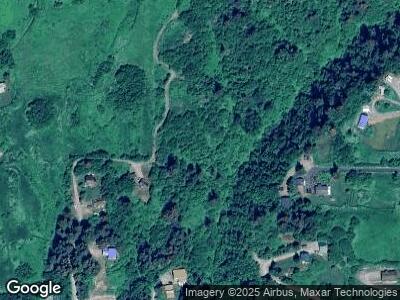
This home is located at 4020 Hunter St, Homer, AK 99603 and is currently estimated at $506,832, approximately $189 per square foot. 4020 Hunter St is a home located in Kenai Peninsula Borough with nearby schools including Paul Banks Elementary School, West Homer Elementary School, and Homer Middle School.
Ownership History
Date
Name
Owned For
Owner Type
Purchase Details
Closed on
Jun 27, 2011
Sold by
Fannie Mae
Bought by
Mccrea Charles T and Mccrea Janice J
Current Estimated Value
Purchase Details
Closed on
Feb 21, 2011
Sold by
Wells Fargo Bank N A
Bought by
Fannie Mae and Federal National Mortgage Association
Purchase Details
Closed on
Nov 19, 2010
Sold by
Wilson Teresa and Wilson Travis
Bought by
Wells Fargo Bank N A
Purchase Details
Closed on
Jul 20, 2005
Sold by
Wilson Teresa A
Bought by
Wilson Travis and Wilson Teresa A
Home Financials for this Owner
Home Financials are based on the most recent Mortgage that was taken out on this home.
Original Mortgage
$204,000
Interest Rate
8.37%
Mortgage Type
Stand Alone Refi Refinance Of Original Loan
Create a Home Valuation Report for This Property
The Home Valuation Report is an in-depth analysis detailing your home's value as well as a comparison with similar homes in the area
Home Values in the Area
Average Home Value in this Area
Purchase History
| Date | Buyer | Sale Price | Title Company |
|---|---|---|---|
| Mccrea Charles T | -- | Fatic | |
| Fannie Mae | -- | None Available | |
| Wells Fargo Bank N A | $298,543 | None Available | |
| Wilson Travis | -- | -- |
Source: Public Records
Mortgage History
| Date | Status | Borrower | Loan Amount |
|---|---|---|---|
| Previous Owner | Wilson Teresa | $224,700 | |
| Previous Owner | Wilson Travis | $204,000 | |
| Previous Owner | Wislon Teresa A | $144,600 |
Source: Public Records
Tax History Compared to Growth
Tax History
| Year | Tax Paid | Tax Assessment Tax Assessment Total Assessment is a certain percentage of the fair market value that is determined by local assessors to be the total taxable value of land and additions on the property. | Land | Improvement |
|---|---|---|---|---|
| 2024 | $4,332 | $422,200 | $79,200 | $343,000 |
| 2023 | $3,719 | $340,600 | $70,000 | $270,600 |
| 2022 | $3,244 | $288,600 | $58,600 | $230,000 |
| 2021 | $3,203 | $287,400 | $57,000 | $230,400 |
| 2020 | $3,251 | $284,200 | $56,500 | $227,700 |
| 2019 | $1,602 | $278,600 | $56,500 | $222,100 |
| 2018 | $3,203 | $278,500 | $53,600 | $224,900 |
| 2017 | $3,211 | $284,200 | $67,800 | $216,400 |
| 2016 | $2,608 | $230,800 | $51,900 | $178,900 |
| 2015 | $2,973 | $255,700 | $51,900 | $203,800 |
| 2014 | $2,973 | $245,500 | $51,900 | $193,600 |
Source: Public Records
Map
Nearby Homes
- 1505 Sterling Hwy
- 1429 Sterling Hwy
- 1129 Sterling Hwy
- 1696 Sterling Hwy Unit A, B, 1, 2
- 1696 Sterling Hwy
- 2419 Judy Rebecca Ct
- 2506 Rene Ct
- 830 Linstrang Way
- 2525 Sterling Hwy
- 4695 Lincoln Cir
- 1147 Shelley Ave
- 3625 W Hill Rd
- 1082 Robert Ave
- 1029 Shelley Ave
- 2750 Sterling Hwy
- 3834 Tajen Ln
- 3710 Tajen Ln
- 2765 Sterling Hwy
- 3866 Cabana Ct
- 1060 Jeffery Ave
- 4020 Hunter St
- Tr D Coyote Way
- Tr B Coyote Way
- 1885 Coyote Way
- 1831 Coyote Way
- 1952 Coyote Way
- 1832 Sterling Hwy
- 1914 Sterling Hwy
- 1962 Sterling Hwy
- L4 Coyote Way
- 1850 Coyote Way
- 2000 Coyote Way
- 1870 Coyote Way
- 1972 Sterling Hwy
- 1698 Hillside Place
- 4061 West Hill Rd
- 1860 Hunter St
- 1762 Sterling Hwy
- 1953 Sterling Hwy
- L8 B4 Watson Place
