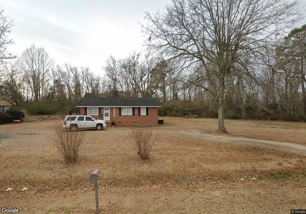
4021 Highway 57 S Fork, SC 29543
Estimated Value: $145,000 - $237,000
--
Bed
--
Bath
--
Sq Ft
0.76
Acres
About This Home
This home is located at 4021 Highway 57 S, Fork, SC 29543 and is currently estimated at $183,622. 4021 Highway 57 S is a home with nearby schools including Lake View Elementary School and Lake View High School.
Ownership History
Date
Name
Owned For
Owner Type
Purchase Details
Closed on
Feb 15, 2023
Sold by
Gleason Earl L
Bought by
Boykin Benjamin R and Hamer Darby M
Current Estimated Value
Home Financials for this Owner
Home Financials are based on the most recent Mortgage that was taken out on this home.
Original Mortgage
$112,626
Outstanding Balance
$108,922
Interest Rate
6.26%
Mortgage Type
Construction
Estimated Equity
$74,700
Purchase Details
Closed on
May 3, 2007
Sold by
Lovelace Frederick
Bought by
Gleason Earl L
Create a Home Valuation Report for This Property
The Home Valuation Report is an in-depth analysis detailing your home's value as well as a comparison with similar homes in the area
Home Values in the Area
Average Home Value in this Area
Purchase History
| Date | Buyer | Sale Price | Title Company |
|---|---|---|---|
| Boykin Benjamin R | $110,000 | -- | |
| Gleason Earl L | $42,000 | -- |
Source: Public Records
Mortgage History
| Date | Status | Borrower | Loan Amount |
|---|---|---|---|
| Open | Boykin Benjamin R | $112,626 |
Source: Public Records
Tax History Compared to Growth
Tax History
| Year | Tax Paid | Tax Assessment Tax Assessment Total Assessment is a certain percentage of the fair market value that is determined by local assessors to be the total taxable value of land and additions on the property. | Land | Improvement |
|---|---|---|---|---|
| 2025 | $653 | $4,280 | $210 | $4,070 |
| 2024 | $601 | $4,280 | $210 | $4,070 |
| 2023 | $601 | $1,950 | $210 | $1,740 |
| 2022 | $1,023 | $2,920 | $320 | $2,600 |
| 2021 | $926 | $2,580 | $320 | $2,260 |
| 2020 | $961 | $2,580 | $320 | $2,260 |
| 2019 | $913 | $2,580 | $320 | $2,260 |
| 2018 | $903 | $2,580 | $320 | $2,260 |
| 2016 | $886 | $2,580 | $320 | $2,260 |
| 2015 | $886 | $2,580 | $320 | $2,260 |
| 2014 | -- | $2,580 | $320 | $2,260 |
| 2013 | -- | $2,580 | $320 | $2,260 |
Source: Public Records
Map
Nearby Homes
- 0 Highway 41 Unit LotWP001 14913177
- 000 Schofield Place
- 1130 Buck Swamp Rd
- 1550 Rone Place
- Lot 9 Tooge Hayes Rd
- Lot 7 Tooge Hayes Rd
- Lot 4 Tooge Hayes Rd
- TBD Tooge Hayes Rd
- Lot 6 Tooge Hayes Rd
- Lot 5 Tooge Hayes Rd
- Lot 8 Tooge Hayes Rd
- Lot 10 Tooge Hayes Rd
- 0 Tbd Sandhill Rd Unit LotWP00B
- 0 Tbd Sandhill Rd Unit LotWP00A
- 0 Tbd Sandhill Rd Unit LotWP00C
- 0 Tbd Sandhill Rd Unit LotWP002 23456478
- 1 TBD Dew RD Dew Rd
- 4807 Sandhill Rd
- 2347 Cooper Ct
- 1210 John St
- 4025 Highway 57 S
- 4029 Highway 57 S
- 4043 Highway 57 S
- 4048 Highway 57 S
- 1842 Leroy Rd
- 4111 Highway 57 S
- 2429 1st Loop Rd
- 4117 Highway 57 Rd S
- 2517 Zack Rd
- 2524 Zack Rd
- 2507 Zack Rd
- 00 1st Loop Rd
- 3830 Highway 41 S
- 3561 S Carolina 41
- 3814 Highway 41 S
- 3818 Highway 41 S
- 2561 1st Loop Rd
- 2561 1st Loop Rd
- 2406 1st Loop Rd
- 2406 1st Loop Rd