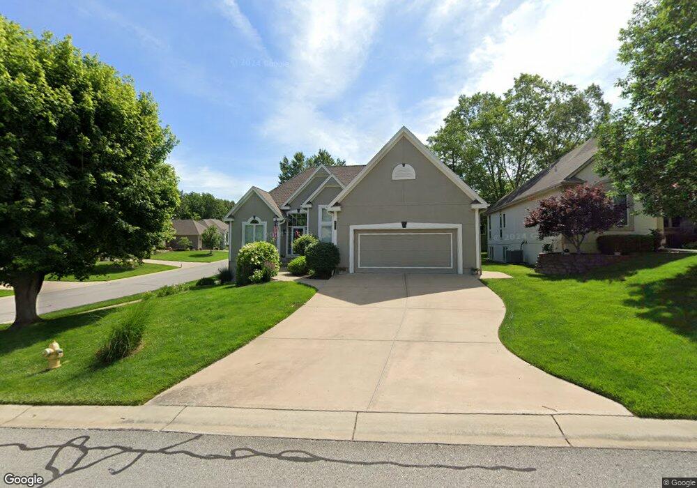
4021 NE Bittersweet Dr Lees Summit, MO 64064
Chapel Ridge NeighborhoodEstimated Value: $370,816 - $596,000
2
Beds
3
Baths
1,571
Sq Ft
$291/Sq Ft
Est. Value
About This Home
This home is located at 4021 NE Bittersweet Dr, Lees Summit, MO 64064 and is currently estimated at $456,454, approximately $290 per square foot. 4021 NE Bittersweet Dr is a home located in Jackson County with nearby schools including Chapel Lakes Elementary School, Delta Woods Middle School, and Blue Springs South High School.
Ownership History
Date
Name
Owned For
Owner Type
Purchase Details
Closed on
May 5, 2011
Sold by
Franco Sandra S
Bought by
Franco Sandra S and Sandra S Franco Living Trust
Current Estimated Value
Purchase Details
Closed on
Sep 12, 2008
Sold by
Knopp Russell G and Knopp Joanne P
Bought by
Franco Sandra S
Home Financials for this Owner
Home Financials are based on the most recent Mortgage that was taken out on this home.
Original Mortgage
$170,000
Interest Rate
6.52%
Mortgage Type
Purchase Money Mortgage
Purchase Details
Closed on
Nov 16, 2001
Sold by
Farmer Marilyn J and Farmer Michael R
Bought by
Knopp Russell G and Knopp Joanne P
Home Financials for this Owner
Home Financials are based on the most recent Mortgage that was taken out on this home.
Original Mortgage
$156,000
Interest Rate
6.59%
Mortgage Type
Purchase Money Mortgage
Purchase Details
Closed on
Mar 31, 2001
Sold by
Farmer Michael R and Farmer Marilyn J
Bought by
Farmer Marilyn J
Home Financials for this Owner
Home Financials are based on the most recent Mortgage that was taken out on this home.
Original Mortgage
$232,000
Interest Rate
7.13%
Mortgage Type
Purchase Money Mortgage
Purchase Details
Closed on
Jun 17, 1999
Bought by
Farmer Michael R
Home Financials for this Owner
Home Financials are based on the most recent Mortgage that was taken out on this home.
Original Mortgage
$95,000
Interest Rate
7.02%
Mortgage Type
New Conventional
Purchase Details
Closed on
May 7, 1997
Sold by
Greystone Designs Inc
Bought by
Wagner Robert H and Wagner Victoria S
Home Financials for this Owner
Home Financials are based on the most recent Mortgage that was taken out on this home.
Original Mortgage
$111,000
Interest Rate
7.62%
Mortgage Type
Purchase Money Mortgage
Purchase Details
Closed on
Mar 29, 1996
Sold by
Lane Darrell D and Joyce Lane R
Bought by
Greystone Designs Inc
Purchase Details
Closed on
Oct 3, 1995
Sold by
Bordner Charles S and Bordner Billie K
Bought by
Lane Darrell D and Joyce Lane R
Create a Home Valuation Report for This Property
The Home Valuation Report is an in-depth analysis detailing your home's value as well as a comparison with similar homes in the area
Home Values in the Area
Average Home Value in this Area
Purchase History
| Date | Buyer | Sale Price | Title Company |
|---|---|---|---|
| Franco Sandra S | -- | None Available | |
| Franco Sandra S | -- | Kansas City Title | |
| Knopp Russell G | -- | Chicago Title Co | |
| Farmer Marilyn J | -- | Premier Land Title Co | |
| Farmer Michael R | -- | -- | |
| Wagner Robert H | -- | Security Land Title Company | |
| Greystone Designs Inc | -- | Coffelt Land Title Inc | |
| Lane Darrell D | -- | Coffelt Land Title Inc |
Source: Public Records
Mortgage History
| Date | Status | Borrower | Loan Amount |
|---|---|---|---|
| Closed | Franco Sandra S | $170,000 | |
| Previous Owner | Knopp Russell G | $156,000 | |
| Previous Owner | Farmer Marilyn J | $232,000 | |
| Previous Owner | Farmer Michael R | $95,000 | |
| Previous Owner | Wagner Robert H | $111,000 |
Source: Public Records
Tax History Compared to Growth
Tax History
| Year | Tax Paid | Tax Assessment Tax Assessment Total Assessment is a certain percentage of the fair market value that is determined by local assessors to be the total taxable value of land and additions on the property. | Land | Improvement |
|---|---|---|---|---|
| 2025 | $4,197 | $57,660 | $8,881 | $48,779 |
| 2024 | $4,121 | $54,798 | $5,523 | $49,275 |
| 2023 | $4,121 | $54,798 | $8,314 | $46,484 |
| 2022 | $4,050 | $47,690 | $5,320 | $42,370 |
| 2021 | $4,046 | $47,690 | $5,320 | $42,370 |
| 2020 | $3,717 | $43,333 | $5,320 | $38,013 |
| 2019 | $3,603 | $43,333 | $5,320 | $38,013 |
| 2018 | $3,565 | $41,589 | $5,113 | $36,476 |
| 2017 | $3,565 | $41,589 | $5,113 | $36,476 |
| 2016 | $3,360 | $39,330 | $6,555 | $32,775 |
| 2014 | $3,466 | $40,308 | $6,130 | $34,178 |
Source: Public Records
Map
Nearby Homes
- 4004 NE Independence Ave
- 4005 NE Channel Dr
- 3723 NE Chapel Dr
- 205 NE Shoreview Dr
- 208 NE Landings Cir
- 214 NE Landings Cir
- 3709 NE Grant St
- 712 NE Ashmont Place
- 3607 NE Stanton St
- 222 NE Bayview Dr
- 793 NE Algonquin St Unit A
- 801 NE Lone Hill Dr
- 3743 NE Woodland Ct
- 327 NE Landings Dr
- 824 NE Algonquin St Unit A
- 4015 NE Sagamore Dr
- 405 NE Grant Ct
- 3568 NE Austin Dr
- 4605 NE Dick Howser Cir
- 3561 NE Austin Dr
- 4017 NE Bittersweet Dr
- 407 NE Wild Rose Ct
- 404 NE Wild Rose Ln
- 4013 NE Bittersweet Dr
- 400 NE Wild Rose Ln
- 4020 NE Bittersweet Dr
- 409 NE Wild Rose Ct
- 4024 NE Bittersweet Dr
- 4016 NE Bittersweet Dr
- 411 NE Wild Rose Ct
- 4028 NE Bittersweet Dr
- 408 NE Wild Rose Ln
- 4009 NE Bittersweet Dr
- 4012 NE Bittersweet Dr
- 412 NE Wild Rose Ln
- 421 NE Wild Rose Ct
- 4048 NE Grant St
- 419 NE Wild Rose Ct
- 4008 NE Bittersweet Dr
- 408 NE Thornberry Place