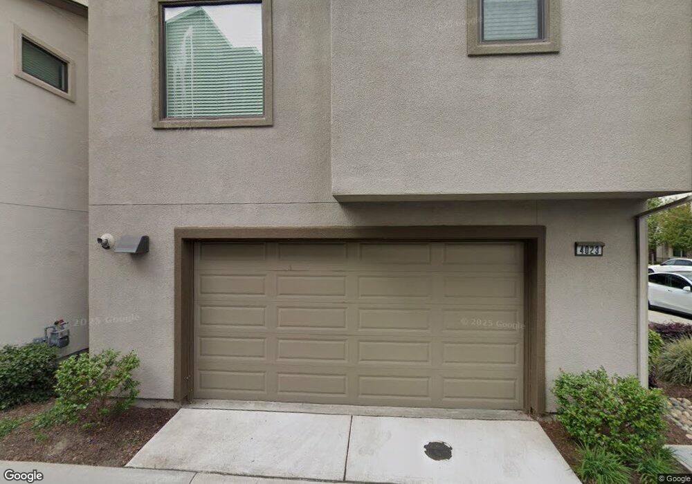
4023 Lambert Way Hayward, CA 94541
Burbank NeighborhoodEstimated Value: $1,005,768 - $1,243,000
4
Beds
5
Baths
1,922
Sq Ft
$583/Sq Ft
Est. Value
About This Home
This home is located at 4023 Lambert Way, Hayward, CA 94541 and is currently estimated at $1,121,192, approximately $583 per square foot. 4023 Lambert Way is a home with nearby schools including Burbank Elementary School, Winton Middle School, and Hayward High School.
Ownership History
Date
Name
Owned For
Owner Type
Purchase Details
Closed on
Sep 2, 2025
Sold by
Tapang Omar Roldan
Bought by
Omar Tapang Living Trust and Tapang
Current Estimated Value
Purchase Details
Closed on
Dec 2, 2016
Sold by
Tri Pointe Homes Inc
Bought by
Tapang Omar Roldan
Home Financials for this Owner
Home Financials are based on the most recent Mortgage that was taken out on this home.
Original Mortgage
$589,596
Interest Rate
3.54%
Mortgage Type
New Conventional
Create a Home Valuation Report for This Property
The Home Valuation Report is an in-depth analysis detailing your home's value as well as a comparison with similar homes in the area
Home Values in the Area
Average Home Value in this Area
Purchase History
| Date | Buyer | Sale Price | Title Company |
|---|---|---|---|
| Omar Tapang Living Trust | -- | None Listed On Document | |
| Tapang Omar Roldan | $737,000 | First American Title Company |
Source: Public Records
Mortgage History
| Date | Status | Borrower | Loan Amount |
|---|---|---|---|
| Previous Owner | Tapang Omar Roldan | $589,596 |
Source: Public Records
Tax History
| Year | Tax Paid | Tax Assessment Tax Assessment Total Assessment is a certain percentage of the fair market value that is determined by local assessors to be the total taxable value of land and additions on the property. | Land | Improvement |
|---|---|---|---|---|
| 2025 | $11,157 | $848,215 | $256,599 | $598,616 |
| 2024 | $11,157 | $831,451 | $251,569 | $586,882 |
| 2023 | $10,987 | $822,011 | $246,637 | $575,374 |
| 2022 | $10,769 | $798,895 | $241,801 | $564,094 |
| 2021 | $10,674 | $783,096 | $237,061 | $553,035 |
| 2020 | $10,541 | $781,997 | $234,631 | $547,366 |
| 2019 | $10,620 | $766,670 | $230,032 | $536,638 |
| 2018 | $9,761 | $751,638 | $225,522 | $526,116 |
| 2017 | $9,652 | $736,900 | $221,100 | $515,800 |
| 2016 | $1,878 | $145,176 | $145,176 | $0 |
Source: Public Records
Map
Nearby Homes
- 204 Sullivan Way
- 589 Staley Ave
- 625 Staley Ave
- 622 Moss Way
- 22964 Alice St
- 537 Dean St
- 24023 Edloe Dr
- 22575 Amador St
- 568 Dean St
- 522 B St
- 720 Grand Terrace
- 406 Craven Ct
- 441 Puerto Place
- 58 Trestle Dr
- 462 Craven Ct
- 710 City Walk Place Unit 4
- 22894 Kingsford Way
- 640 Plaza Place
- 728 City Walk Place Unit 4
- 229 Spring Harvest Rd
- 4025 Lambert Way
- 2009 Jubilee Dr
- 2014 Jubilee Dr
- 2012 Jubilee Dr
- 2013 Jubilee Dr
- 4024 Freestone Place
- 4027 Lambert St
- 2010 Jubilee Dr
- 4026 Freestone Place
- 617 Santina Dr
- 4028 Freestone Place
- 22795 Filbert St
- 4029 Lambert Way
- 406 Morello Dr
- 614 Santina Dr
- 4030 Freestone Place
- 3110 Freestone Place
- 3014 Traveler St
- 722 Tilton Dr
- 22797 Filbert St
Your Personal Tour Guide
Ask me questions while you tour the home.