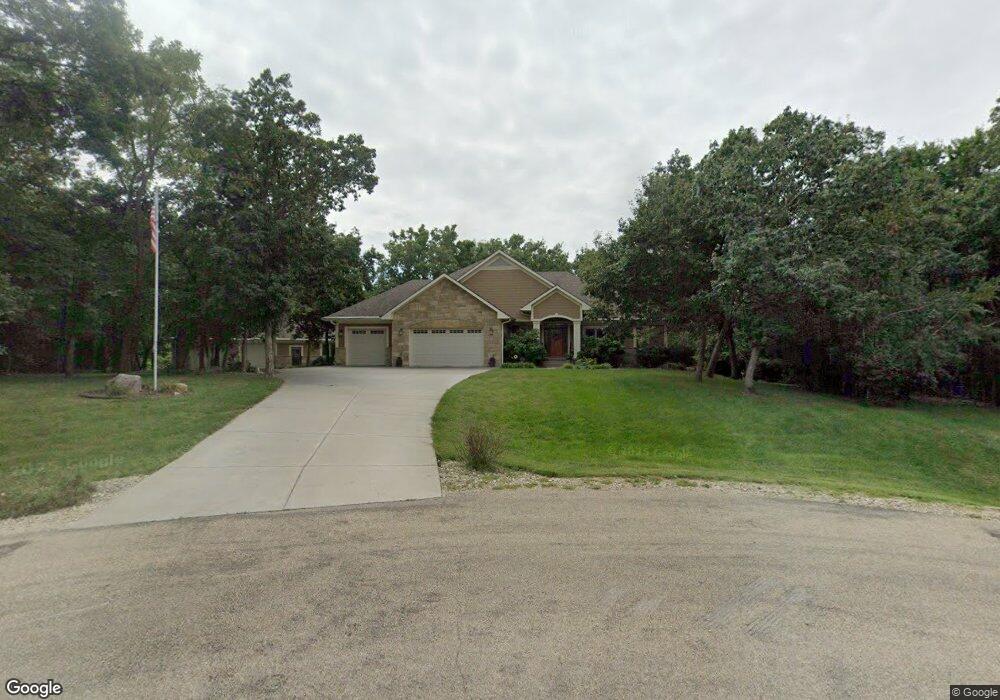
4025 Walnut Creek Dr Wamego, KS 66547
Estimated Value: $195,000 - $744,272
4
Beds
4
Baths
2,003
Sq Ft
$272/Sq Ft
Est. Value
About This Home
This home is located at 4025 Walnut Creek Dr, Wamego, KS 66547 and is currently estimated at $544,091, approximately $271 per square foot. 4025 Walnut Creek Dr is a home with nearby schools including Rock Creek Junior/Senior High School.
Ownership History
Date
Name
Owned For
Owner Type
Purchase Details
Closed on
May 18, 2020
Sold by
Boley Thomas F and Boley Judith C
Bought by
Boley Brett T
Current Estimated Value
Purchase Details
Closed on
Jul 25, 2014
Sold by
Modean Joseph S and Modean Nikole Y
Bought by
Boley Thomas F and Boley Judith C
Home Financials for this Owner
Home Financials are based on the most recent Mortgage that was taken out on this home.
Original Mortgage
$312,000
Interest Rate
4.15%
Create a Home Valuation Report for This Property
The Home Valuation Report is an in-depth analysis detailing your home's value as well as a comparison with similar homes in the area
Home Values in the Area
Average Home Value in this Area
Purchase History
| Date | Buyer | Sale Price | Title Company |
|---|---|---|---|
| Boley Brett T | -- | None Available | |
| Boley Thomas F | -- | None Available |
Source: Public Records
Mortgage History
| Date | Status | Borrower | Loan Amount |
|---|---|---|---|
| Previous Owner | Boley Thomas F | $312,000 |
Source: Public Records
Tax History Compared to Growth
Tax History
| Year | Tax Paid | Tax Assessment Tax Assessment Total Assessment is a certain percentage of the fair market value that is determined by local assessors to be the total taxable value of land and additions on the property. | Land | Improvement |
|---|---|---|---|---|
| 2025 | $7,317 | $80,803 | $8,285 | $72,518 |
| 2024 | $73 | $76,968 | $7,940 | $69,028 |
| 2023 | $7,431 | $75,512 | $7,940 | $67,572 |
| 2022 | $6,373 | $68,989 | $7,712 | $61,277 |
| 2021 | $6,373 | $64,980 | $7,489 | $57,491 |
| 2020 | $6,373 | $64,592 | $7,535 | $57,057 |
| 2019 | $6,470 | $64,751 | $6,914 | $57,837 |
| 2018 | $6,660 | $64,687 | $6,799 | $57,888 |
| 2017 | $5,683 | $62,559 | $6,461 | $56,098 |
| 2016 | $5,334 | $60,842 | $5,510 | $55,332 |
| 2015 | -- | $59,800 | $4,393 | $55,407 |
| 2014 | -- | $51,865 | $3,933 | $47,932 |
Source: Public Records
Map
Nearby Homes
- 13318 Woodland Dr
- 4225 Rockenham Rd
- 4075 Rockenham Cir
- 13000 Anthony Dr
- 13880 Berry Ln
- 00000 Countryside Ln Unit Lot 26
- 00000 Countryside Ln Unit Lot 24
- 00000 Countryside Ln Unit Lot 22
- 00000 Countryside Ln Unit Lot 20
- 00000 Countryside Ln Unit Lot 19
- 00000 Countryside Ln Unit Lot 18
- 00000 Countryside Ln Unit Lot 17
- 00000 Countryside Ln Unit Lot 15
- 00000 Countryside Ln Unit Lot 16
- 00000 Countryside Ln Unit Lot 14
- 00000 Countryside Ln Unit Lot 11
- 00000 Countryside Ln Unit Lot 10
- 00000 Countryside Ln Unit Lot 9
- 00000 Countryside Ln Unit Lot 8
- 00000 Countryside Ln Unit Lot 7
- 4036 Walnut Creek Dr
- 4057 Walnut Creek Dr
- 4060 Walnut Creek Dr
- 4081 Walnut Creek Dr
- 13355 Woodland Dr
- 4110 Walnut Creek Dr
- 3940 Woodland Cir
- 13445 Woodland Dr
- 13420 Woodland Dr
- 13436 Turkey Trail
- 13234 Turkey Trail
- 13258 Turkey Trail
- 13245 Turkey Trail
- 13269 Turkey Trail
- 13210 Turkey Trail
- 4060 Vineyard Rd
- 3920 Woodland Cir
- 13381 Turkey Trail
- 13316 Turkey Trail
- 13337 Turkey Trail