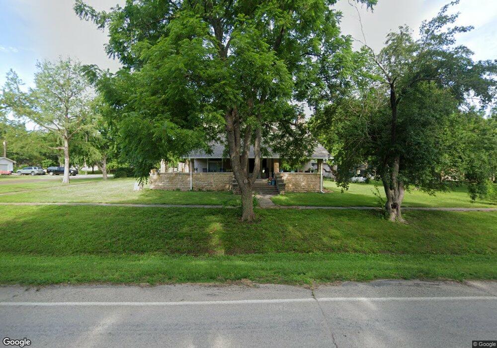
403 Main St Maple Hill, KS 66507
Estimated Value: $207,764 - $420,000
About This Home
This home is located at 403 Main St, Maple Hill, KS 66507 and is currently estimated at $284,441, approximately $86 per square foot. 403 Main St is a home with nearby schools including Wabaunsee Senior High School.
Ownership History
We collect this data history from publicly available records. To have your information removed, we recommend requesting removal directly through your county’s website.
Purchase Details
Purchase Details
Purchase History
We collect this data history from publicly available records. To have your information removed, we recommend requesting removal directly through your county’s website.
| Date | Buyer | Sale Price | Title Company |
|---|---|---|---|
| $196,562 | Kansas Secured Title | ||
| -- | -- |
Tax History
We collect this data history from publicly available records. To have your information removed, we recommend requesting removal directly through your county’s website.
| Year | Tax Paid | Tax Assessment Tax Assessment Total Assessment is a certain percentage of the fair market value that is determined by local assessors to be the total taxable value of land and additions on the property. | Land | Improvement |
|---|---|---|---|---|
| 2025 | $2,746 | $23,202 | $3,405 | $19,797 |
| 2024 | -- | $21,889 | $3,075 | $18,814 |
| 2023 | -- | $20,650 | $2,809 | $17,841 |
| 2022 | -- | $18,438 | $2,496 | $15,942 |
Map
- 631 Green St
- 416 Navarre St
- 218 E Perry St
- 18306 Cottonwood Rd
- 517 Perry St
- 0000 SE Snokomo Frontage Rd
- 6521 NW Hall Rd
- 0000 SW West Union Rd
- 26906 Gladden Rd
- Lot 2, Blk B SW 17th St
- 0000 SW 13th St
- Lot 3, Blk A SW Urish Rd
- 300 W Durink St
- 309 N 4th St
- 511 W Mission St
- 802 W Bertrand Ave
- 11120 SW 13th St
- 2209 SW Glick Rd
- 114 E Tomahawk Dr
- 1209 N Navajo Dr
Ask me questions while you tour the home.