
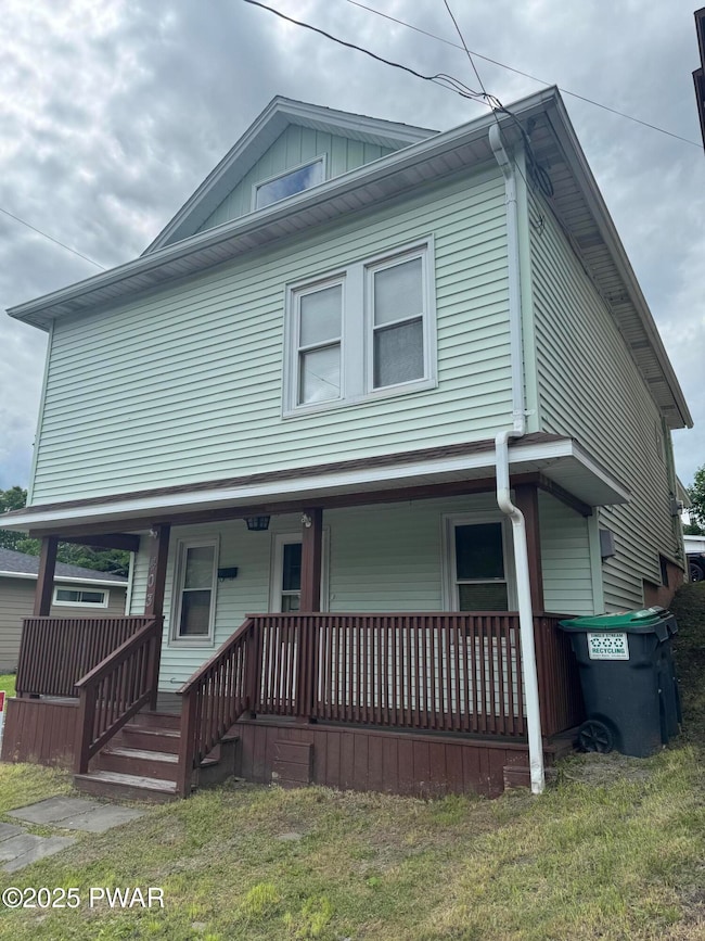
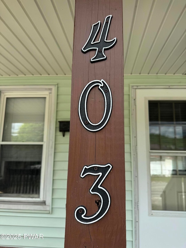
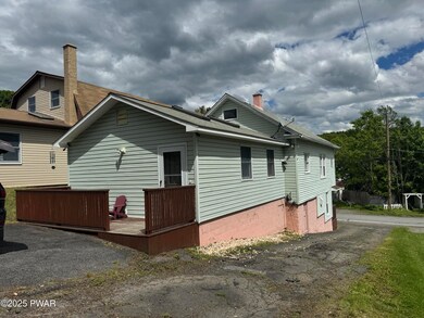
403 Marion St Browndale, PA 18421
Estimated payment $1,235/month
Highlights
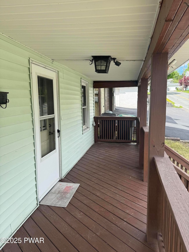
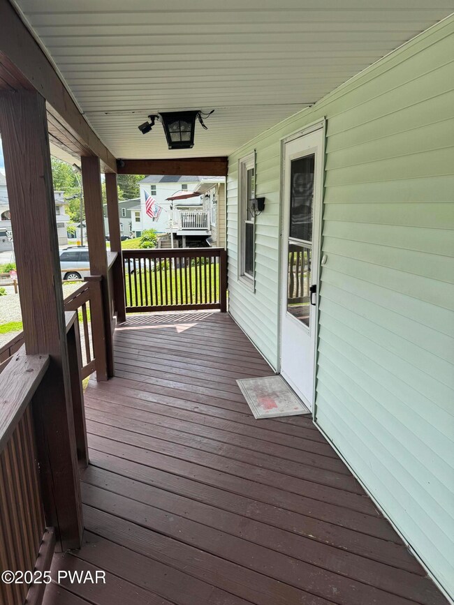
- Deck
- Game Room
- Living Room
- No HOA
- Covered patio or porch
- Laundry Room
About This Home
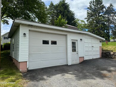
BROWNDALE - GREAT STARTER HOME - DETACHED GARAGE/WORKSHOP - Looking to get started? Look here... This 3 bedroom, 1.5 bath home will get you there. Large Living room, cozy Kitchen (granite countertop) with snack bar, Full bathroom and a wonderful Main bedroom, sitting area and walk in closet, all on the first floor! Make your way upstairs to 2 more bedrooms. In the basement, you'll find a Bar/Rec Room, Laundry Room (with toilet), and a Utility area as well! Come to Browndale and the Forest City School District this year!!
Home Details
Home Type
- Single Family
Est. Annual Taxes
- $2,064
Year Built
- Built in 1920
Lot Details
- 5,663 Sq Ft Lot
- Lot Dimensions are 37x159x36x164
- Property fronts a state road
Home Design
- Shingle Roof
- Asphalt Roof
- Vinyl Siding
Interior Spaces
- 1,598 Sq Ft Home
- 2-Story Property
- Insulated Windows
- Living Room
- Game Room
- Utility Room
Kitchen
- Electric Oven
- Electric Range
- Microwave
- Dishwasher
Flooring
- Carpet
- Laminate
- Vinyl
Bedrooms and Bathrooms
- 3 Bedrooms
Laundry
- Laundry Room
- Dryer
- Washer
Basement
- Laundry in Basement
- Crawl Space
Parking
- Garage
- Off-Street Parking
Outdoor Features
- Deck
- Covered patio or porch
- Outdoor Storage
Utilities
- Dehumidifier
- Zoned Heating
- Baseboard Heating
- Hot Water Heating System
- Heating System Uses Oil
- 101 to 200 Amp Service
- Cable TV Available
Community Details
- No Home Owners Association
Listing and Financial Details
- Assessor Parcel Number 06-2-0004-0074
Map
Home Values in the Area
Average Home Value in this Area
Tax History
| Year | Tax Paid | Tax Assessment Tax Assessment Total Assessment is a certain percentage of the fair market value that is determined by local assessors to be the total taxable value of land and additions on the property. | Land | Improvement |
|---|---|---|---|---|
| 2025 | $2,064 | $129,700 | $17,800 | $111,900 |
| 2024 | $2,006 | $129,700 | $17,800 | $111,900 |
| 2023 | $2,807 | $129,700 | $17,800 | $111,900 |
| 2022 | $1,497 | $64,300 | $9,100 | $55,200 |
| 2021 | $1,481 | $64,300 | $9,100 | $55,200 |
| 2020 | $1,452 | $64,300 | $9,100 | $55,200 |
| 2019 | $1,381 | $64,300 | $9,100 | $55,200 |
| 2018 | $1,377 | $64,300 | $9,100 | $55,200 |
| 2017 | $318 | $64,300 | $9,100 | $55,200 |
| 2016 | -- | $64,300 | $9,100 | $55,200 |
| 2014 | -- | $64,300 | $9,100 | $55,200 |
Property History
| Date | Event | Price | Change | Sq Ft Price |
|---|---|---|---|---|
| 05/30/2025 05/30/25 | For Sale | $189,500 | +180.7% | $119 / Sq Ft |
| 06/12/2020 06/12/20 | Sold | $67,500 | -24.9% | $28 / Sq Ft |
| 05/23/2020 05/23/20 | Pending | -- | -- | -- |
| 11/06/2019 11/06/19 | For Sale | $89,900 | -- | $37 / Sq Ft |
Purchase History
| Date | Type | Sale Price | Title Company |
|---|---|---|---|
| Deed | $87,000 | None Available | |
| Deed | $67,500 | None Available | |
| Deed | $51,000 | None Available | |
| Interfamily Deed Transfer | -- | None Available |
Mortgage History
| Date | Status | Loan Amount | Loan Type |
|---|---|---|---|
| Open | $69,600 | New Conventional | |
| Previous Owner | $53,000 | New Conventional |
Source: Pike/Wayne Association of REALTORS®
MLS Number: PWBPW251627
APN: 004231
Disclaimer: Certain information contained herein is derived from information provided by parties other than Homes.com. All information provided is deemed reliable, but is not guaranteed to be accurate and should be independently verified.
![]() IDX information is provided exclusively for personal, non-commercial use, and may not be used for any purpose other than to identify prospective properties consumers may be interested in purchasing. Information is deemed reliable but not guaranteed.
IDX information is provided exclusively for personal, non-commercial use, and may not be used for any purpose other than to identify prospective properties consumers may be interested in purchasing. Information is deemed reliable but not guaranteed.
- 22 Elovar Dr
- 403 Martin St
- 419 Martin St
- 413 Martin St
- 417 Martin St
- 31 Ridge St
- 1 West St
- 424 Hudson St
- 301 S Main St
- 109 North St
- 1029 Upper Main St
- 330 Susquehanna St
- 242 Hudson St
- 193 Flat Rock Rd
- 631 Ravnikar Rd
- 694 Main St
- 500 Block Clinton St
- 621 Main St
- 0 Flat Rock Rd
- 518 Wood St Lots137 & 138
