Estimated Value: $271,397 - $317,000
3
Beds
2
Baths
1,130
Sq Ft
$260/Sq Ft
Est. Value
About This Home
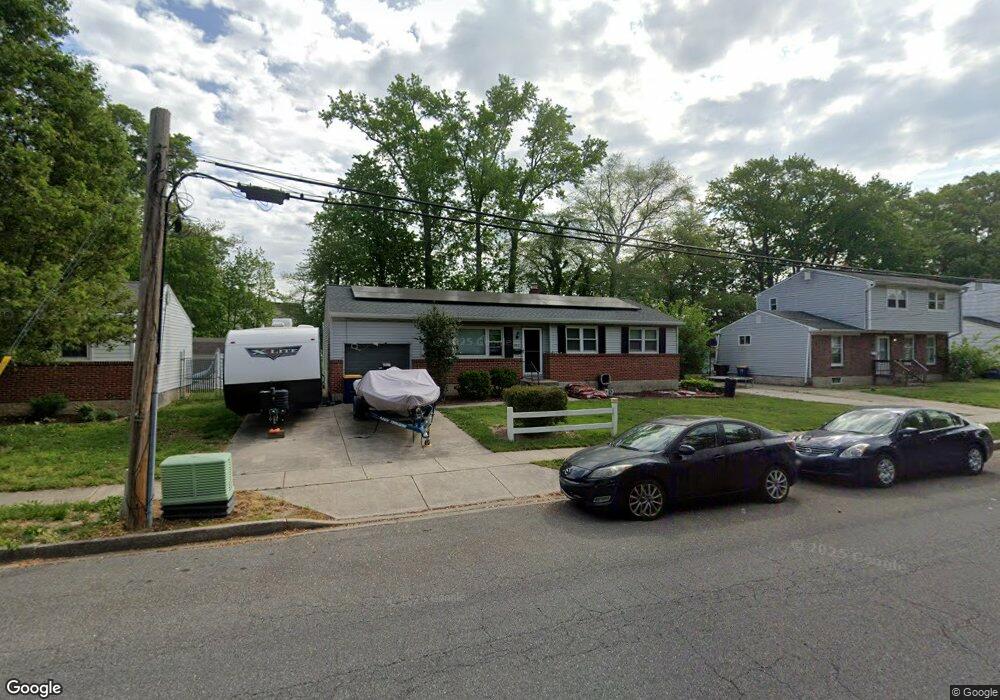
This home is located at 403 Nimitz Rd, Dover, DE 19901 and is currently estimated at $294,349, approximately $260 per square foot. 403 Nimitz Rd is a home located in Kent County with nearby schools including Towne Point Elementary School, William Henry Middle School, and Central Middle School.
Ownership History
Date
Name
Owned For
Owner Type
Purchase Details
Closed on
Mar 31, 2008
Sold by
Miller Ronald D and Miller Linda K
Bought by
Brumfield Walter L
Current Estimated Value
Home Financials for this Owner
Home Financials are based on the most recent Mortgage that was taken out on this home.
Original Mortgage
$190,000
Outstanding Balance
$120,921
Interest Rate
6.06%
Mortgage Type
VA
Estimated Equity
$173,428
Create a Home Valuation Report for This Property
The Home Valuation Report is an in-depth analysis detailing your home's value as well as a comparison with similar homes in the area
Home Values in the Area
Average Home Value in this Area
Purchase History
| Date | Buyer | Sale Price | Title Company |
|---|---|---|---|
| Brumfield Walter L | $190,000 | None Available |
Source: Public Records
Mortgage History
| Date | Status | Borrower | Loan Amount |
|---|---|---|---|
| Open | Brumfield Walter L | $190,000 |
Source: Public Records
Tax History
| Year | Tax Paid | Tax Assessment Tax Assessment Total Assessment is a certain percentage of the fair market value that is determined by local assessors to be the total taxable value of land and additions on the property. | Land | Improvement |
|---|---|---|---|---|
| 2025 | $1,474 | $250,800 | $91,300 | $159,500 |
| 2024 | $1,424 | $250,800 | $91,300 | $159,500 |
| 2023 | $1,033 | $35,100 | $9,700 | $25,400 |
| 2022 | $999 | $35,100 | $9,700 | $25,400 |
| 2021 | $962 | $35,100 | $9,700 | $25,400 |
| 2020 | $289 | $35,100 | $9,700 | $25,400 |
| 2019 | $879 | $35,100 | $9,700 | $25,400 |
| 2018 | $802 | $35,100 | $9,700 | $25,400 |
| 2017 | $788 | $35,100 | $0 | $0 |
| 2016 | $791 | $35,100 | $0 | $0 |
| 2015 | $791 | $35,100 | $0 | $0 |
| 2014 | $793 | $35,100 | $0 | $0 |
Source: Public Records
Map
Nearby Homes
- 1221 Garfield Dr
- 40 Anchor Ln
- 848 Townsend Blvd
- 1014 White Oak Rd
- 750 Miller Dr
- 139 Spruance Rd
- 114 Spruance Rd
- 809 Bacon Ave
- 108 N Halsey Rd
- 33 Spruance Rd
- 59 Chatham Ct
- 57 Chatham Ct
- 107 Lakeview Dr
- 920 E Division St
- 711 E Division St
- 274 Kings Hwy
- 10 Loockerman Ct
- 668 Vista Ave
- 436 Nob Hill Rd
- 78 Washington St