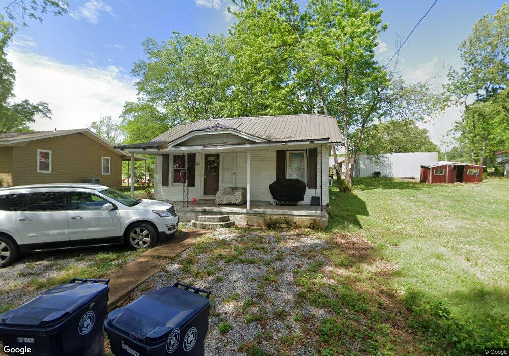
403 Sharp St Corinth, MS 38834
Estimated Value: $69,000 - $104,920
Studio
--
Bath
884
Sq Ft
$101/Sq Ft
Est. Value
About This Home
This home is located at 403 Sharp St, Corinth, MS 38834 and is currently estimated at $89,230, approximately $100 per square foot. 403 Sharp St is a home with nearby schools including Corinth Elementary School, Corinth Middle School, and Corinth High School.
Ownership History
Date
Name
Owned For
Owner Type
Purchase Details
Closed on
Oct 5, 2017
Sold by
Brooks R M R and Brooks Linda H
Bought by
Lewison Dale
Current Estimated Value
Home Financials for this Owner
Home Financials are based on the most recent Mortgage that was taken out on this home.
Original Mortgage
$33,737
Outstanding Balance
$28,013
Interest Rate
3.78%
Mortgage Type
Unknown
Estimated Equity
$61,217
Purchase Details
Closed on
Jan 29, 2016
Sold by
Hall Ernest and Hall Ethel
Bought by
Brooks R M and Brooks Linda H
Purchase Details
Closed on
Mar 4, 2008
Sold by
Butler Kimberly and Butler Timothy W
Bought by
Hall Ernest and Hall Ethel
Create a Home Valuation Report for This Property
The Home Valuation Report is an in-depth analysis detailing your home's value as well as a comparison with similar homes in the area
Purchase History
| Date | Buyer | Sale Price | Title Company |
|---|---|---|---|
| Lewison Dale | -- | None Available | |
| Brooks R M | -- | -- | |
| Hall Ernest | -- | -- |
Source: Public Records
Mortgage History
| Date | Status | Borrower | Loan Amount |
|---|---|---|---|
| Open | Lewison Dale | $33,737 |
Source: Public Records
Tax History
| Year | Tax Paid | Tax Assessment Tax Assessment Total Assessment is a certain percentage of the fair market value that is determined by local assessors to be the total taxable value of land and additions on the property. | Land | Improvement |
|---|---|---|---|---|
| 2025 | $70 | $2,027 | $0 | $0 |
| 2024 | $1 | $1,290 | $0 | $0 |
| 2023 | $70 | $1,290 | $0 | $0 |
| 2022 | $70 | $1,290 | $0 | $0 |
| 2021 | $70 | $1,290 | $0 | $0 |
| 2020 | $70 | $1,283 | $0 | $0 |
| 2019 | $70 | $1,283 | $0 | $0 |
| 2018 | $72 | $1,283 | $0 | $0 |
| 2017 | $72 | $0 | $0 | $0 |
| 2016 | $62 | $0 | $0 | $0 |
| 2015 | -- | $0 | $0 | $0 |
| 2014 | -- | $0 | $0 | $0 |
Source: Public Records
Map
Nearby Homes
- 1601 Tishomingo St
- 54 Cr 143 Rd
- 909 Linden St
- 810 N Madison St
- 1904 W Linden St
- 113 S Madison St
- 2 U S 72
- 1 U S 72
- 811 Graham St
- (Lot 3) N Madison St
- (Lot 2) N Madison St
- 1701 E 6th St
- 1204 Main St
- 209 Chambers St
- 1218 Proper St
- 1303 Ross St
- 0 Breckenridge St
- TBD Wenasoga Hwy 45 S Rd
- 0 Hwy 45 Wenasoga Rd Unit 10212388
- 0 Hwy 45 Wenasoga Rd Unit 25-39
Your Personal Tour Guide
Ask me questions while you tour the home.