Estimated Value: $70,313 - $97,000
--
Bed
--
Bath
682
Sq Ft
$121/Sq Ft
Est. Value
About This Home
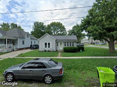
This home is located at 403 W Main St, Maroa, IL 61756 and is currently estimated at $82,578, approximately $121 per square foot. 403 W Main St is a home located in Macon County with nearby schools including Maroa-Forsyth Grade School, Maroa-Forsyth Middle School, and Maroa-Forsyth Senior High School.
Ownership History
Date
Name
Owned For
Owner Type
Purchase Details
Closed on
Jun 21, 2023
Sold by
Bland Debra K and Bland Steven R
Bought by
Mcwilliams Shawn Lynea
Current Estimated Value
Home Financials for this Owner
Home Financials are based on the most recent Mortgage that was taken out on this home.
Original Mortgage
$62,225
Outstanding Balance
$61,261
Interest Rate
6.35%
Mortgage Type
New Conventional
Estimated Equity
$16,055
Purchase Details
Closed on
Oct 11, 2022
Sold by
Bland Debra K
Bought by
Bland Debra K and Bland Steven R
Purchase Details
Closed on
Apr 24, 2013
Sold by
Robinson Beals Tina R
Bought by
Bland Debra K
Purchase Details
Closed on
Jun 1, 2003
Create a Home Valuation Report for This Property
The Home Valuation Report is an in-depth analysis detailing your home's value as well as a comparison with similar homes in the area
Home Values in the Area
Average Home Value in this Area
Purchase History
| Date | Buyer | Sale Price | Title Company |
|---|---|---|---|
| Mcwilliams Shawn Lynea | -- | None Listed On Document | |
| Bland Debra K | -- | -- | |
| Bland Debra K | -- | None Available | |
| -- | $38,500 | -- |
Source: Public Records
Mortgage History
| Date | Status | Borrower | Loan Amount |
|---|---|---|---|
| Open | Mcwilliams Shawn Lynea | $62,225 | |
| Previous Owner | Robinson Tina R | $0 | |
| Previous Owner | Robinson Tina R | $1,222 | |
| Previous Owner | Robinson Tina R | $0 |
Source: Public Records
Tax History Compared to Growth
Tax History
| Year | Tax Paid | Tax Assessment Tax Assessment Total Assessment is a certain percentage of the fair market value that is determined by local assessors to be the total taxable value of land and additions on the property. | Land | Improvement |
|---|---|---|---|---|
| 2023 | $2,185 | $23,563 | $3,427 | $20,136 |
| 2022 | $2,071 | $22,226 | $3,232 | $18,994 |
| 2021 | $2,005 | $21,112 | $3,070 | $18,042 |
| 2020 | $1,838 | $19,895 | $2,893 | $17,002 |
| 2019 | $1,838 | $19,895 | $2,893 | $17,002 |
| 2018 | $1,757 | $19,423 | $2,824 | $16,599 |
| 2017 | $1,838 | $19,505 | $2,836 | $16,669 |
| 2016 | $1,270 | $19,482 | $2,833 | $16,649 |
| 2015 | $1,184 | $18,914 | $2,750 | $16,164 |
| 2014 | $1,141 | $18,727 | $2,723 | $16,004 |
| 2013 | $1,152 | $18,727 | $2,723 | $16,004 |
Source: Public Records
Map
Nearby Homes
- 212 W Washington St
- 218 S Oak St
- 410 E Kennedy St
- 1076 U S 51
- 8527 Sawyer Rd
- 1650 Schellabarger Rd
- 164 Shadow Ridge Blvd
- 0 Betty Ln Unit 10514801
- 157 Shadow Ridge Blvd
- 120 Shadow Ridge Blvd
- 130 S Grant St
- 6080 Stagecoach Rd
- 6150 Stagecoach Rd
- 450 Phillip Cir
- 72 Edgelea Dr
- 4877 Tunbridge Hill Rd
- 342 E Cox St
- 1029 Jemima St
- 1026 State Route 10 E
- 701 S Cain St