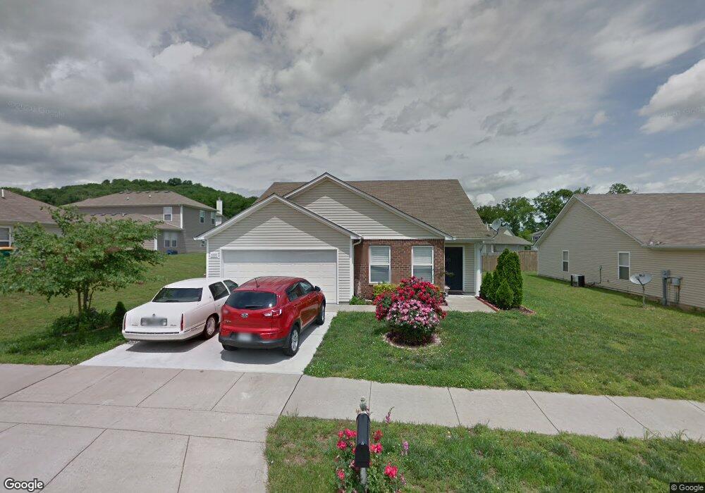
4033 Randall Ln Thompsons Station, TN 37179
Estimated Value: $399,000 - $437,000
--
Bed
2
Baths
1,626
Sq Ft
$256/Sq Ft
Est. Value
About This Home
This home is located at 4033 Randall Ln, Thompsons Station, TN 37179 and is currently estimated at $416,893, approximately $256 per square foot. 4033 Randall Ln is a home located in Williamson County with nearby schools including Primrose School of Spring Hill.
Ownership History
Date
Name
Owned For
Owner Type
Purchase Details
Closed on
Aug 24, 2009
Sold by
Boylan Melissa A and Boylan Jonathan S
Bought by
Lazo Jose M and Lazo Camelia
Current Estimated Value
Home Financials for this Owner
Home Financials are based on the most recent Mortgage that was taken out on this home.
Original Mortgage
$157,100
Outstanding Balance
$101,906
Interest Rate
5.11%
Mortgage Type
FHA
Estimated Equity
$314,987
Purchase Details
Closed on
Nov 4, 2005
Sold by
Longo Claude E and Longo Janet
Bought by
Boylan Jonathan S and Longo Melissa A
Purchase Details
Closed on
Jun 17, 2005
Sold by
Centex Homes
Bought by
Longo Claude E and Longo Melissa A
Home Financials for this Owner
Home Financials are based on the most recent Mortgage that was taken out on this home.
Original Mortgage
$137,837
Interest Rate
5.7%
Mortgage Type
FHA
Create a Home Valuation Report for This Property
The Home Valuation Report is an in-depth analysis detailing your home's value as well as a comparison with similar homes in the area
Home Values in the Area
Average Home Value in this Area
Purchase History
| Date | Buyer | Sale Price | Title Company |
|---|---|---|---|
| Lazo Jose M | $159,999 | None Available | |
| Boylan Jonathan S | -- | -- | |
| Longo Claude E | $140,000 | -- |
Source: Public Records
Mortgage History
| Date | Status | Borrower | Loan Amount |
|---|---|---|---|
| Open | Lazo Jose M | $157,100 | |
| Previous Owner | Longo Claude E | $137,837 |
Source: Public Records
Tax History Compared to Growth
Tax History
| Year | Tax Paid | Tax Assessment Tax Assessment Total Assessment is a certain percentage of the fair market value that is determined by local assessors to be the total taxable value of land and additions on the property. | Land | Improvement |
|---|---|---|---|---|
| 2024 | $478 | $64,675 | $18,750 | $45,925 |
| 2023 | $478 | $64,675 | $18,750 | $45,925 |
| 2022 | $1,184 | $64,675 | $18,750 | $45,925 |
| 2021 | $1,184 | $64,675 | $18,750 | $45,925 |
| 2020 | $950 | $44,000 | $11,250 | $32,750 |
| 2019 | $950 | $44,000 | $11,250 | $32,750 |
| 2018 | $920 | $44,000 | $11,250 | $32,750 |
| 2017 | $911 | $44,000 | $11,250 | $32,750 |
| 2016 | $898 | $44,000 | $11,250 | $32,750 |
| 2015 | -- | $37,625 | $8,750 | $28,875 |
| 2014 | -- | $37,625 | $8,750 | $28,875 |
Source: Public Records
Map
Nearby Homes
- 2131 Carlton Ln
- 1252 Annapolis Cir
- 458 Buckwood Ave W
- 311 Buckwood Ln N
- 452 Buckwood Ave W
- 465 Buckwood Ave
- 467 Buckwood Ave E
- 462 Buckwood Ave W
- 466 Buckwood Ave W
- 1710 Tellico Dr
- 454 Buckwood Ave E
- 1140 Summerville Cir
- 457 Buckwood Ave E
- 1317 Branchside Ct
- 459 Buckwood Ln E
- 303 Buckwood Ln
- 450 Buckwood Ave W
- 321 Buckwood Ln N
- Charleville Plan at Emberly
- Belmont Plan at Emberly
- 4035 Randall Ln
- 5000 Hancock Cir
- 5002 Hancock Cir
- 2744 Sutherland Dr
- 4037 Randall Ln
- 5004 Hancock Cir
- 2746 Sutherland Dr
- 4034 Randall Ln
- 4036 Randall Ln
- 4032 Randall Ln
- 2742 Sutherland Dr
- 4030 Randall Ln
- 4038 Randall Ln
- 5006 Hancock Cir
- 2740 Sutherland Dr
- 4028 Randall Ln
- 2669 New Port Royal Rd
- 2667 New Port Royal Rd
- 2671 New Port Royal Rd
- 2753 Sutherland Dr