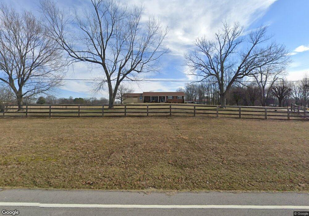
4036 Highway 31 W Cottontown, TN 37048
Estimated Value: $376,000 - $520,000
--
Bed
2
Baths
1,416
Sq Ft
$307/Sq Ft
Est. Value
About This Home
This home is located at 4036 Highway 31 W, Cottontown, TN 37048 and is currently estimated at $434,667, approximately $306 per square foot. 4036 Highway 31 W is a home located in Sumner County with nearby schools including Harold B. Williams Elementary School, White House Middle School, and White House High School.
Ownership History
Date
Name
Owned For
Owner Type
Purchase Details
Closed on
Aug 3, 2020
Sold by
Smith Joseph Lee and Smith Jamie
Bought by
Ryder Margaret
Current Estimated Value
Home Financials for this Owner
Home Financials are based on the most recent Mortgage that was taken out on this home.
Original Mortgage
$187,200
Outstanding Balance
$166,366
Interest Rate
3.1%
Mortgage Type
New Conventional
Estimated Equity
$268,301
Purchase Details
Closed on
May 31, 2016
Sold by
Hopper Glenda Joy and Pickett Sandra Lee
Bought by
Smith Joseph Lee
Home Financials for this Owner
Home Financials are based on the most recent Mortgage that was taken out on this home.
Original Mortgage
$246,887
Interest Rate
3.66%
Mortgage Type
VA
Create a Home Valuation Report for This Property
The Home Valuation Report is an in-depth analysis detailing your home's value as well as a comparison with similar homes in the area
Home Values in the Area
Average Home Value in this Area
Purchase History
| Date | Buyer | Sale Price | Title Company |
|---|---|---|---|
| Ryder Margaret | $234,000 | Title Escrow Of Robertson Cn | |
| Smith Joseph Lee | $239,000 | Title Escrow Of Robertson Co |
Source: Public Records
Mortgage History
| Date | Status | Borrower | Loan Amount |
|---|---|---|---|
| Open | Ryder Margaret | $187,200 | |
| Previous Owner | Smith Joseph Lee | $246,887 |
Source: Public Records
Tax History Compared to Growth
Tax History
| Year | Tax Paid | Tax Assessment Tax Assessment Total Assessment is a certain percentage of the fair market value that is determined by local assessors to be the total taxable value of land and additions on the property. | Land | Improvement |
|---|---|---|---|---|
| 2024 | $1,743 | $122,625 | $55,600 | $67,025 |
| 2023 | $1,435 | $63,700 | $29,575 | $34,125 |
| 2022 | $1,441 | $63,700 | $29,575 | $34,125 |
| 2021 | $1,441 | $63,700 | $29,575 | $34,125 |
| 2020 | $1,441 | $63,700 | $29,575 | $34,125 |
| 2019 | $1,441 | $0 | $0 | $0 |
| 2018 | $974 | $0 | $0 | $0 |
| 2017 | $974 | $0 | $0 | $0 |
| 2016 | $974 | $0 | $0 | $0 |
| 2015 | -- | $0 | $0 | $0 |
| 2014 | -- | $0 | $0 | $0 |
Source: Public Records
Map
Nearby Homes
- 1500 Hidden Meadow Dr
- 3828 U S 31w
- 1552 Hidden Meadow Dr
- 1130 Adam Dr
- 102 Spring View Dr
- 111 Renee Ct
- 0 Martin Ln
- 1214 Hollis Terrace
- 102 Arrowood Dr
- 356 Lee Rd
- 301 Old Highway 31 W
- 2306 Brokeshire Dr
- 800 Bowling Branch Rd
- 8149 Netterfield Dr
- 8137 Netterfield Dr
- 8131 Netterfield Dr
- 8117 Netterfield Dr
- 8105 Netterfield Dr
- 4025 Burton Dr
- 4037 Burton Dr
- 4036 U S 31w
- 4048 Highway 31 W
- 4030 31w Hwy
- 4041 S Old Highway 31 W
- 4033 Highway 31 W
- 4033 Hwy 31w
- 4030 Highway 31 W
- 4049 Highway 31 W
- 4056 Highway 31 W
- 4033 S Highway 31w W
- 4011 Highway 31 W
- 4011 Highway 31 W
- 1504 Hidden Meadow Dr
- 4006 Highway 31 W
- 4006 Highway 31 W
- 0 Highway 31w Unit 1958255
- 0 Highway 31w Unit 1841508
- 0 Highway 31w Unit 1831916
- 0 Highway 31w Unit 1768607
- 0 Highway 31w Unit RTC2615603