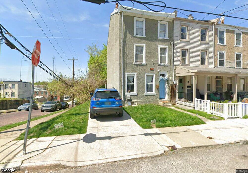
404 Dupont St Philadelphia, PA 19128
Roxborough NeighborhoodEstimated Value: $376,000 - $466,116
4
Beds
3
Baths
2,190
Sq Ft
$194/Sq Ft
Est. Value
About This Home
This home is located at 404 Dupont St, Philadelphia, PA 19128 and is currently estimated at $424,779, approximately $193 per square foot. 404 Dupont St is a home located in Philadelphia County with nearby schools including James Dobson Elementary School, Roxborough High School, and Holy Child School.
Ownership History
Date
Name
Owned For
Owner Type
Purchase Details
Closed on
Sep 11, 2007
Sold by
Ford Deborah and Pettaway William
Bought by
Mosmen Craig N
Current Estimated Value
Home Financials for this Owner
Home Financials are based on the most recent Mortgage that was taken out on this home.
Original Mortgage
$158,400
Outstanding Balance
$100,699
Interest Rate
6.65%
Mortgage Type
Purchase Money Mortgage
Estimated Equity
$324,080
Purchase Details
Closed on
Apr 29, 1999
Sold by
Pettaway William
Bought by
Pettaway William and Pettaway Maria E
Create a Home Valuation Report for This Property
The Home Valuation Report is an in-depth analysis detailing your home's value as well as a comparison with similar homes in the area
Home Values in the Area
Average Home Value in this Area
Purchase History
| Date | Buyer | Sale Price | Title Company |
|---|---|---|---|
| Mosmen Craig N | $198,000 | None Available | |
| Pettaway William | -- | -- |
Source: Public Records
Mortgage History
| Date | Status | Borrower | Loan Amount |
|---|---|---|---|
| Open | Mosmen Craig N | $158,400 |
Source: Public Records
Tax History Compared to Growth
Tax History
| Year | Tax Paid | Tax Assessment Tax Assessment Total Assessment is a certain percentage of the fair market value that is determined by local assessors to be the total taxable value of land and additions on the property. | Land | Improvement |
|---|---|---|---|---|
| 2025 | $4,264 | $369,300 | $73,860 | $295,440 |
| 2024 | $4,264 | $369,300 | $73,860 | $295,440 |
| 2023 | $4,264 | $304,600 | $60,900 | $243,700 |
| 2022 | $3,526 | $304,600 | $60,900 | $243,700 |
| 2021 | $3,526 | $0 | $0 | $0 |
| 2020 | $3,526 | $0 | $0 | $0 |
| 2019 | $3,466 | $0 | $0 | $0 |
| 2018 | $3,110 | $0 | $0 | $0 |
| 2017 | $3,110 | $0 | $0 | $0 |
| 2016 | $3,110 | $0 | $0 | $0 |
| 2015 | $2,977 | $0 | $0 | $0 |
| 2014 | -- | $222,200 | $34,414 | $187,786 |
| 2012 | -- | $20,480 | $3,130 | $17,350 |
Source: Public Records
Map
Nearby Homes
- 444 Dupont St
- 4538 Mitchell St
- 375 Green Ln
- 4557 Manayunk Ave
- 4531 Mitchell St
- 452 Green Ln
- 434-36 Conarroe St
- 389 Conarroe St
- 438 1/2 Leverington Ave
- 407 Conarroe St
- 329 Krams Ave
- 4416 Pechin St
- 451 Green Ln
- 315 Dupont St
- 4448 Mitchell St
- 450 Ripka St
- 468 Leverington Ave
- 485 Ripka St
- 4475 Fleming St
- 352 Ripka St
- 408 Dupont St
- 410 Dupont St
- 412 Dupont St
- 0 Pechin St Unit 6734535
- Pechin St
- 414 Dupont St
- 409 Dupont St Unit 2nd
- 409 Dupont St
- 411 Dupont St
- 4518 Pechin St
- 413 Dupont St
- 418 Dupont St
- 415 Dupont St
- 419 Dupont St
- 420 Dupont St
- 422 Dupont St
- 372 Dupont St
- 415 Krams Ave
- 4514-16 Pechin St
- 4514 Pechin St