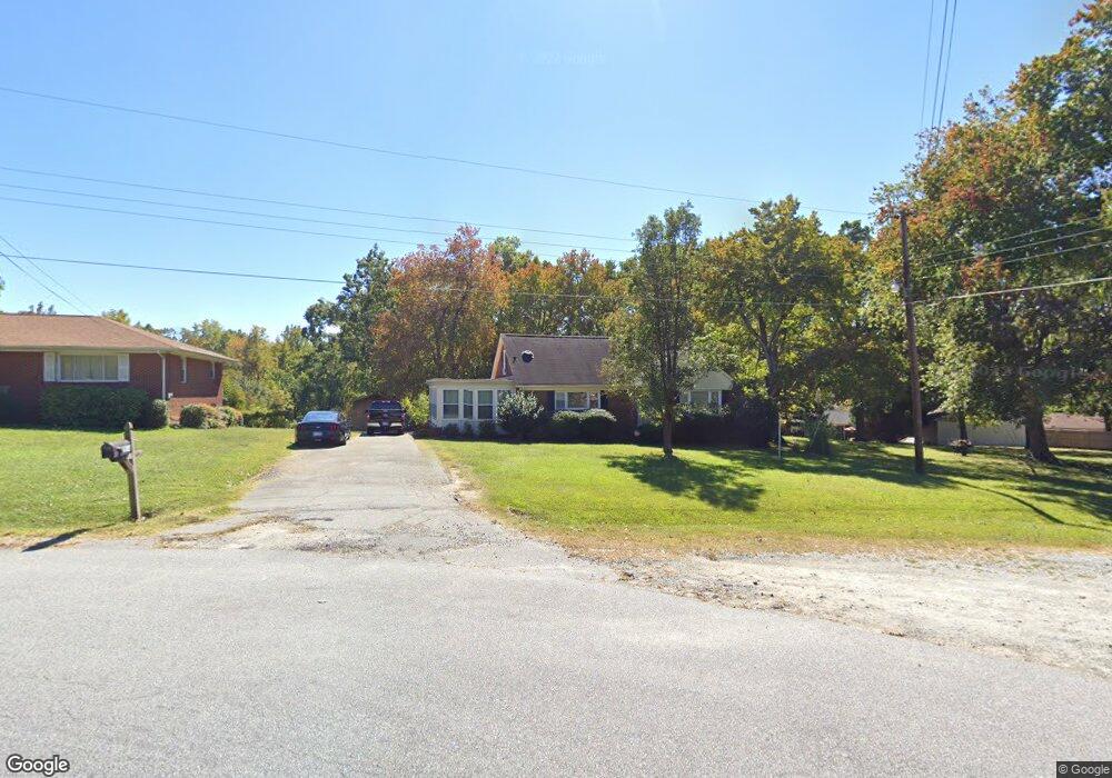
404 Janice Dr High Point, NC 27263
Greater High Point NeighborhoodEstimated Value: $225,032 - $260,000
3
Beds
2
Baths
1,477
Sq Ft
$164/Sq Ft
Est. Value
About This Home
This home is located at 404 Janice Dr, High Point, NC 27263 and is currently estimated at $242,508, approximately $164 per square foot. 404 Janice Dr is a home located in Guilford County with nearby schools including Allen Jay Elementary School, Southern Guilford Middle, and Southern Guilford High School.
Ownership History
Date
Name
Owned For
Owner Type
Purchase Details
Closed on
Feb 15, 2018
Sold by
Gulledge Timothy K and Gulledge Julie S
Bought by
Gulledge Timothy and Gulledge Julie
Current Estimated Value
Home Financials for this Owner
Home Financials are based on the most recent Mortgage that was taken out on this home.
Original Mortgage
$110,600
Outstanding Balance
$78,581
Interest Rate
3.99%
Mortgage Type
VA
Estimated Equity
$163,927
Purchase Details
Closed on
Jan 27, 1998
Sold by
Glen Portis Randall and Glen Patsy W
Bought by
Gulledge Timothy K and Gulledge Julie S
Home Financials for this Owner
Home Financials are based on the most recent Mortgage that was taken out on this home.
Original Mortgage
$77,914
Interest Rate
7.07%
Mortgage Type
FHA
Create a Home Valuation Report for This Property
The Home Valuation Report is an in-depth analysis detailing your home's value as well as a comparison with similar homes in the area
Home Values in the Area
Average Home Value in this Area
Purchase History
| Date | Buyer | Sale Price | Title Company |
|---|---|---|---|
| Gulledge Timothy | -- | None Available | |
| Gulledge Timothy K | $78,000 | -- |
Source: Public Records
Mortgage History
| Date | Status | Borrower | Loan Amount |
|---|---|---|---|
| Open | Gulledge Timothy | $110,600 | |
| Closed | Gulledge Timothy K | $77,914 |
Source: Public Records
Tax History Compared to Growth
Tax History
| Year | Tax Paid | Tax Assessment Tax Assessment Total Assessment is a certain percentage of the fair market value that is determined by local assessors to be the total taxable value of land and additions on the property. | Land | Improvement |
|---|---|---|---|---|
| 2025 | $926 | $105,600 | $20,000 | $85,600 |
| 2024 | $926 | $105,600 | $20,000 | $85,600 |
| 2023 | $926 | $105,600 | $20,000 | $85,600 |
| 2022 | $926 | $105,600 | $20,000 | $85,600 |
| 2021 | $771 | $87,900 | $20,000 | $67,900 |
| 2020 | $771 | $87,900 | $20,000 | $67,900 |
| 2019 | $771 | $87,900 | $0 | $0 |
| 2018 | $767 | $87,900 | $0 | $0 |
| 2017 | $748 | $87,900 | $0 | $0 |
| 2016 | $760 | $86,900 | $0 | $0 |
| 2015 | $765 | $86,900 | $0 | $0 |
| 2014 | $773 | $86,900 | $0 | $0 |
Source: Public Records
Map
Nearby Homes
- 706 E Fairfield Rd
- 600 E Fairfield Rd
- 926 Norton St
- 921 Norton St
- 1103 Pegram Ave
- 2708 Ernest St
- 914 Nance Ave
- 2716 Allen Jay Rd
- 825 Hopewell St
- 2719 Granville St
- 10844 N Main St
- 327 Wynnewood Dr
- 112 Havenwood Dr
- 1020 Westbrook Ct
- 3820 David St
- 10812, 10822, 10828 N Main St
- 2616 Ingram Rd
- 1846 Sechrest Cir
- 512 Dale St
- 3813 Salisbury St