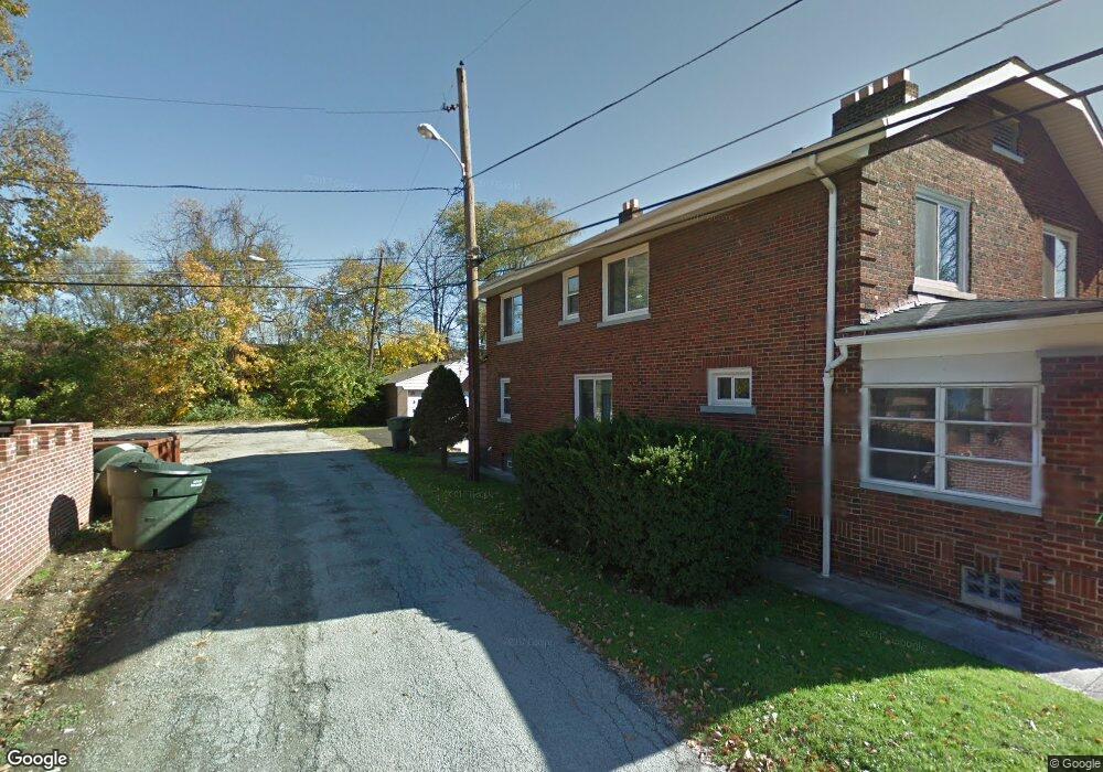
404 Rhoads Ave Unit 406 Columbus, OH 43205
Franklin Park NeighborhoodEstimated Value: $296,702 - $483,000
6
Beds
2
Baths
2,352
Sq Ft
$163/Sq Ft
Est. Value
About This Home
This home is located at 404 Rhoads Ave Unit 406, Columbus, OH 43205 and is currently estimated at $384,426, approximately $163 per square foot. 404 Rhoads Ave Unit 406 is a home located in Franklin County with nearby schools including Ohio Avenue Elementary School, Champion Middle School, and East High School.
Ownership History
Date
Name
Owned For
Owner Type
Purchase Details
Closed on
Oct 18, 2019
Sold by
Paramore Charlotte D
Bought by
Smith Constance D
Current Estimated Value
Purchase Details
Closed on
Jan 2, 2007
Sold by
Estate Of Rhenetta Marie Davis
Bought by
Davis Albert J
Purchase Details
Closed on
Dec 29, 2006
Sold by
Davis Albert J
Bought by
Smith Constance D and Paramore Charlotte D
Purchase Details
Closed on
Apr 25, 1985
Bought by
Davis Rhenetta M
Create a Home Valuation Report for This Property
The Home Valuation Report is an in-depth analysis detailing your home's value as well as a comparison with similar homes in the area
Home Values in the Area
Average Home Value in this Area
Purchase History
| Date | Buyer | Sale Price | Title Company |
|---|---|---|---|
| Smith Constance D | $33,500 | None Available | |
| Davis Albert J | -- | None Available | |
| Smith Constance D | -- | None Available | |
| Davis Rhenetta M | -- | -- |
Source: Public Records
Tax History
| Year | Tax Paid | Tax Assessment Tax Assessment Total Assessment is a certain percentage of the fair market value that is determined by local assessors to be the total taxable value of land and additions on the property. | Land | Improvement |
|---|---|---|---|---|
| 2025 | $3,234 | $71,300 | $22,790 | $48,510 |
| 2024 | $3,234 | $71,300 | $22,790 | $48,510 |
| 2023 | $3,193 | $71,295 | $22,785 | $48,510 |
| 2022 | $1,476 | $28,110 | $1,750 | $26,360 |
| 2021 | $1,478 | $28,110 | $1,750 | $26,360 |
| 2020 | $1,481 | $28,110 | $1,750 | $26,360 |
| 2019 | $1,438 | $23,420 | $1,470 | $21,950 |
| 2018 | $1,323 | $23,420 | $1,470 | $21,950 |
| 2017 | $1,438 | $23,420 | $1,470 | $21,950 |
| 2016 | $1,332 | $19,850 | $3,360 | $16,490 |
| 2015 | $1,211 | $19,850 | $3,360 | $16,490 |
| 2014 | $1,081 | $17,680 | $3,360 | $14,320 |
| 2013 | $612 | $18,620 | $3,535 | $15,085 |
Source: Public Records
Map
Nearby Homes
- 1847 Oak St
- 1779 E Main St
- 592 Rhoads Ave Unit 594
- 572 Bulen Ave
- 1707 E Main St Unit 1705
- 1800 E Fulton St
- 1714 Oak St
- 377 Berkeley Rd
- 211 Preston Rd
- 1555 E Rich St Unit 557
- 623 Seymour Ave
- 547 Berkeley Rd
- 1571 Franklin Ave
- 489 Lilley Ave
- 731 Bulen Ave
- 518 Kelton Ave Unit 45
- 555 Lilley Ave
- 522 Kelton Ave
- 538-540 Kelton Ave
- 711 Seymour Ave
- 410 Rhoads Ave Unit 412
- 414 Rhoads Ave Unit 416
- 414-416 Rhoads Ave
- 420 Rhoads Ave Unit 422
- 420-422 Rhoads Ave
- 392 Rhoads Ave
- 1884-1888 E Rich St
- 1884 E Rich St
- 1884 E Rich St Unit B
- 1888 E Rich St Unit C
- 407 Rhoads Ave Unit 409
- 407 Rhoads Ave Unit 409
- 407 Rhoads Ave
- 1899 Bryden Rd
- 1885 Bryden Rd
- 1871 Bryden Rd
- 1858 E Rich St
- 1850 E Rich St
- 1861 Bryden Rd Unit 863
- 1863 E Rich St
Your Personal Tour Guide
Ask me questions while you tour the home.