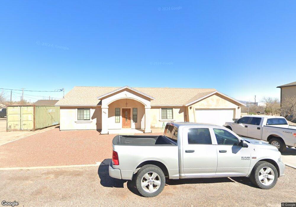
404 W Rustler Rd Safford, AZ 85546
Estimated Value: $271,682 - $312,000
Studio
--
Bath
1,444
Sq Ft
$208/Sq Ft
Est. Value
About This Home
This home is located at 404 W Rustler Rd, Safford, AZ 85546 and is currently estimated at $300,671, approximately $208 per square foot. 404 W Rustler Rd is a home located in Graham County with nearby schools including Dorothy Stinson School, Ruth Powell Elementary School, and Lafe Nelson School.
Ownership History
Date
Name
Owned For
Owner Type
Purchase Details
Closed on
Jun 4, 2013
Sold by
Michel Emil and Michel Margaret Jane
Bought by
Elias William M
Current Estimated Value
Home Financials for this Owner
Home Financials are based on the most recent Mortgage that was taken out on this home.
Original Mortgage
$80,000
Outstanding Balance
$56,474
Interest Rate
3.32%
Mortgage Type
New Conventional
Estimated Equity
$244,197
Purchase Details
Closed on
Jul 17, 2006
Sold by
Wagner Alvin and Wagner Barbara
Bought by
Michael Emil and Michel Margaret Jane
Purchase Details
Closed on
Jan 12, 2005
Sold by
Martinez Sammy G and Martinez Tilly
Bought by
Wagner Alvin and Wagner Barbara
Create a Home Valuation Report for This Property
The Home Valuation Report is an in-depth analysis detailing your home's value as well as a comparison with similar homes in the area
Home Values in the Area
Average Home Value in this Area
Purchase History
| Date | Buyer | Sale Price | Title Company |
|---|---|---|---|
| Elias William M | $120,000 | Pioneer Title Agency | |
| Michael Emil | $165,000 | Safford Title Agency | |
| Wagner Alvin | $5,500 | Safford Title Agency |
Source: Public Records
Mortgage History
| Date | Status | Borrower | Loan Amount |
|---|---|---|---|
| Open | Elias William M | $80,000 |
Source: Public Records
Tax History
| Year | Tax Paid | Tax Assessment Tax Assessment Total Assessment is a certain percentage of the fair market value that is determined by local assessors to be the total taxable value of land and additions on the property. | Land | Improvement |
|---|---|---|---|---|
| 2027 | $1,243 | -- | -- | -- |
| 2026 | $1,045 | -- | -- | -- |
| 2025 | $1,045 | $17,059 | $835 | $16,224 |
| 2024 | $1,076 | $15,969 | $835 | $15,134 |
| 2023 | $1,076 | $13,929 | $802 | $13,127 |
| 2022 | $1,053 | $12,510 | $891 | $11,619 |
| 2021 | $1,146 | $0 | $0 | $0 |
| 2020 | $1,102 | $0 | $0 | $0 |
| 2019 | $1,150 | $0 | $0 | $0 |
| 2018 | $1,084 | $0 | $0 | $0 |
| 2017 | $1,028 | $0 | $0 | $0 |
| 2016 | $966 | $0 | $0 | $0 |
| 2015 | $892 | $0 | $0 | $0 |
Source: Public Records
Map
Nearby Homes
- 425 W Saddlehorn Dr
- .84ac W Saddle Horn Dr
- .84ac W Saddle Horn Dr Unit 230 - 232
- TBA W Saddle Horn Dr
- 0000 W Doggie Dr Unit 163
- tbd Pommel St Unit B
- 000 S Branding Iron Rd Unit 38
- 7348 S Branding Iron Rd
- TBD Tbd Hwy 191 S Unit 2
- TBD Tbd Hwy 191 S Unit 1
- .34ac US Hwy 191 -- Unit 11 & 12
- .34ac US Hwy 191
- TBD Dakota Dr
- 555 W Frying Pan Dr
- 111 E Pommel St
- 593 W Frying Pan Dr
- 0 Pommel Unit 1721987
- TBD #5 Tbd S Hwy 191 Unit 5
- 97 Lariat Way
- 596 Clearview Dr
- 7601 S Cantle St
- 390 W Rustler Rd
- 7589 S Cantle St
- 443 W Rustler Rd
- 7571 S Cantle St
- 7596 S Cantle St
- 7617 S Stirrup Trail
- 7562 S Stirrup Trail
- 301 W Rustler Rd
- 7523 S Cantle St
- 7548 S Cantle St
- 275 W Saddle Dr
- 7563 S Stirrup Trail
- 135 E Saddle Dr
- 137 E Saddle Dr
- 467 W Spur Dr
- 112 E Saddle Dr
- 462 W Spur Dr
- 204 Latigo St
- 221 W Saddle Dr
Your Personal Tour Guide
Ask me questions while you tour the home.